
North Battleford
| North Battleford | |||
|---|---|---|---|
 North Battleford City Hall |
|||
| Location in Saskatchewan | |||
|
|||
| State : |
|
||
| Province : | Saskatchewan | ||
| Region: | Central-West | ||
| Rural municipality: | North Battleford No. 437 | ||
| Coordinates : | 52 ° 45 ′ N , 108 ° 17 ′ W | ||
| Height : | 512 m | ||
| Area : | 33.55 km² | ||
| Residents : | 14,315 (as of 2016) | ||
| Population density : | 426.7 inhabitants / km² | ||
| Time zone : | Central Time ( UTC − 6 ) | ||
| Postal code : | S9A | ||
| Area code : | +1 306 | ||
| Foundation : | 1875 | ||
| Mayor : | Ryan Bater | ||
| Website : | www.cityofnb.ca | ||

North Battleford (officially: City of North Battleford ) is a city in Canada. It is located in the west of the Canadian province of Saskatchewan and is the seventh largest city in the province with 33.55 km². North Battleford is separated from Battleford to the south by the North Saskatchewan River . Both cities are also known as "The Battlefords" . The place borders on the parish of the same name North Battleford No. 437 . In 2016 the number of inhabitants was 14,315.
North Battleford and Battleford are connected to the surrounding towns by numerous roads, including a. from Yellowhead Highway , Highway 4 , Highway 26 , Highway 29, and Highway 40 . Battleford Provincial Park is 25 miles north on Highway 4.
geography
North Battleford is in western Saskatchewan Province. The border with the neighboring province of Alberta is just under 100 km to the west; those to the United States about 475 miles south. The city of Saskatoon is 150 km to the southeast. To the south and west, the city is separated by the North Saskatchewan River from the neighboring city of Battleford to the south. Together they are also called The Battlefords . Both cities extend over an area of 56.88 km², whereas North Battleford is 33.55 km² larger than Battleford, which has an area of 23.33 km².
The city is bordered to the west by North Battleford No. 437, part of which is in Census Division No. 16 and a part is in the SARM Division No. 6 extends.
Neighboring communities
| Lloydminster | Meadow Lake | Prince Albert |
| Cut knife |
.svg)
|
Blaine Lake |
| Wilkie | Battleford , Biggar | Saskatoon |
climate
North Battleford lies in the transition area between the maritime and continental climate zones. The climate itself is cold-temperate and is assigned the effective climate classification DfB . During the summer months, temperatures reach a maximum of 21 ° to 24 ° C. In winter, temperatures drop to between −18 ° and −21 ° C. The highest measured temperature was 39.5 ° C on July 13, 2002, the lowest measured at −51.7 ° C on February 1, 1893 and January 12, 1916.
The annual rainfall is around 374 mm. The summers are usually moderately warm and with a lot of rainfall. Compared to the winter months, there is significantly more rainfall here; on average, these are usually 32 to 71 mm. The normal maximum temperature is 24 degrees Celsius in July and August. The winters, however, tend to have little precipitation. The normal amount of snowfall is 104 mm. In addition to the winter months, snowfall is possible in September and May; the snow cover is usually 2 to 8 mm thick during this time. In the months of December, January and February the average amount of snow is 17 to 20 mm. Spring and autumn are often mild with temperatures of 10 to 18 degrees Celsius and rainfall between 13 and 34 mm.
| North Battleford, 2010-1981 | ||||||||||||||||||||||||||||||||||||||||||||||||
|---|---|---|---|---|---|---|---|---|---|---|---|---|---|---|---|---|---|---|---|---|---|---|---|---|---|---|---|---|---|---|---|---|---|---|---|---|---|---|---|---|---|---|---|---|---|---|---|---|
| Climate diagram | ||||||||||||||||||||||||||||||||||||||||||||||||
| ||||||||||||||||||||||||||||||||||||||||||||||||
|
Average monthly temperatures and rainfall for North Battleford, 2010-1981
Source: Environment Canada
|
||||||||||||||||||||||||||||||||||||||||||||||||||||||||||||||||||||||||||||||||||||||||||||||||||||||||||||||||||||||||
history
Like other cities in Canada, North Battleford can look back on a long history. The oldest evidence of the presence of population groups goes back to around 1000 years. Long before European settlement, indigenous cultures lived in what is now North Battleford and Battleford, including members of the Cree and Blackfoot tribes . Both tribal groups still belong to a common language group, the so-called Algonquin . The Assiniboine , who also settled in this area, are in turn relatives of the Sioux language family . All three tribes often fought bitter conflicts over the available resources such as wood, grain and game animals.
.jpg)
European settlement in and around North Batttleford began after French colonists established temporary fur trading posts across Canada. The "New Canadians" then founded their own settlement in 1778, that of Fort Montaigne d'Aigle (English Eagle Hills Fort). "Cole", a Canadian trader, was commissioned to build it. As a location, he selected an area about 14 km (9 miles) below the confluence of the Saskatchewan and Battle Rivers . The fort was built from 1779 to 1780 and was primarily intended to provide protection against attacks by thieves and Indians. In the same year, shortly after its completion, the trading post was the scene of a bitter conflict between the local tribes and the trading people. Cole himself was murdered in the fighting by insurgent Indians. In the early 19th century, Alex Henry Jr. visited the former trading post, which had been almost completely destroyed after the fighting.
The final and permanent development in the region around Battleford took place in 1875. European settlers settled on the south bank of the North Saskatchewan River and gave the settlement the name Battleford. In 1876 the place was officially declared the capital of the Northwest Territories and held this function until 1883.

In 1905, construction began on a railway line belonging to the Canadian Northern Railway , which was to connect the city of Edmonton in Alberta with the northern region of the North Saskatchewan River. As the line was built, a second settlement was built north of Battleford and named North Battleford. This town received in 1906 the status of a village ( Village ), a year later the title of City ( Town ) and 1913 finally the status of City . At that time, North Battleford had 5,000 residents.
The Assyrians were among the first to settle in and around North Battleford . This group of people, consisting of 36 men and only a few women, comes from Urmia in northwestern Iran and immigrated to the area in 1903. Assyrian missionary Dr. Isaac Adams was instrumental in this development. About three years later, 40 more settlers from Urmia immigrated to North Battleford. When economic emergencies broke out in the late 1900s, Adams left town with a few relatives and moved to Turlock , United States. Some names of the descendants of the families that stayed in North Battleford have survived to this day, including Bakus, Essau and Odishaw.
Until the 1940s, the population grew sixfold. From about 4,690 in 1941 to over 11,000 in 1961. The city became an important administrative, economic, educational and health center in the region. Within two decades, from 1961 to 1981, the number of inhabitants doubled from 1,627 to 3,565.
The Latter Rain Revival and the Latter Rain Movement , two sub-movements of the `` Latter Rain '' , an important Christian movement after the Second World War, began in North Battleford from 1946 to 1948.

National Historic Sites
Battleford has numerous historic buildings and sites that are part of the National Historic Site of Canada . Among them is the Battleford Court House , which was built in 1909, as well as the North Battleford Public Library from 1916 and the North Battleford Station from 1956.
Population development
The Statistics Canada census, conducted in 2011, registered a population of 13,888 in North Battleford. The Population Center of North Battleford counted 17,595 residents; in 2011 this was the seventh largest population center in Saskatchewan. In 2016 it had to surrender this title to the city of Swift Current and has since been the eighth largest municipality in the province. The North Battleford-Battleford metropolitan area had about 19,216 inhabitants at the time.
The population of North Battleford grew steadily at the beginning of the 20th century. In 1911 the number of inhabitants, the year in which the first census was carried out, was 2,105. For around ten years there were twice as many people. The population rose to over 7,000 by 1951 and passed the 10,000 mark in the early 1960s. The 1991 census showed a preliminary maximum of approximately 14,350. After the turn of the millennium, the population dropped to 13,692. In 2006 the number of inhabitants fell again by 3.7% to 13,190. Since 2011, the number of people living in North Battleford has been increasing again. While in 2006 there were still just under 31,200 inhabitants, five years later there were 13,888. By 2016, the demographic value rose further by 3.1% to 14,315.


The vast majority of the European population are those who immigrated from France. Europeans make up the largest proportion of North Battleford's population at 62.8%. The second largest majority with a percentage of 17.8% are members of the First Nations , followed by the Asian inhabitants (9.6%) and the Métis with 9.3%. African Americans make up the smallest proportion of the population at 0.4%.
|
|
|
||||||||||||||||||||||||||||||||||||||||||||||||||||||||||||||||||||||||||||||||||||||||||

crime
Along with Prince Albert, North Battleford is one of the Canadian cities with the highest crime rate. The city ranks second in the list of the Crime Severity Index . In 2018, the news magazine Maclean's ranked North Battleford as the most dangerous place in Canada. The magazine published an article in the same year with the title "Canada's most dangerous place, North Battleford, is fighting for its future" (Eng .: "Canada's most dangerous place, North Battleford, fighting for its future"). The main focus was on the security initiatives that the city council had founded.
Following the publication of the article, Mayor Ryan Bater said:
“The reality is we require the provincial and federal levels of government to take notice of this and align their efforts with ours. This needs to be a partnership. This can't be something the governments do in silos and we need to be working together. If we can do that, then sometime in the future we can see some great results. "
“The reality is that the state and federal government is taking note of it and directing its efforts towards us. Only in this way can a partnership succeed. The government in silos cannot do this alone; we have to work with them. If we can do that, then at some point in the future we will see great results. "

Attractions
North Battleford is one of four locations for the Saskatchewan Western Development Museum . Today a small museum reminds of the agricultural past of the place. The pioneer village in the form of an open-air museum is located in the south-eastern part of the city and includes several residential buildings, a barn and a grain elevator from the early 20th century and numerous exhibition halls. The museum is open from January to March. A significant feature is the grain elevator with the identification number 889, which was originally located in Keatley . It was dismantled from its old location in 1983 and moved to North Battleford that same year.

There is also the gallery of Allen Sapp , an important Cree painter who lived and worked in North Battleford. The single-storey building was built in brick style in 1916.
Utilities
The water supply is ensured by North Battleford Water Inquiry , a joint venture of the administrative region. The drinking water comes from surrounding lakes and a larger reservoir west of the center. The water fed from it is fed into a tower and stored. Battleford to the south is supplied with water in the same way.

In 2001, a problem in the urban water system caused an estimated 6,280 residents to be infected with cryptosporidiosis . The affected persons suffered from diarrhea and abdominal pain as well as a slight fever; cryptosporidia were directly detected in around 1,907 people. A failure of the devices was named as the cause, which was caused by insufficient maintenance work in the outdated water filtration system. Private households as well as public institutions such as hospitals and schools were affected. Victims and relatives filed a lawsuit for millions of dollars in damages in 2003. This was initially revoked by the highest regional court. The affected people received compensation totaling $ 3.3 million from the local government after the lawsuit was only recognized in 2017.
In addition to the waterworks, the main supplier is the North Battleford Energy Center , a conventional power plant that covers around 90% of North Battleford's energy requirements. It was built from 2010 to 2011 and has a maximum output of 260 MW. In 2013, the company signed a 20-year contract, a so-called Power Purchase Agreement , with the Canadian energy company SaskPower .
traffic
North Battleford is accessible via numerous highways. The Yellowhead Highway runs northwest to southeast and intersects Highway 4 and Highway 40 . Highway 4 comes from the north and leaves the city in a southbound direction. This is crossed by Highway 26 northwest. Highway 40, coming from the east, briefly merges with Highway 4 until it continues in a westerly direction as an independent highway. The Highway 29 leads from the southwest Coming into Highway 40. In addition, there a number of other highways. The Highway 378 branches at the city Spiritwood on the Highway 3 and closes the Highway 4 to the north. This in turn is crossed by Highway 658 in the southern part of the city. To the east of North Battleford, Highway 687 , 20 km in length, provides a short connection between Highways 378 and 16.

North Battleford Airport (other name: Cameron McIntosh Airport ), opened during World War II, is 2.8 km east of the city area. This replaced North Battleford / Hamlin Airport from 2007 , which was closed due to declining passenger numbers. North Battleford Airfield has two runways and is one of the most important in the region.
In addition to some bus routes, the city operates a transit bus-like traffic. A so-called Handi-Bus , a van in the form of a minibus, runs throughout the city and is mainly intended for people with disabilities. A similar system already exists in the city of Saskatoon .
sport and freetime
The North Battleford Civic Center in the city center was built in 1962 and can accommodate 2,500 visitors. The Battlefords North Stars play their home games in this multifunctional hall. It is also the home of the North Battleford Kinsmen Indoor Rodeo , which takes place every April. Another notable sports facility is the North Battleford CUplex , which opened in 2013. On this campus is the Northland Power Curling Center as well as the NationsWest Field House and the Battlefords CO-OP Aquatic Center. The city also has a golf course and campsite.
gallery

North Battleford Civic Center

NationsWest Field House
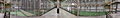
Inside the NationsWest Field House

North Battleford Aquatic Center
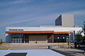
Dekker Center of Fine Arts

The clock on the Rotary Plaza


media
North Battleford-based media includes newspapers and magazines, as well as television and radio. The daily Battleford's New Optimist is published weekly every Tuesday and Thursday in North Battleford and Battleford. The newspaper is also part of the National NewsMedia Council . Other major newspapers are The Battleford's Daily News and the Feed The Artist Magazine .
Three Saskatchewan public broadcaster stations are based in North Battleford. These include CJNB , CJCQ-FM and CJHD-FM . A few radio stations in the city of Saskatoon receive coverage in both cities. North Battleford and Battleford are served via the CFQC-TV2 channel 6, which is received via the CFQC-DT station. CTV , the largest television station in Canada, is connected through this station.
sons and daughters of the town
- Ray Hare (1917-1975) American football player
- Bill Hunter (1920–2002), ice hockey player, coach and manager
- Johnny Esaw (1925-2013), broadcaster
- Irwin McIntosh (1926-1988), publisher
- Emile Francis (* 1926), ice hockey coach
- Allen Sapp (1928–2015), painter
- Herbert O. Sparrow (* 1930–2012), politician
- Alistair MacLeod (1936-2014), writer
- Lloyd Axworthy (* 1939), political scientist and politician
- Joni Mitchell (* 1943), singer-songwriter
- Skip Krake (* 1943), ice hockey player
- Lillian Dyck (* 1945), politician
- Ed Lukowich (* 1946), curler
- Dave King (born 1947), ice hockey coach
- Lee Richardson (born 1947), businessman and politician
- Dale Hoganson (born 1949), ice hockey player
- Gregory Sheppard (born 1949), ice hockey player
- John David Thrower (born 1951), composer
- Bernie Lukowich (* 1952), ice hockey player
- Len Taylor (* 1952), politician and member of the Saskatchewan Legislative Assembly
- Ron Kennedy (1953–2009), ice hockey player and coach
- Ron Delorme (born 1955), ice hockey player
- Carole James (* 1957), politician and leader of the British Columbia New Democratic Party
- W. Brett Wilson (born 1957), businessman and investor
- Bob Francis (* 1958), ice hockey coach
- Kenneth Nowakowski (* 1958), Bishop of the Ukrainian Greek Catholic Church in London
- Merlin Malinowski (* 1958), ice hockey player
- Al Tuer (* 1963), ice hockey player
- Rueben Mayes (born 1963), American football player
- Bruce Hoffort (born 1966), ice hockey player
- Corey Schwab (* 1970), ice hockey goalkeeper and coach
- Fiona Smith-Bell (* 1973), ice hockey player
- Ian Gordon (born 1975), ice hockey player
- Jody Lehman (* 1975), Canadian-British ice hockey player
- Gregory Schmidt (* 1976), ice hockey player
- Wade Belak (* 1976-2011), ice hockey player
- Steve Munn (* 1978), ice hockey player
- Layne Ulmer (* 1980), ice hockey player
- Deidra Dionne (* 1982), ski jumper
- Andrew Albers (born 1985), baseball player
- Colby Cave (1994-2020), ice hockey player
Unknown date
- Brian Plummer († 2008), rock musician
- Nancy Nash , blues and pop singer

Individual evidence
- ^ Saskatchewan Census Profile of 2011 & 2016 - North Battleford. Statistics Canada , accessed May 23, 2020 .
- ^ North Battleford, Saskatchewan, Canada. In: Google Maps. GoogleMaps, accessed May 23, 2020 .
- ^ Saskatchewan's Climate: Current. SaskAdapt, accessed June 13, 2020 .
- ↑ Canadian Climate Normals. Statistics Canada , accessed June 13, 2020 .
- ^ Daily Data Report for February 1893. Statistics Canada , accessed June 13, 2020 .
- ↑ North Battleford at Environment Canada (Eng.)
- ^ The Atlas of Canada
- ↑ http://www.enhaut.ca/voor1/voorhits.html#f367
- ^ The Encyclopedia of Saskatchewan
- ^ The Encyclopedia of Saskatchewan - North Battleford
- ^ Migration and Settlement in Saskatchewan
- ↑ esask.uregina.ca
- ^ National Historic Sites of Canada in Saskatchewan - Canadian National Railways Station
- ^ Population and Dwelling Count Highlight Tables, 2011 Census. In: population and dwelling Counts, for Canad, provincesand territories, and population centers, 2011 and 2006 censuses. Statistics Canada , accessed June 1, 2020 .
- ↑ 2006 Community Profiles. In: Population and dwelling counts. Statistics Canada , accessed June 1, 2020 .
- ^ Census Profile, 2016 Census. In: Statistics Canada. Statistics Canada , accessed June 2, 2020 .
- ↑ 2 Saskatchewan cities ranked in Canada's most dangerous places. Global News, accessed June 3, 2020 .
- ^ Canada's most dangerous place, North Battleford, is Fighting for its future. Maclean's , accessed June 3, 2020 .
- ↑ Officials react to article calling North Battleford 'Canads's most dangerous city'. BattlefordsNOW, accessed June 3, 2020 .
- ^ Western Development Museum - North Battleford. Museums Association of Saskatchewan - Museums are more…, accessed June 4, 2020 .
- ^ North Battleford Western Development Museum - Hours, Admission, Location. Western Development Museum North Battleford, accessed June 4, 2020 .
- ^ Allen Sapp Gallery - The Gonor Collection. North Battleford, accessed June 4, 2020 .
- ^ Treated water starting to flow from Battleford to North Battleford, Sask. CBC, accessed June 7, 2020 .
- ^ Cryptosporidium Outbreak (Water Treatment Failure): North Battleford, Saskatchewan, Spring 2001. MSL Academic Endeavors, accessed June 7, 2020 .
- ^ Province, City to Compensate North Battleford, Sask., Tained water victims. CBC, accessed June 7, 2020 .
- ^ North Battleford Energy Center. Needham DBS, accessed June 7, 2020 .
- ^ North Battleford - Northland Power. Northland Power, accessed June 7, 2020 .
- ^ Highway 687, Saskatchewan, Canada. GoogleMaps, accessed June 7, 2020 .
- ^ New Handi-Bus Ready for Service in the Battlefords. battlefords now, accessed June 7, 2020 .
- ^ Civic Center study to be undertaken. News Optimist, accessed June 5, 2020 .
- ^ Northland Power Curling Center officially open. News Optimist, accessed June 5, 2020 .
- ↑ nation Westfield House now open. News Optimist, accessed June 5, 2020 .
- ^ North Battleford Golf and Country Club - Saskatchewan Golf. North Battleford - Golf & Country Club, accessed June 5, 2020 .
- ^ Contact Us - The Battlefords New Optimist . In: Contact The Battlefords News Optimist Today! hrsg = The Battleford's New Optimist. Retrieved May 30, 2020 (English).
- ^ Battlefords Daily News - Driving battlefordsdaily news perfection . The Battleford's Daily News, accessed May 30, 2020 .
- ^ The History of Canadian Broadcasting. CFQC-DT, accessed May 30, 2020 .
- ↑ Emile Francis , nhl.com
- ↑ Emile Francis , hockeydb.com
Web links
Estevan | Flin Flon | Humboldt | Lloydminster | Martensville | Meadow Lake | Melfort | Melville | Moose Jaw | North Battleford | Prince Albert | Regina | Saskatoon | Swift Current | Warman | Weyburn | Yorkton