Pedersore
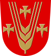
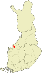
| coat of arms | map |
|---|---|

|

|
| Basic data | |
| State : |
|
| Landscape : | Ostrobothnia |
| Administrative community : | Jakobstad |
| Geographical location | 63 ° 39 ′ N , 22 ° 41 ′ E |
| Surface: | 826.11 km² |
| of which land area: | 794.33 km² |
| of which inland waterways: | 31.78 km² |
| Residents : | 11,016 (Dec. 31, 2018) |
| Population density : | 13.9 inhabitants / km² |
| Municipality number : | 599 |
| Language (s) : | Swedish , Finnish |
| Website : | www.pedersore.fi |
Pedersöre ( Swedish , Finnish , Peder Soren kunta ) is a commune in the western Finnish landscape Ostrobothnia . It includes the area around the port city of Jakobstad on the archipelago of the Gulf of Bothnia . 91 percent of the 11,016 inhabitants (as of December 31, 2018) are Finland-Swedes , 7 percent speak Finnish as their mother tongue. The community is officially bilingual.
The administrative seat is Bennäs (Finnish: Pennäinen ), the largest town is Kållby ( Kolppi ). The parish also includes the parish village of Pedersöre and the places Bäckby, Edsevö, Esse (Finnish: Ähtävä ; consisting of the villages Överesse and Ytteresse; Finnish: Ala-Ähtävä and Yli-Ähtävä ), Forsby, Sandsund ( Hietasalmi ), Karby, Katternö, Lappfors, Lepplax ( Leppälahti ), Lövö, Östensö, Purmo , Sundby, Västersund.
Pedersöre is one of the oldest communities in Österbotten and was first mentioned in a document in 1348. The city of Jakobstad was founded in 1652 on the territory of the municipality and received its Finnish name Pietarsaari after Pedersöre. The municipality Pedersöre, however, was officially called Pietarsaaren maalaiskunta in Finnish until 1989 , which means “rural municipality Jakobstad”. The stone church of Pedersöre is today in the urban area of Jakobstad. It dates from the early 16th century and was converted into a cruciform church under Jacob Rijfs in 1787–1795.
Web links
Individual evidence
- ↑ Maanmittauslaitos (Finnish land surveying office): Suomen pinta-alat kunnittain January 1, 2010 (PDF; 199 kB)
- ↑ Statistical Office Finland: Table 11ra - Key figures on population by region, 1990-2018
