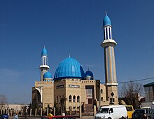
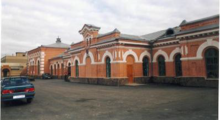
Petropavl
|
||
| Basic data | ||
|---|---|---|
| State : |
|
|
| Territory : | Northern Kazakhstan | |
| Founded : | 1752 | |
| Coordinates : | 54 ° 53 ' N , 69 ° 10' E | |
| Height : | 140 m | |
| Area : | 221.6 km² | |
| Residents : | 219,231 (Jan 1, 2020) | |
| Population density : | 989 inhabitants per km² | |
| Time zone : | EKST ( UTC + 6 ) | |
| Telephone code : | (+7) 7152 | |
| Postal code : | 150000-150013 | |
| License plate : | 15 (old: T, O) | |
| Äkim ( Mayor ) : | Bolat Shumabekov | |
| Website : | ||
| Location in Kazakhstan | ||
|
|
||
Petropavl ( Kazakh Петропавл ; Russian Петропавловск Petropavlovsk ) is a city in Kazakhstan . It is located in the north of the country, not far from the border with Russia, around 280 kilometers west of Omsk and 430 kilometers north of Nur-Sultan . It is the administrative center and, with 219,231 inhabitants (as of January 1, 2020), it is also the largest city in Northern Kazakhstan .
geography
Geographical location
The city is located in the southwestern part of the West Siberian lowlands on the right bank of the Ishim River , around 50 kilometers from the border with Russia . It is located in the northern Kazakhstan region and is the provincial capital of the latter.
climate
Petropawl has a humid continental climate that is warm in summer , which corresponds to the effective climate classification Dfb . The climate is characterized by large temperature differences between the summer and winter months. The summers are warm with average temperatures below 20 ° C, in winter the temperature drops to an average of -15 ° C. The lowest temperature ever recorded in Petropawl was on January 5, 1901 with a value of −48 ° C. The highest temperature value in the city was 40.5 ° C and was measured on July 18, 1940. The annual rainfall is around 350 mm, with most of the rainfall occurring in summer.
| Petropavl | ||||||||||||||||||||||||||||||||||||||||||||||||
|---|---|---|---|---|---|---|---|---|---|---|---|---|---|---|---|---|---|---|---|---|---|---|---|---|---|---|---|---|---|---|---|---|---|---|---|---|---|---|---|---|---|---|---|---|---|---|---|---|
| Climate diagram | ||||||||||||||||||||||||||||||||||||||||||||||||
| ||||||||||||||||||||||||||||||||||||||||||||||||
|
Average monthly temperatures and rainfall for Petropavl
Source: pogodaiklimat.ru , www.weather-atlas.com
|
||||||||||||||||||||||||||||||||||||||||||||||||||||||||||||||||||||||||||||||||||||||||||||||||||||||||||||||||||||||||||||||||||||||||||||||||||||||||||||||||||||||||||||||||||||
history
The city was founded in the 18th century on June 12, 1752 as a military Cossack fortress to defend the Central Asian border of the Russian Empire against the nomads from the Kazak steppes and was named after Peter and Paul . In 1807 Petropavlovsk was granted city rights and was assigned to the Tobolsk governorate . On May 11, 1849, a major fire destroyed over 450 buildings. The city and its surrounding areas were split off in 1868 to form the Akmolinsk region.
politics
mayor
The current mayor ( Äkim , kas. Әкім) of Shymkent has been Bolat Shumabekow since April 12, 2019 . During the Soviet period, the city administration was headed by the chairman of the executive committee. The following are the mayors of the city since 1990:
|
|
coat of arms
The coat of arms of Petropawl shows a Shangyraq (Kazakh шаңырақ), the crown of a Kazakh yurt . The three symmetrical lines that cross in the middle of the coat of arms are the roof poles (Kazakh Уық / uyq) of Shanghai. This Shangyraq is framed by a traditional pattern that is supposed to represent the folk art of the Kazakh people. At the bottom of the coat of arms is the inscription Петропавл (Kazakh for Petropavl). In addition, the coat of arms contains four symbols that best characterize the city at the beginning of the 21st century: at the top a key symbolizing the city's geographical position as the gateway to the north of Kazakhstan. On the right is a sheaf of wheat that represents the city as the center of the agricultural region in northern Kazakhstan. At the bottom there is an open book as a symbol for education and culture. Finally, on the left side, there is a gear that stands for industry and technology. The two colors of the coat of arms are gold and blue-green .
Town twinning
- Omsk , Russia
population
The city has a population of 207,402 (2014). About 71% of the population are ethnic Russians .
Population development
|
|
|
|
¹ census result
Culture and sights
Buildings
Sports
The city is home to the soccer club FK Qysyl-Schar SK .
Economy and Infrastructure
traffic
The A1 , which starts in the Kazakh capital, and the A16 from Schesqasghan end in the city . The A12 begins in Petropavlovsk and leads north to the Russian border.
Petropavl Airport is 11 km south of the city .
The oldest and therefore original main branch of the Trans-Siberian Railway crosses Kazakh territory on a 180-kilometer section (today, however, the main line runs further north in Russia on a newer branch). The route to Nur-Sultan , which runs via Kokshetau , also begins here .
education
Petropawl is home to the North Kazakhstan State University .
sons and daughters of the town
- Juri Annenkow (1889–1974), Russian artist
- Magschan Schumabaew (1893–1938), Kazakh writer
- Sabit Mukanow (1900–1973), Kazakh writer
- Lydia Auster (1912–1993), Estonian composer
- Vladimir Trettschikow (1913-2006), Russian painter
- Ermek Serkebaew (* 1926), Kazakh singer
- Vladimir Schatalow (* 1927), Soviet cosmonaut
- Murat Ajthozhin (1939–1987), Soviet molecular biologist
- Raisa Ryazanova (born 1944), Russian actress
- Alexander Viktorenko (* 1947), Soviet cosmonaut
- Valery Nikolaev (* 1947), Russian interpreter
- Yuri Pachomow (* 1956), Russian major general of Tyumen
- Vladimir Gachinski (1960–2005), artist
- Baqyt Duissenbayev (* 1970), Kazakh diplomat
- Alexander Vinokurow (* 1973), racing cyclist
- Yevgeny Awertschenko (* 1982), football player
- Zhanat Zhakiyanov (born 1983), boxer
- Sergei Skorych (* 1984), football player
- Dmitri Babenko (* 1985), speed skater
- Wladimir Loginowski (* 1985), soccer goalkeeper
- Irina Ektowa (* 1987), triple jumper
- Roman Kirejew (* 1987), racing cyclist
- Ruslan Tleubajew (* 1987), racing cyclist
- Artyom Sakharov (* 1991), racing cyclist
- Jekaterina Ektowa (* 1992), long and triple jumper
- Michail Litwin (* 1996), sprinter
See also
Web links
- Petropavl Official Website (Kazakh and Russian)
Individual evidence
- ↑ Численность населения Республики Казахстан по полу в разрезе областей и столицы, столицы, столицы, анколицы, столицы, городоав, областей и столицы, анкония, горойцы, коники, городоав,. ( Excel ; 96 KB) stat.gov.kz, accessed on July 19, 2020 (Russian).
- ↑ Погода в Петропавловске. Температура воздуха и осадки. Январь 1901 г. pogodaiklimat.ru, accessed August 10, 2019 (in Russian).
- ↑ Погода в Петропавловске. Температура воздуха и осадки. Июль 1940 г. pogodaiklimat.ru, accessed August 10, 2019 (in Russian).
- ↑ Символика города. Положение о гербе города Петропавловска. petropavl.sko.gov.kz, accessed August 3, 2019 (Russian).


