Piz Segnas
| Piz Segnas | ||
|---|---|---|
|
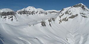
Piz Segnas (center left) from the southeast, from Fil de Cassons . On the far left Atlas, on the far right on the same ridge, the upswing to Piz Sardona and on the right in the foreground Piz Dolf . |
||
| height | 3098 m above sea level M. | |
| location | Border canton Glarus / Canton Graubünden , Switzerland | |
| Mountains | Glarus Alps | |
| Dominance | 7.09 km → Glaserhorn | |
| Notch height | 606 m ↓ Trinser Furgga | |
| Coordinates | 737 277 / 196 845 | |
|
|
||
| rock | Verrucano structure on limestone | |
| Age of the rock | Verrucano is the oldest rock in the Alps | |
| First ascent | 1861 by G. Sand-Frank with Heinrich Elmer | |
|
Piz Segnas seen from the west, i.e. the Glarus side; the left end of the Scheefeld is the Piz Sardona , to the right of the highest point is the Atlas and a chamber in front of it is the Tschingelhörner |
||
The Piz Segnas is a mountain in Switzerland . The summit structure - like that of the neighboring Piz Sardona - consists of the very old rocks of the Verrucano ceiling, which were pushed over the much younger layers of flysch that form the base of the mountain when the Alps unfolded . Throughout the area you can see the striking thrust line of the Glarus Thrust , also known as the Tectonic Arena Sardona , on the mountain flanks , which has been listed under this name as a UNESCO World Heritage Site since 2008 .
location
The summit is the main summit of this area and is located northeast of the Segnespass , which connects Elm in the canton of Glarus with Flims in the canton of Graubünden . To the south of it, the Tschingelhörner stand prominently as the foreground below the horizon, which extends into the Bernese and Valais Alps. A ridge extends south of the summit and forms the one kilometer long atlas (2925 meters). To the east, the Piz Dolf stands in front of the panorama, which extends to the Ortler or to the northeast to the Alpstein .
rise
The summit is reached from the west or from the northeast. The route from the northeast, however, leads over the receding glacier and is becoming more and more critical, which is why the westward ascent is described here (see reference). The mountain railway from Flims to Naraus and then on foot to Camona da Segnas ( 2102 m ) enables a shorter ascent . In the summer, the Graubergbahn, which is closer to itself, was not in operation from 1990 to 2015; it was operated again in 2016 when the Cassonsbahn was shut down. In the summer of 2009, a bus to Nagens (1 kilometer SW of the Camona da Segnas, at 2127 m asl) was in operation for the first time, from where something has to be descended on the Segnas ground near the hut. From the Segnas hut (Camona da Segnas) is about the Kar up towards the Bless passport. Before reaching the top of the pass below the west ridge, depending on the conditions, you climb over rubble or firn to the saddle not far from the southern pre-summit ( 3012 m ). From there it goes over the narrow ridge to the summit. The ascent is free of glaciers, but leads over alpine terrain and firn .
A good view of the mountain is possible from Fil de Cassons; either after an ascent through the Bargis Valley to Fuorcla Raschaglius and under the southern flank of Piz Dolf or, until 2015, with the cable car from Flims. A new railway is to lead into the area of the upper Segnasboden.
Plane crash
On August 4, 2018, the Junkers Ju 52 HB-HOT crashed on Piz Segnas, killing all 20 occupants.
literature
- Manfred Hunziker: Ringelspitz / Arosa / Rätikon, Alpineouren / Bündner Alpen , Verlag des SAC 2010, ISBN 978-3-85902-313-0 , p. 165.
- Richard Goedeke : 3000 meters in the northern Alps . Bruckmann, Munich 2004, ISBN 3-7654-3930-4
Web links
Individual evidence
- ↑ National map 1: 25,000 Elm, number 1174.
- ↑ Hiking Switzerland; Bargistal and Fil de Cassons on holiday in Graubünden ( Memento of the original from June 7, 2011 in the Internet Archive ) Info: The archive link was inserted automatically and has not yet been checked. Please check the original and archive link according to the instructions and then remove this notice.


