
Port Vila
| Port Vila | |||
|---|---|---|---|
|
|||
| Coordinates | 17 ° 45 ′ 0 ″ S , 168 ° 18 ′ 0 ″ E | ||
| Basic data | |||
| Country | Vanuatu | ||
| Shefa | |||
| ISO 3166-2 | VU-SEE | ||
| surface | 23.6 km² | ||
| Residents | 51,437 (2016-11-16) | ||
| density | 2,179.5 Ew. / km² | ||
| founding | 17th century | ||
 Aerial photograph of Port Vila (2006)
|
|||


Port Vila is the capital of the Pacific state of Vanuatu . It is located on the southwest coast of the island of Efate in the Vanuatu province of Shefa . The city has (as of 2009) 44,000 inhabitants.
Economy and Transport
Port Vila is the commercial center of Vanuatu. The country's most important port is located there, and Bauerfield Airport is also the most important airport.
The port of Port Vilas is often called by Australian cruise ships. The jetty for the cruise ships is three kilometers west of the city.
There is no regular city bus network with fixed routes, timetables or line numbers in Port Vila. The buses of various private companies run different routes depending on requirements.
history
Portuguese seafarers were the first Europeans to come to the island in the 17th century . In the period that followed, a small settlement developed, which was simply referred to as the Vila (Portuguese for small town). In 1906, Port Vila became the seat of French, then English and finally joint colonial administration .
At the end of 1959, the city, which at that time had 2500 inhabitants, was 60% destroyed by a hurricane.
In autumn 2004, 25 graves with three dozen human skeletons from the Lapita culture and pottery from 1200 BC were found in a burial site near the city . Found.
During the Second World War , Port Vila was used by the US armed forces as an important air force base in the Pacific, which explains the name of the airport ( Bauerfield International Airport ).
In 1987 the city was badly damaged by the cyclone "Uma". One of the city's landmarks, the Supreme Court building and the court files stored there, were completely destroyed by fire on the night of June 6th to 7th, 2007. On March 14, 2015, 90% of all buildings in Port Vila were destroyed or severely damaged by cyclone " Pam ".
architecture
One of the most striking buildings in the city is the parliament building, which was built in 1992 with Chinese help. A larger than life bronze sculpture of a Ni Vanuatu family stands in front of the entrance. Another monument made of carved totem poles was erected opposite the parliament .
Another striking building in Port Vilas is the Sacre Coeur Cathedral, the cathedral church of the Port-Vila diocese . Not far from the cathedral, the small church Porte du Ciel was built for the Vietnamese population in 1954. Also noteworthy are the Presbyterian Church on Independence Park, the smaller Church of Christ near the hospital and the Eglise de l'Assomption church with an attached monastery in the south of the city.
The town hall was built on a slope, from which a beautiful view over the city and harbor as well as the offshore island of Iririki is offered. A similarly impressive view is offered by the memorial for those killed in World War II, which was erected on a lawn in front of the Reserve Bank of Vanuatu.
At the main post office on Lini Highway, the city's main commercial street, the colorful reliefs and murals by Aloi Pilioko, one of the South Pacific's foremost contemporary artists, are noteworthy. Another mural of this kind is on an administration building opposite the market hall, which is no less worth visiting. In the Pilioko Art Gallery about 5 km south of the city, you can see other works by the artist as well as works of art from other islands in the Pacific.
The buildings of the University of the South Pacific , whose architectural style is partly based on traditional Melanesian architecture, are also worth a visit.
Cultural institutions

The Vanuatu Cultural Center serves as Vanuatu's national museum and cultural center. a. Ceramic of the Lapita culture is on display. Vanuatu's traditional sand drawings are also explained and demonstrated here. On the eastern edge of the city is the Ekasup Cultural Village, which resembles an open-air museum. In the center of the city there is an English and a French library.
Green spaces
The lively and well-kept Seafront Park with lawns, ponds and flower beds stretches between the main shopping street Lini Highway and Vila Bay . From here there is an impressive view of the islands of Ifira and Iririki off the capital. On Iririki, the former residence of the British governor is worth seeing.
Independence Park on the eastern edge of the city center, around which various ministries and authorities are grouped, has a large lawn with a grandstand. Sports competitions and cultural events take place here. Independence Park got its name in 1990 on the occasion of the celebrations of the 10th anniversary of Vanuatu's independence.
In contrast, the park-like urban cemetery northeast of the city center is an oasis of calm, in which the graves of the Chinese minority, laid out in the typical Chinese style, represent a striking contrast to the graves of the Christian majority, which are richly decorated with flowers.
gallery

Wall paintings and reliefs on the main post office

Seafront Park

Sacre Coeur Cathedral
Presbyterian Church

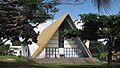
Vanuatu Parliament
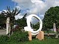
Monument opposite the Parliament

Mural opposite the market hall


.jpg)
sons and daughters of the town
- Janice Alatoa (* 1988), track and field athlete
Web links
Individual evidence
- ↑ 2009 National Population and Housing Census. Vanuatu National Statistics Office, 2009, p. 12.
- ↑ Jocelyn Harewood: Vanuatu and New Caledonia. P. 57. Footscray 2009.
- ^ Graves of the Pacific's First Seafarers Revealed , Richard Stone: Science Magazine. April 21, 2006: Vol. 312. No. 5772, p. 360.
- ↑ http://www.bbc.com/news/world-asia-31892872.htm BBC.com, accessed March 15, 2015.
- ↑ Michael Brillat: Südsee , p. 54. Munich 2011
- ↑ Michael Brillat: Südsee , p. 52. Munich 2011
- ^ Jocelyn Harewood: Vanuatu and New Caledonia , p. 59. Footscray 2009