
Queich
| Queich | ||
 River course |
||
| Data | ||
| Water code | DE : 23772 | |
| location |
Palatinate Forest
|
|
| River system | Rhine | |
| Drain over | Rhine → North Sea | |
| source | at Hauenstein 49 ° 10 ′ 6 ″ N , 7 ° 50 ′ 49 ″ E |
|
| Source height | 273 m above sea level NHN | |
| muzzle | near Germersheim from the left in the Rhine Coordinates: 49 ° 13 '39 " N , 8 ° 23' 4" E 49 ° 13 '39 " N , 8 ° 23' 4" E |
|
| Mouth height | 95 m above sea level NHN | |
| Height difference | 178 m | |
| Bottom slope | 3.5 ‰ | |
| length | 51.6 km | |
| Catchment area | 271.158 km² | |
| Discharge at the Siebeldingen A Eo gauge : 196 km² Location: 28.9 km above the mouth |
NNQ (08/12/1959) MNQ 1957/2009 MQ 1957/2009 Mq 1957/2009 MHQ 1957/2009 HHQ (12/21/1993) |
507 l / s 831 l / s 1.75 m³ / s 8.9 l / (s km²) 10.4 m³ / s 28.2 m³ / s |
| Left tributaries | Wellbach , Eisbach , Fuchsbach | |
| Right tributaries | Ranschbach , Birnbach | |
| Reservoirs flowed through | Paddle pond | |
| Medium-sized cities | Landau , Germersheim | |
| Small towns | Annweiler | |
 Queich in Annweiler |
||
 In Landau |
||
The Queich is an almost 52 km long left and western tributary of the Upper Rhine . It rises in the southern part of the Palatinate Forest , the German part of the Wasgau , near Hauenstein and flows into the Rhine in the Upper Rhine Plain in the city of Germersheim . Along with those of Speyerbach , Lauter and Schwarzbach, its river system is one of the four major drainage systems in the Palatinate Forest.
geography
source
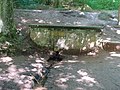
The Queich source is located 3 km south of the municipality of Hauenstein at 273 m above sea level. NHN at the east foot of the 461 m high Winterberg . It is set with hewn stones from the red sandstone typical of the landscape , at the spring there is also a water treading pool and benches.
course
The Queich initially flows as a narrow stream through the Stephanstal in a northerly direction. Shortly before the start of the residential development in Hauenstein, it is dammed up to the 200 m long and 40 m wide paddle pond . After crossing the municipality, she turns to the east and moves in large arcs through the Queichtal, which is named after her . You pass Wilgartswiesen and Rinnthal ; there it receives its strongest inflow from the left and northwest, the 15 km long Wellbach . Then it moves through Annweiler-Sarnstall , where the Rimbach flows from the southwest , through Annweiler and Annweiler-Queichhambach . There she is again amplified from the left and northwest, from their second strongest inflow, the little earlier by Eußerbach and Dernbach formed Eisbach .
Queichquelle
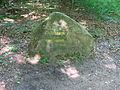
Ritterstein "Queichursprung"

Marking near the source of Queich

In Annweiler

In Offenbach

Spiegelbach branch (to the right)

In the Bellheim Forest


After a good 20 km in Albersweiler, the valley opens up towards the Rhine plain, and the hilly landscape begins on the German Wine Route , which is the most important wine-growing region in the Palatinate . In Siebeldingen the Queich crosses the German Wine Route, at the suburb of Godramstein it reaches the urban area of Landau . There it is mostly piped and can only be perceived in some places at least as a channel . In the suburb of Queichheim , the Queich leaves the city after arriving in the open plain about 30 km below its source; here the Birnbach flows from the right.
Your next stops are Offenbach an der Queich and Ottersheim , whose districts it only flows through in the north, while it does not touch the settlement areas further south. At the Ottersheim dividing weir , the Queich branches off the water for the right branch of the Spiegelbach estuary , which reaches the Rhine to the southeast via Bellheim and Sondernheim, which is incorporated into Germersheim . The Queich itself turns more to the north-northeast and flows into the north of the city of Germersheim at 95 m above sea level in the Rhine.
Catchment area
The 271.158 km² catchment area of the Queich extends from the Palatinate Forest , over the Dahn-Annweiler-Felsenland to the Northern Upper Rhine Lowland and is drained through it over the Rhine to the North Sea.
It borders
- in the northeast to the catchment area of the Hainbach , which drains over the Woogbach into the Speyerbach ,
- in the southeast to that of the Klingbach , which drains over the Michelsbach into the Rhine,
- in the southwest of the Lauter , which flows into the Rhine,
- in the west to the Schwarzbach , which drains over the Blies , the Saar and the Moselle into the Rhine and
- in the north to that of the Speyerbach, which flows into the Rhine.
The highest point is the Roßberg at 637 m above sea level. NHN in the northwest of the catchment area.
Tributaries
Table of the main tributaries and branches of the Queich.
Data after
- GeoExplorer of the Rhineland-Palatinate Water Management Authority ( information ) and
- Map service of the landscape information system of the Rhineland-Palatinate Nature Conservation Administration (LANIS map) ( notes )
The color gray highlights the data set by the Queich itself.
The color blue highlights the branches that branch off.
|
Stat. in km |
Surname | GKZ | location | Length in km |
EZG in km² |
Mouth | Mouth height in m above sea level NHN |
Source location | Source height in m above sea level NHN |
Remarks |
|---|---|---|---|---|---|---|---|---|---|---|
| Gillenbach | 23772-12 | right | 2.3 | 2.4 | Hauenstein, town center | 225 | Hauenstein, Ostfuß high head | 276 | ||
| Mischbach | 23772-13? | Left | 0.4 | 0.6 | Hauenstein, northeast end | 224 | Hauenstein, south of the sports fields | 233 | ||
| Steinbach | 23772-14 | right | 1.9 | 2.1 | Hauenstein, Westfuß Spirkelbacher Rauhberg | 217 | Hauenstein, east foot Weimersberg | 268 | ||
| (Bach vom Kohlwoog) | 23772-16 | Left | 1.2 | 3.2 | Wilgartswiesen, southern edge | 211 | Wilgartswiesen, Kohlwoog | 235 | ||
| (Inflow from below the Tiergartenhalde) | 23772-18 | Left | 1.1 | 1.9 | Wilgartswiesen, start of town | 209 | Wilgartswiesen, nature reserve | 230 | ||
| Spirkelbach | 23772-18 | right | 3.3 | 3.3 | Wilgartswiesen, driveway B 10 | 208 | Spirkelbach, Westfuss Höllenberg | 248 | ||
| Wellbach | 23772-2 | Left | 12.8 | 59.3 | Rinnthal, junction B 48 from B 10 | 190 | Eschkopf , Ostfuß | 490 | ||
| (Inflow from the Finstertal) | 23772-3? | Left | 0.8 | 0.9 | Sarnstall, north end | 185 | Sarnstall, Im Finstertal | 254 | ||
| Rimbach | 23772-4 | right | 8.2 | 20.9 | Sarnstall, south end | 182 | Darstein, Northwest Foot Kochelstein | 269 | ||
| Ebersbach | 23772-52 | right | 3.2 | 4.7 | Annweiler, western edge | 181 | Wernersberg, southwest foot Ebersberg | 267 | ||
| (Inflow from the quarry) | 23772-53? | right | 1.5 | 1.1 | Annweiler, Westende | 180 | Annweiler, western slope of Klingelberg | 270 | ||
| Bindersbach | 23772-54 | right | 1.4 | 2.3 | Annweiler, Messplatz | 178 | Bindersbach, northern edge | 230 | ||
| Trifelsbach | 23772-56 | right | 2.9 | 2.8 | Annweiler, northern edge, Queich Bridge B 10 | 176 | Annweiler, Ostfuß Ruin Anebos | 287 | ||
| Hahnenbach | 23772-58 | Left | 2.8 | 3.9 | Queichhambach, opposite. Northwest edge | 172 | Gräfenhausen, eastern foot sweeping head | 278 | ||
| (Bach vom Hohenberg) | 23772-592 | right | 2.0 | 0.9 | Queichhambach, northern edge | 172 | Queichhambach, north-west slope Hohenberg | 370 | ||
| Eisbach | 23772-6 | Left | 10.5 | 49.8 | Annweiler, Neumühle | 168 | Edenkoben, Pfaffenkopf , Westfuss | 353 | with Quellbach Katzenbach ; Lower course instead of Eisbach after a larger upper course also Eußerbach | |
| Wintersbach (?) | 23772-71? | right | 1.5 | 1.0 | Albersweiler, train station | 167 | Albersweiler, north slope Hohenberg | 235 | ||
| Schwelterbach | 23772-72 | Left | 2.6 | 2.7 | Albersweiler, near Friedhofsweg | 162 | Frankweiler, Ostabfall Orensberg | 320 | ||
| Kolchenbach | 23772-74 | right | 2.5 | 2.3 | Siebeldingen, western edge | 162 | Birkweiler, Kastanienbusch | 247 | ||
| Siebeldinger Bach | 23772-75? | Left | 1.7 | 1.6 | Siebeldingen, western edge | 160 | next to the German Wine Route Frankweiler – Siebeldingen | 215 | ||
| Frankenbächel / Ransgraben | 23772-76 | Left | 3.2 | 3.4 | Godramstein, southwest | 152 | Frankweiler, location | 227 | ||
| Ranschbach | 23772-78 | right | 6.9 | 5.0 | Landau, a little to the west | 147 | Ranschbach, Rosental | 299 | ||
| Birnbach | 23772-8 | right | 15.0 | 12.6 | Queichheim, St. Pauls Stift | 135 | Leinsweiler, west on the northwest slope of the Wetterberg | 352 | ||
| →→ Spiegelbach | 237548 | to the right | 9.9 | 54.6 | Sondernheim, in the Old Rhine | 98 | Ottersheim dividing weir between Neumühle von Offenbach an der Queich and Zeiskamer Mühle | 123 | Departure of the Spiegelbach estuary | |
| Large trench | 23772-92 | Left | 2.7 | 2.0 | Zeiskam, below Zeiskam mill | 119 | Offenbach an der Queich, low forest lights Queichschlag | 124 | is the right branch of a Floßbach / Fuchsbach / the later Druslach , possibly previously fed by the Queich itself | |
| Sollach | 23772-94 | right | 8.1 | 12.9 | Germersheim, edge of the forest in the west | 110 | Flatland wedge in the fork of the Ottersheim dividing weir | 122 | from several drainage ditches | |
| Trumpeter pit | 23772-96 | right | 2.3 | 2.6 | Germersheim, northern edge of the old fortress grounds at Filchnerstrasse | 100 | Departure from the Queich in Germersheim, west edge, corner of August-Becker-Strasse | 105 | The Queich runs along the outside of the former fortress city, the Trompetergraben goes off to the right and runs through the city until the reunification. According to another source, the two parallel branches are just reversed: the Queich runs through the city and the Trompetergraben on the edge. | |
| →→ Kleinrheingraben / Wörthgraben | 2377322 | to the left | 2.3 | 3.0 | Lingenfeld, Old Rhine | 100 | Germersheim, northern edge of the old fortress grounds at Filchnerstrasse, water crossing | 100 | Departure at the confluence of the Queich and Trompetergraben, flows into the Lingenfeld Altrhein. From here the Queich has a short estuary to the Rhine itself. | |
| Queich | 23772 | n / A | 51.6 | 271.2 | Germersheim | 95 | Hauenstein , Stephanstal | 273 | flows into the Rhine |
geology
Abrasion in the Palatinate Forest

The Federal Institute for Geosciences and Raw Materials writes about the importance of the Queich for the geological shape of the Palatinate Forest in the presentation of its map for the region:
“Together with the Wasgau, the Palatinate Forest represents the most diverse red sandstone landscape in Germany. Layers of the Middle and Upper Red Sandstone are open here. During the tectonic uplift of the Palatinate Forest, the Queich and its tributaries cut into the mountains and cleared the valleys over a wide area. In the wide, ragged valley expansions on the eastern edge of the Palatinate Forest, the Annweiler layers of the lower red sandstone and the red-lying area of the Nahe group come to light. "
The alluvial fan in the Rhine plain
From the foothills of the Upper Rhine Graben, numerous brooks strive towards the Rhine, including from the Palatinate Forest over the Haardtrand in an easterly direction. In the last ice age and with its decline, there was abundant meltwater available, which transported large amounts of rubble and sand from the mountains to the Rhine plain. The water spread over the plain, and so gravel and sand were deposited there and formed so-called alluvial fans. The name comes from the triangular shape that extends into the plain towards the Rhine.
The exit of the Queich from the Palatinate Forest near Albersweiler via the Haardt near Godramstein into the Rhine plain created an alluvial fan as far as the Rhine lowlands.
Because the predominantly sandy soil was of little interest for arable farming, because it was not very productive, forest areas could be preserved on these alluvial areas even after agriculture had been established as an economic form, while the loess areas were cleared early . The Queich thus created the basis for the existence of the Bellheim Forest .
history
Mills, wood drift and paper industry
The use of the water power of the Queich for mills is old. Since the 13th century, the water was also used for the drift of short timber. The main time of this use was around the middle of the 19th century. However, the Trift presupposed that the Queich was temporarily dammed in Klausen or Woogen in order to provide the timber transports and sufficient water supply . During these periods of time, all the mills below did not have the necessary water. As soon as the wood was released, there was an abundance of water, but this often caused flooding of the mill inflows and, if wood became wedged, even damage. In 1881 the mill operators finally managed to stop drifting entirely. Since then, the water from the Queich has only been used to operate mills, apart from the Sarnstall paper industry , which needed the water for paper production and released it back into the creek bed in a correspondingly polluted state.
Albersweiler Canal and Landau Fortress
When the French Marshal Vauban expanded the city of Landau into a fortress during the Palatinate War of Succession , he had the Albersweiler Canal built between 1688 and 1691 , a 12 km long navigable connection from Landau up to the Albersweiler quarry , which ran parallel to the Queich and was fed with its water has been. Remnants of this second oldest artificial waterway in Germany (after the Finow Canal from 1608) are still preserved, such as the locks with which the stream water was diverted into the canal.
Queich lines
In the Austrian War of Succession in the 1740s, French troops ordered the construction of the Queich lines between Landau and the Rhine near Hördt as a line of fortification. A preserved ski jump can still be found in the Hördter Wald near Spiegelbach .
Relocation of the lower reaches
More recent research suggests that the lower course of the Queich at around the height of Zeiskam was moved around 2 km to the north at some point, probably already in the Middle Ages . The reason was obviously that they wanted to relocate the confluence with the Rhine to the city of Germersheim for reasons of the Holztrift .
Attractions

Hauenstein Shoe Museum

Evangelical Church Rinnthal

Trifels Castle near Annweiler

Bornheim stork barn

Germersheim Fortress


Buildings
- Pilgrimage church Maria Himmelspforte on the Winterberg above the Queich spring
- German Shoe Museum and Transparent Shoe Factory in Hauenstein
- Falkenburg ruins near Wilgartswiesen
- Evangelical parish church in neoclassical style in Rinnthal
- Trifels Castle near Annweiler
- Museum under the Trifels , Wassergasse and Stadtmühle in Annweiler
- Lock house in Landau
- Lock at the Paulusstift in Landau-Queichheim
- Partition weir near Ottersheim
- Fortress Germersheim with various historical and modern hydraulic structures, z. B. a new fish ladder in 2009
nature
- Bach nature trail run by the Queichtal fishing club on the riding meadows between Godramstein and Landau
- Stork barn (care station) and stork center (educational institution) of the Palatinate Stork campaign in Bornheim
- The water meadows along the Queich are flooded several times a year between April and August in a small-scale mosaic according to historical water rights in a cooperation between agriculture, municipalities and nature conservation associations as a Rhineland-Palatinate pilot project (including Natura 2000 project area). The most important actor is the "Queichwiesen Interest Group". The water meadows are the habitat of the largest Rhineland-Palatinate white stork population.
traffic

Queichtalbahn west of Annweiler

Barbarossa tunnel near Annweiler


Between Hauenstein and Landau, the Landau – Rohrbach railway has been running along the Queich since 1875 , as has federal road 10 , which crosses several tunnels near Annweiler. Below Landau the Queich flows through wide meadows and the Bellheim Forest . This area is only accessible to motor vehicles through side streets.
The Queichtalradweg , which follows the entire course of the Queich from the source to the mouth, is laid out on a well-developed network of trails .
literature
- Federal Institute for Geosciences and Raw Materials (Ed.): Geological overview map 1: 200,000, sheet CC 7110 Mannheim .
Web links
Individual evidence
- ^ German Hydrological Yearbook Rhine Region, Part I 2009 State Institute for Environment, Measurements and Nature Conservation Baden-Württemberg, p. 98, accessed on January 22, 2016 (PDF, German, 1.85 MB).
- ↑ Landscape information system of the nature conservation administration: LANIS map service . Retrieved March 3, 2014.
- ↑ Landscape information system of the nature conservation administration: Exact marking of the source . Retrieved March 8, 2014.
- ↑ Landscape information system of the nature conservation administration: Exact marking of the mouth . Retrieved March 8, 2014.
- ↑ a b c d e f Length and catchment area measured on: Map service of the landscape information system of the Rhineland-Palatinate nature conservation administration (LANIS map) ( notes )
- ↑ a b Geological overview map 1: 200,000, sheet CC 7110 Mannheim. Federal Institute for Geosciences and Natural Resources, accessed on December 22, 2014 .
- ↑ a b Carola Schnug-Böger thing, Doris Herrmann: Information board Speyer Forest (stand at the forest recreation ) on behalf of the city of Speyer, photographed on May 16, 2012 found.