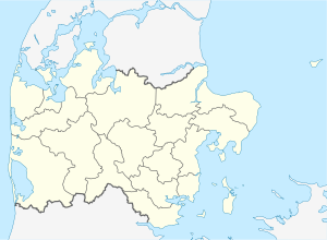
Randers Fjord
| Randers Fjord | ||
|---|---|---|
| Waters | Kattegat | |
| Land mass | Central Denmark region | |
| Geographical location | 56 ° 33 '40 " N , 10 ° 14' 50" E | |
|
|
||
| Tributaries | Gudenå , Alling Å | |
The Randers Fjord is a 30 km long Danish fjord that runs from the town of Randers to the Kattegat between Denmark and Sweden . In the upper part of the river Gudenå flows into the fjord. To the northeast, coming from the district Allingåbro, there is a second arm, the Grund Fjord with the inflow from the smaller river Alling Å . In a northerly direction the fjord runs past the villages of Uggelhuse, Hollandsbjerg, Mellerup, Holbæk and Udbyhøj Vasehuse, which all belong to Randers Municipality . The Udbyhøj Lystbådehavn marina is located in the transition to the Kattegat .
ecology
Since the Randers Fjord the tidal subject, the air coming from the tributaries mix fresh water with the sea in oppressive salt water and let brackish water with different salt concentration occur. While the upper part of the fjord has the character of a broad river, there are extensive reed beds in the lower part , while the water is much narrower.
From Gudenå, Denmark's longest watercourse, significant amounts of fresh water flow into the narrow fjord , especially when the water in the Kattegat is low . During floods , however, the fresh water flow is stopped by the salt water penetrating from the outside. This results in different numbers of freshwater and saltwater fish. All year round, sea trout that come from the Gudenå and its tributaries or from the Allingå at the end of Grund Fjord migrate through the water system of Fjrods. The water in the Grund Fjord consists mainly of fresh water and is laden with organic matter such as dead algae.
Large parts of the area around the fjord form the Randers Fjord Nature Development Park, which aims to preserve the geological and ecological features of the fjord and provide visitors with guided tours and information about the nature reserves. The Randers Fjord Nature Park is part of the overall Danish Nature Park project .
Ferry connections
About in the middle of the fjord, a ferry connects the districts of Voer and Mellerup. The Djursland fjord center is also located there . Another ferry connection is in the estuary from Udbyhøj South to Udbyhøj Strand.
Leisure and Tourism
The Randers Fjord is a popular fishing area for both locals and tourists due to its length and fish stocks . Fishing spots are the port of Randers, Dronningborg Bredning, Støvring Dæmningen, Uggelhuse, the Grund Fjord, Mellerup, Kanalinsel, Skalmstrup Vig, Stenrevet, Udbyhøj and the sand dunes Sælhundepollerne in the confluence with the Kattegat.
In coordination with the goals of the nature development park, the aim is to achieve gentle tourism . There are options for camping, bicycle camping, mooring for boats and the usual option for Denmark to stay in mostly privately rented holiday homes.
There is a golf club near the fjord .
Individual evidence
- ↑ Grund Fjord Nature Park . Retrieved June 19, 2018 (Danish).
- ↑ Randers Fjord Nature Park . Retrieved June 17, 2018 (Danish).
- ↑ The nature parks of Denmark . Retrieved June 17, 2018 (Danish).
- ↑ Fishing in East Juttland . Retrieved June 17, 2018.
- ↑ Visit Randers . Retrieved June 17, 2018.
- ↑ Randers Fjord Camping . Retrieved June 17, 2018 (Danish).
- ↑ Randers Fjord Golf Club . Retrieved June 17, 2018.


