
Sagres
| Sagres | ||||||
|---|---|---|---|---|---|---|
|
||||||
| Basic data | ||||||
| Region : | Algarve | |||||
| Sub-region : | Algarve | |||||
| District : | Faro | |||||
| Concelho : | Vila do Bispo | |||||
| Coordinates : | 37 ° 0 ′ N , 8 ° 56 ′ W | |||||
| Residents: | 1909 (as of June 30, 2011) | |||||
| Surface: | 34.37 km² (as of January 1, 2010) | |||||
| Population density : | 56 inhabitants per km² | |||||
| Postal code : | 8650 | |||||
| politics | ||||||
| Address of the municipal administration: | Junta de Freguesia de Sagres Rua Joaquim Maurício 8650-383 Sagres |
|||||
| Website: | www.jf-sagres.pt | |||||


Sagres [ ˈsaɣɾɯʃ ] is a Portuguese municipality in the west of the Algarve , near Cabo de São Vicente , the most south-westerly point of mainland Europe . The place belongs to the district of Vila do Bispo , had 1909 inhabitants on June 30, 2011 and an area of 34.4 km². It is also located in the Parque Natural do Sudoeste Alentejano e Costa Vicentina , a nature reserve that stretches along the entire southwestern Portuguese coast.


Legendary nautical academy
Because of its exposed location, the place served as the starting point for numerous sea voyages in earlier centuries. The product allegedly in the 15th century , founded the so-called Maritime Academy (escola náutica) of Prince Henry the Navigator , then governor of the Algarve , is but a legend of later centuries, as Portuguese historians have shown at the beginning of the last century. The actual training of the seafarers took place mainly in Lisbon and Lagos .
The southern border of the area explored at that time was at Cape Bojador , approx. 27 ° N, on the African west coast, the Cape of No Return. Sea monsters and burns were feared behind it. The first modern European to go around it and come back was Gil Eanes from Lagos in 1434 .
Cont
Southwest of Sagres on a one kilometer long and about 300 meter wide headland with steeply sloping cliffs , the Ponta de Sagres , is the Fort ' Fortaleza de Sagres ', a national monument of paramount importance. Inside this fortress is a famous stone circle, which was only uncovered in 1928, the age and purpose of which is unclear. The circle, divided into 42 fields and with a diameter of 43 m, is interpreted as a wind rose ( Rosa dos Ventos ), but could also have been a sundial . However, everyone agrees that it dates from the time of Henry the Navigator.
To the north of it, on the cliffs above the beach of Praia de Beliche, there is a smaller fort , ' Fortaleza de Beliche ', which was destroyed by the soldiers of Francis Drake in 1587 , with the exception of the small chapel of Santa Catharina. After it was rebuilt in 1632 and again destroyed in 1755 by the great earthquake and the subsequent tsunami , it lay in ruins for over 200 years. According to current estimates, this earthquake had a strength of around nine on the Richter scale and its epicenter was only 200 km southwest of Cabo de São Vicente in the Atlantic. It was one of the most destructive natural disasters in European history. The Fortaleza de Beliche was restored in 1960 on the 500th anniversary of the death of Henry the Navigator.
lighthouse
At Cabo de São Vicente , the most south-westerly point of Europe, there is a large lighthouse , which, with a nominal length of around 90 kilometers, is considered to be the strongest in Europe. The lighthouse can be visited from time to time.
tourism
In the 1980s and 1990s, an insider tip for individualists, dropouts and those looking for relaxation, surfers brought life and money to the place, but it has not lost its calm, although there are now evening entertainment options. A lot has been built in Sagres since 1998, with hotels and accommodations in all price ranges being built that are adapted to nature.
Attractions
- The Fort Fortaleza de Sagres (only tower and walls are preserved), situated on a 1000 m long, 300 m wide rock, Ponta de Sagres.
- The Fort Fortaleza do Cabo de São Vicente the former Convento do Corvo monastery
- The Fort Fortaleza de Belixe or Fortaleza de Santo António do Belixe
- The Fort Fortaleza de Nossa Senhora da Guia or Forte da Baleeira

administration

Sagres is the seat of a municipality of the same name ( Freguesia ) in the district ( concelho ) of Vila do Bispo in the Faro district . 1909 inhabitants live in it on an area of 34 km² (as of June 30, 2011).
The municipality consists only of the village of Sagres.
literature
- Leite, Duarte: O Infante Dom Henrique , in: Leite, Duarte, História dos Descobrimentos, Vol. 1, Lisboa 1959, 67–265.
- Mees, Jules: Henri le navigateur et l'académie portugaise de Sagres , in: Boletim da Sociedade de Geografia de Lisboa, Vol. 21 (1903), 33–51.
- Randles, WGL: The Alleged Nautical School Founded in the Fifteenth Century at Sagres by Prince Henry of Portugal, Called the 'Navigator' , in: Imago Mundi, Vol. 45 (1993), 20-28.
Web links
- Map of the Freguesia Sagres at the Instituto Geográfico do Exército
- Map of Sagres and Cape Vincente
- Sagres Municipal Council website
- Tourism website around Sagres (German, English, Spanish and Portuguese)
Picture gallery

Praia do Tonel beach in Sagres
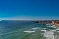
Cliffs in Sagres

The fortress "Fortaleza de Sagres"


Individual evidence
- ↑ a b www.ine.pt - indicator resident population by place of residence and sex; Decennial in the database of the Instituto Nacional de Estatística
- ↑ Overview of code assignments from Freguesias on epp.eurostat.ec.europa.eu
- ^ Address of the community
