Seengen
| Seengen | |
|---|---|
| State : |
|
| Canton : |
|
| District : | Lenzburg |
| BFS no. : | 4208 |
| Postal code : | 5707 |
| Coordinates : | 657 967 / 242050 |
| Height : | 477 m above sea level M. |
| Height range : | 441–713 m above sea level M. |
| Area : | 9.69 km² |
| Residents: | 4086 (December 31, 2019) |
| Population density : | 422 inhabitants per km² |
|
Proportion of foreigners : (residents without citizenship ) |
11.7% (December 31, 2019) |
| Website: | www.seengen.ch |
|
Seengen |
|
| Location of the municipality | |
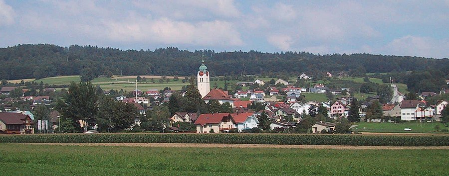
Seengen ( Swiss German : ˈseːŋə ) is a municipality in the Swiss canton of Aargau . It belongs to the Lenzburg district and is located in the Seetal at the northern end of Lake Hallwil .
geography
The center of the widely ramified village is about one kilometer from the lake shore on the eastern edge of the lake valley. The Aabach plain extends to the west . The area around the northern tip of the lake is swampy and protected . The gently sloping slopes of the 712 meter high Eichberg rise to the east and north. This is part of the Rietenberg chain and forms the natural border to the Bünztal . Vineyards extend to the southeast, where the slopes meet the lake shore .
The area of the municipality is 969 hectares , of which 317 hectares are forested and 142 hectares are built over. The highest point is at 712 meters on the Eichberg, the lowest at 441 meters on the banks of the Aabach at the three border point to Hallwil and Seon . Neighboring communities are Egliswil in the north, Villmergen in the northeast, Sarmenstorf in the southeast, Meisterschwanden in the south, Boniswil in the southwest, Hallwil in the west and Seon in the northwest.
history
5000 years ago, during the Neolithic Age , people lived on the shores of Lake Hallwil (see, among others, Meisterschwanden – Erlenhölzli and Beinwil am See – Ägelmoos ).
In Seengen there was a lakeside settlement (pile dwellings) in the Riesi moor reserve (also called Risle or Rieslen ) in the Late Bronze Age , approx. 11–9 . Century BC BC (see Seengen-Riesi ). This site has been part of the UNESCO World Heritage “ Prehistoric pile dwellings around the Alps ” since 2011 .
During the time of the Roman Empire, there were three manors in the municipality of Seengen . One was located at the current church and was inhabited in the 1st and 2nd centuries, as various finds of terra sigillata , brick stamps and mosaic fragments have shown. The other two manors (from the 2nd and 3rd centuries) were located directly next to each other at the level of the Markstein and were connected by a paved floor.
Archaeological finds indicate the subsequent settlement by the Alemanni . Seynga was first mentioned in a document in 893 in an interest toboggan run by the Fraumünster in Zurich . The place name comes from the Old High German Seingun , which means "for the settlers on the lake (shore)". In the late 12th century, the Hallwylers had a residential tower built on the Aabach, from which Hallwyl Castle developed. The Hallwylers were an influential ministerial family in the service of the Counts of Lenzburg , and from 1173 onwards, the Counts of Kyburg . After these died out, the Habsburgs took over sovereignty and blood jurisdiction in 1273 .
In 1415 the confederates conquered Aargau. Seengen now belonged to the subject area of the city of Bern , the so-called Bernese Aargau . The village was the capital of a judicial district in the Lenzburg district , in which the Lords of Hallwyl exercised lower jurisdiction and other rights. In 1528 the Bernese introduced the Reformation . Eichhof, first mentioned in 1346, a former Steckhof , was probably integrated into the community in 1751. The first traditional opening dates from 1462, the first school building was built in 1686. Agriculture was dominant , and viticulture also played a larger role. From the middle of the 18th century, the processing of cotton in homework brought additional income opportunities.
In March 1798 the French took Switzerland, ousted the «Gracious Lords» of Bern and proclaimed the Helvetic Republic . Seengen has been part of the canton of Aargau since then. The spa facility in Brestenberg Castle, founded in 1844, attracted wealthy guests from all over Europe. In agriculture, there was a change from traditional cereal farming to dairy farming. In the 19th century, straw weaving was temporarily important. The economic development stagnated, however, as the Seetalbahn, opened in 1883, runs far away from the village on the western edge of the valley. Because of this, the industry was slow to develop. In the mid-1970s, however, a lot of building activity began, which resulted in a doubling of the population.
Attractions
Hallwyl Castle is the landmark of Seengen . The Hallwyler's headquarters is one of the most important moated castles in Switzerland and is located on two artificial islands in the Aabach, around one kilometer west of the village center. Brestenberg Castle is about a kilometer to the south . It is a Hallwyler country estate, which was created in 1625 through the expansion of a house built in the 16th century. In the 19th century there was a water spa that was known throughout Europe; today the castle is privately owned and not open to the public.
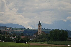
The old late Gothic church of Seengen , which was consecrated in 1496, became more and more dilapidated and was demolished in 1825. As a replacement, a new building in the late classicist style was built in 1820/21 . The master builder was Kopp from Beromünster , who at the same time built an almost identical church in Meisterschwanden . The interior is oval, while the outer walls form an elongated octagon. The rectory was built in 1742. The former Untervogtei on Kreuzgasse was built around 1440 as a residential tower on behalf of Rudolf IV von Hallwyl . In 1578 the older walls were completely converted into a stepped gable house in the late Gothic style. The Alte Schmitte, built in 1774, is located in the upper village. It was acquired by the municipality in 1990 and renovated; today it serves as a museum for temporary exhibitions with regional themes.
coat of arms
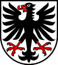
The blazon of the municipal coat of arms reads: "In white, red armored and tongued black eagle." The coat of arms corresponds to that of the extinct ministerial family of the Lords of Seengen, which was first depicted in the Zurich coat of arms in 1340 .
population
The population developed as follows:
| year | 1559 | 1798 | 1850 | 1900 | 1930 | 1950 | 1960 | 1970 | 1980 | 1990 | 2000 | 2010 |
| Residents | approx. 330 | 1176 | 1528 | 1353 | 1288 | 1445 | 1447 | 1512 | 1643 | 2064 | 2526 | 3417 |
On December 31, 2019, 4086 people lived in Seengen, the proportion of foreigners was 11.7%. In the 2015 census, 47.4% described themselves as Reformed and 20.9% as Roman Catholic ; 31.7% were non-denominational or of other faiths. In the 2000 census, 93.9% stated German as their main language, 1.0% each Albanian and Italian and 0.8% each French and Serbo-Croatian .
Politics and law
The assembly of those entitled to vote, the municipal assembly , exercises legislative power. The executing authority is the five-member municipal council . He is elected by the people in the majority procedure, his term of office is four years. The parish council leads and represents the parish. To this end, it implements the resolutions of the municipal assembly and the tasks assigned to it by the canton. The District Court of Lenzburg is the first instance responsible for legal disputes . Seengen belongs to the Friedensrichterkreis XII (Seon).
economy
According to the corporate structure statistics (STATENT) collected in 2015, Seengen has around 1200 jobs, 7% of them in agriculture, 18% in industry and 75% in the service sector. Many employees are commuters and work in the vicinity (mainly in Seon or Lenzburg ).
The village has had market rights since 1763 . The cattle, agricultural machinery and goods market takes place in spring and autumn, but cattle and agricultural machinery have not been offered since the 1980s. On the first weekend of December there is also an annual Christmas market in Seengen .
Viticulture has always been of great importance . To the south of the village, on the slopes above Lake Hallwil, an area of 11.1 hectares was planted with vines in 2018. A dozen different varieties are grown, with Blauburgunder , Chardonnay , Merlot and Riesling × Sylvaner predominating.
traffic
Seengen lies on the cantonal road from Meisterschwanden to Boniswil , where it meets the main road 26 from Lenzburg via Hochdorf to Lucerne . Kantonsstrasse 374 leads to Egliswil , Kantonsstrasse 373 to Sarmenstorf . The connection to the public transport network is provided by two bus routes operated by Regionalbus Lenzburg , which run from Lenzburg train station via Seengen to Bettwil and Teufenthal . On weekends there is a night bus from Lenzburg via Seengen to Sarmenstorf. There is a landing stage for the Hallwilersee shipping company near Hallwil Castle .
education
The community has two kindergartens and five school houses in which all levels of compulsory elementary school are taught ( primary school , secondary school , secondary school and district school ). The closest grammar schools are the Alte Kantonsschule and the Neue Kantonsschule , both in Aarau .
Culture
Several Seetal winter customs are maintained in Seengen , including chlauschlöpping .
Personalities
- Max Alphonse Erismann (1847–1923), politician
- Cédric Hächler (* 1993), ice hockey player
- Johann Ludwig Nüscheler (1672–1737), pastor and antistes of Zurich
- Johann Ribi von Lenzburg († 1374), bishop
literature
- Felix Müller: Seengen. In: Historical Lexicon of Switzerland .
- Michael Stettler , Emil Maurer : The art monuments of the canton of Aargau . Ed .: Society for Swiss Art History . Volume II: The districts of Lenzburg, Brugg. Wiese Verlag, Basel 1953, DNB 750561750 .
Web links
Individual evidence
- ↑ Cantonal population statistics 2019. Department of Finance and Resources, Statistics Aargau, March 30, 2020, accessed on April 2, 2019 .
- ↑ Cantonal population statistics 2019. Department of Finance and Resources, Statistics Aargau, March 30, 2020, accessed on April 2, 2019 .
- ^ National map of Switzerland, sheets 1090 and 1110, Swisstopo.
- ↑ Standard area statistics - municipalities according to 4 main areas. Federal Statistical Office , November 26, 2018, accessed on May 20, 2019 .
- ^ Martin Hartmann, Hans Weber: The Romans in Aargau . Verlag Sauerländer, Aarau 1985, ISBN 3-7941-2539-8 , p. 199-200 .
- ^ Beat Zehnder: The community names of the canton of Aargau . In: Historical Society of the Canton of Aargau (Ed.): Argovia . tape 100 . Verlag Sauerländer, Aarau 1991, ISBN 3-7941-3122-3 , p. 393-394 .
- ^ Joseph Galliker, Marcel Giger: Municipal coat of arms of the Canton of Aargau . Lehrmittelverlag des Kantons Aargau, book 2004, ISBN 3-906738-07-8 , p. 274 .
- ↑ Population development in the municipalities of the Canton of Aargau since 1850. (Excel) In: Eidg. Volkszählung 2000. Statistics Aargau, 2001, archived from the original on October 8, 2018 ; accessed on May 20, 2019 .
- ↑ Resident population by religious affiliation, 2015. (Excel) In: Population and Households, Community Tables 2015. Statistics Aargau, accessed on May 20, 2019 .
- ↑ Swiss Federal Census 2000: Economic resident population by main language as well as by districts and municipalities. (Excel) Statistics Aargau, archived from the original on August 10, 2018 ; accessed on May 20, 2019 .
- ↑ circles of justice of the peace. Canton of Aargau, accessed on June 21, 2019 .
- ↑ Statistics of the corporate structure (STATENT). (Excel, 157 kB) Statistics Aargau, 2016, accessed on May 20, 2019 .
- ↑ Grape harvest control 2018 Canton Aargau. (PDF, 2.4 MB) Agricultural Center Liebegg, 2019, accessed on June 21, 2019 .


