Othmarsingen
| Othmarsingen | |
|---|---|
| State : |
|
| Canton : |
|
| District : | Lenzburg |
| BFS no. : | 4205 |
| Postal code : | 5504 |
| Coordinates : | 658 627 / 250326 |
| Height : | 395 m above sea level M. |
| Height range : | 385-542 m above sea level M. |
| Area : | 4.72 km² |
| Residents: | 2926 (December 31, 2019) |
| Population density : | 620 inhabitants per km² |
|
Proportion of foreigners : (residents without citizenship ) |
25.7% (December 31, 2019) |
| Website: | www.othmarsingen.ch |
|
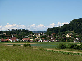
View of Othmarsingen |
|
| Location of the municipality | |
Othmarsingen ( Swiss German : Otmisinge, ˈɔtmɪʓiŋːə ) is a municipality in the Swiss canton of Aargau . It belongs to the Lenzburg district and is located in the lower Bünztal , just under three kilometers east of the district capital.
geography
The village is located in a valley on both sides of the straightened Bünz and is surrounded on three sides by forest. There are two main settlement areas, the village center on the west bank and the area around the train station. The hamlet of Steinhof is located on the south-eastern border of the municipality. In the east rises the «mountain», an extension of the Wagenrain , which forms the natural border with the Reuss valley . To the northwest of the village center, the Bünz flows through an incision in a flat terminal moraine , which was created towards the end of the Würm Ice Age when the Reuss Glacier retreated .
The area of the municipality is 472 hectares , of which 193 hectares are forested and 126 hectares are built over. The highest point is at 542 meters on the «mountain», the lowest at 385 meters on the Bünz. Neighboring communities are Brunegg in the north, Mägenwil in the northeast, Hägglingen in the east, Dottikon in the southeast, Hendschiken in the south, Lenzburg in the southwest and Möriken-Wildegg in the west.
history
Individual finds indicate a settlement during the Neolithic and the Bronze Age . During Roman times there was a larger settlement ( Vicus Lindfeld ) with a large theater just beyond the western boundary of the municipality . In the 5th and 6th centuries, who allowed Alemanni down. Otewizzingin was first mentioned in a document in 1184. The place name comes from the Old High German Otwizingun and means "among the people of Otwiz". By 1306 at the latest, the village was under the rule of the Habsburgs . The lower jurisdiction was first owned by the Lords of Rupperswil and after they died out came to the Hallwylers . After the construction of a chapel in 1371, the village was divided into two parts in church matters for almost five hundred years, between the parishes of Staufberg (later Lenzburg ) and Ammerswil .
In 1415 the confederates conquered Aargau. Othmarsingen now belonged to the subject area of the city of Bern , the so-called Bernese Aargau . The village was on the border with the Free Offices and the County of Baden . After several changes of ownership, the city of Bern took over the lower rulership rights in 1484 and Othmarsingen became the capital of a judicial district in the Lenzburg district. In 1528 the Bernese introduced the Reformation . During the Peasants' War (1653) and the Second Villmerger War (1712), troops passing through devastated the village. From 1767 stagecoaches operated on the expanded Heerstrasse Bern – Zurich.
In March 1798 the French took Switzerland, ousted the «Gracious Lords» of Bern and proclaimed the Helvetic Republic . Since then, Othmarsingen has belonged to the canton of Aargau. On September 6, 1877 opened National Railway , the railway line Zofingen-Wettingen with a station in Othmarsingen. The bankruptcy of this company the following year hit the community hard because of its financial commitment. For decades the debts had to be paid off. On June 1, 1882, opened aargauische südbahn the route Hendschiken -Othmarsingen- Brugg . While the economy was initially shaped by agriculture , several industrial companies settled here after the turn of the century. In 1968, the Swiss Army's fleet of motor vehicles began operations.
Attractions
The Othmarsinger Reformed Church was built in 1675 under the supervision of the Bern builder Abraham Dünz . The building has the shape of an elongated dodecagon; In 1895 a church tower was added on the north side. The carved choir stalls, the baroque pulpit and the stained glass on the windows are worth seeing. On the right bank of the Bünz is the old mill, built around 1550, a late Gothic gable building. On the left Bünzufer stands the Urechhaus, a three-story classicist residential building, built by Carl Ahasver von Sinner .
coat of arms
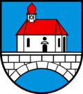
The blazon of the municipal coat of arms reads: "White bridge with black and blue joints with a red roofed white church." The coat of arms, which first appeared on the municipal seal in 1811, refers to a chapel that existed from 1675 to 1895 and was part of a bridge over the Bünz. From 1915 the church and the arch of the bridge were drawn in perspective on the coat of arms, but this contradicts the heraldic rules. In 2002 there was a return to the older, correct version.
population
The population developed as follows:
| year | 1764 | 1850 | 1900 | 1930 | 1950 | 1960 | 1970 | 1980 | 1990 | 2000 | 2010 |
| Residents | 531 | 1134 | 903 | 1079 | 1173 | 1362 | 1787 | 1707 | 1844 | 2117 | 2391 |
On December 31, 2019, 2926 people lived in Othmarsingen, the proportion of foreigners was 25.7%. In the 2015 census, 28.4% described themselves as Reformed and 27.0% as Roman Catholic ; 44.6% were non-denominational or of another faith. 84.4% stated German as their main language in the 2000 census , 2.1% each Italian and Turkish , 1.8% Albanian , 1.6% Serbo-Croatian and 0.7% each English , French and Portuguese .
Politics and law
The assembly of those entitled to vote, the municipal assembly , exercises legislative power. The executing authority is the five-member municipal council . He is elected by the people in the majority procedure, his term of office is four years. The parish council leads and represents the parish. To this end, it implements the resolutions of the municipal assembly and the tasks assigned to it by the canton. The District Court of Lenzburg is the first instance responsible for legal disputes . Othmarsingen belongs to the Friedensrichterkreis XI (Lenzburg).
economy
According to the corporate structure statistics (STATENT) collected in 2015, there are around 1,300 jobs in Othmarsingen, 2% of them in agriculture, 26% in industry and 72% in the service sector. The Othmarsingen Army Motor Vehicle Park, which has been expanded into a logistics center for the Swiss Army, is well known. Another important employer is the confectionery and pharmaceutical company Disch AG. Most of the employed are commuters and work in the larger communities in the area or in the Zurich agglomeration.
traffic
Othmarsingen has excellent transport connections. To the north-east of the village center, Kantonsstrasse 280 ( Wohlen - Brugg ) and Kantonsstrasse 279 ( Lenzburg - Baden ) cross. The Mägenwil junction of the A1 motorway is near this intersection , the Lenzburg junction is west of the village. The Brugg connection to the A3 is six kilometers away.
At the SBB station Othmarsingen, two important railway lines cross, the east-west main line and the Basel SBB –Brugg– Arth-Goldau railway line , which is particularly important for freight traffic. The S11 line of the Zurich S-Bahn ( Aarau - Zurich HB - Winterthur ) and regional trains to Brugg – Baden and Wohlen – Muri stop here . A bus line operated by Regionalbus Lenzburg leads to Lenzburg train station . On weekends there is a night S-Bahn (Winterthur – Zurich HB– Baden –Lenzburg – Aarau) and a night bus from Lenzburg via Möriken and Mägenwil to Othmarsingen.
On July 18, 1982, near the train station , there was a serious railway accident in Othmarsingen when a freight train collided with a night express train from Dortmund to Rimini . Six people were killed and around a hundred injured.
education
The community has four kindergartens and two schoolhouses in which primary school is taught. In addition, there is the Special Education Center for Work Level and Vocational Preparation (HZWB) in Othmarsingen. All types of the upper level ( junior high school , secondary school , district school ) can be attended in Lenzburg . The closest grammar schools are the Old Canton School Aarau , the New Canton School Aarau and the Canton School Wohlen .
Personalities
- Hans Dubs (1923–2005), federal judge
- Sophie Haemmerli-Marti (1868–1942), dialect poet
literature
- Felix Müller: Othmarsingen. In: Historical Lexicon of Switzerland .
- Michael Stettler , Emil Maurer : The art monuments of the canton of Aargau . Ed .: Society for Swiss Art History . Volume II: The districts of Lenzburg, Brugg. Wiese Verlag, Basel 1953, DNB 750561750 .
Web links
Individual evidence
- ↑ Cantonal population statistics 2019. Department of Finance and Resources, Statistics Aargau, March 30, 2020, accessed on April 2, 2019 .
- ↑ Cantonal population statistics 2019. Department of Finance and Resources, Statistics Aargau, March 30, 2020, accessed on April 2, 2019 .
- ^ National map of Switzerland, sheet 1090, Swisstopo.
- ↑ Standard area statistics - municipalities according to 4 main areas. Federal Statistical Office , November 26, 2018, accessed on May 21, 2019 .
- ^ Beat Zehnder: The community names of the canton of Aargau . In: Historical Society of the Canton of Aargau (Ed.): Argovia . tape 100 . Verlag Sauerländer, Aarau 1991, ISBN 3-7941-3122-3 , p. 339-341 .
- ^ Joseph Galliker, Marcel Giger: Municipal coat of arms of the Canton of Aargau . Lehrmittelverlag des Kantons Aargau, book 2004, ISBN 3-906738-07-8 , p. 246 .
- ↑ Population development in the municipalities of the Canton of Aargau since 1850. (Excel) In: Eidg. Volkszählung 2000. Statistics Aargau, 2001, archived from the original on October 8, 2018 ; accessed on May 21, 2019 .
- ↑ Resident population by religious affiliation, 2015. (Excel) In: Population and Households, Community Tables 2015. Statistics Aargau, accessed on May 21, 2019 .
- ↑ Swiss Federal Census 2000: Economic resident population by main language as well as by districts and municipalities. (Excel) Statistics Aargau, archived from the original on August 10, 2018 ; accessed on May 21, 2019 .
- ↑ circles of justice of the peace. Canton of Aargau, accessed on June 20, 2019 .
- ↑ Statistics of the corporate structure (STATENT). (Excel, 157 kB) Statistics Aargau, 2016, accessed on May 21, 2019 .


