Sint-Oedenrode
 flag |
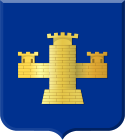
 coat of arms |
| province |
|
| local community |
|
|
Area - land - water |
64.94 km 2 64.41 km 2 0.53 km 2 |
| Residents | 15,080 (June 30, 2017) |
| Coordinates | 51 ° 34 ′ N , 5 ° 28 ′ E |
| Important traffic route |
|
| prefix | 0413 |
| Postcodes | 5294, 5298, 5465-5466, 5481-5482, 5491 |
| The town hall of Sint Oedenrode | |
Sint-Oedenrode ( ) is a former municipality in the Dutch province of Noord-Brabant , about 12 km north of Eindhoven . On January 1, 2017, Sint-Oedenrode was incorporated into the municipality of Meierijstad . The former municipality of Sint-Oedenrode comprised the town of Sint-Oedenrode and the villages of Boskant, Nijnsel and Olland.
history
Sint-Oedenrode was raised to town in 1232 by Duke Heinrich I of Brabant . Since the city was shielded on one side by the river Dommel and on the other by a moor, the place had no city wall in contrast to other cities.
economy
There are many small industrial and trading companies in the village. Agriculture remains the main employer, however.
Town twinning
The town has been a twin town of Alzenau (Lower Franconia) since the 1960s .
Personalities
- Bram van Dam (1943–2008), Dutch sports and nutrition scientist
Web links
Individual evidence
- ↑ Personen met een uitkering; soort uitkering, wijken en buurten 2017 Centraal Bureau voor de Statistiek , accessed on March 30, 2018 (Dutch)


