Sophienhöhe (Jülich)
| Sophienhöhe | ||
|---|---|---|
|
Sophienhöhe at the Hambach opencast mine (near Niederzier ) |
||
| height | 301.8 m above sea level NHN | |
| location | Düren district , North Rhine-Westphalia , Germany | |
| Mountains | artificial embankment | |
| Coordinates | 50 ° 55 '55 " N , 6 ° 26' 56" E | |
|
|
||
| Type | Partly recultivated waste dump | |
| rock | Scrap material from the Hambach opencast mine |
|
| Age of the rock | Tertiary | |
|
Rhenish lignite district |
||

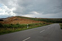
The Sophienhöhe , also known as Monte Sophia , is a recultivated waste dump that was created by the mining of lignite seams from the Hambach opencast mine . It is located near Jülich in the Düren district ( North Rhine-Westphalia ) and covers an area of around 13 km² and its highest point at 301.8 m above sea level. NHN lies. The name is derived from the Sophienwald and Sophienerde farms located near today's Sophienhöhe .
geography
location
The Sophienhöhe is located - visible from afar, towering over the Jülich Börde - directly north of the Hambach opencast mine, around 6 km east of Jülich . While most of it belongs to its urban area, its north-eastern part is in the municipality of Titz and its eastern and southern part in that of Niederzier . Its largest part lies in the area of the original (meanwhile largely cleared) Hambach Forest , a forest area between the villages of Stimmernich , Hambach and Alt- Lich-Steinstrasse .
Altitude
The Sophienhöhe rises with the character of a small mountain range, which clearly characterizes the landscape in the otherwise rather flat Jülich area, an average of 200 m above the surrounding area. Its highest points are the Steinstrasse Wall ( 301.8 m ), on which the small Römerturm ( ⊙ ) observation tower stands, the Höller Horn ( 291.5 m ) and the Jülich Kopf ( 285.8 m ). On the ground of its summit (i.e. not on the observation tower there) you stand about 595 m above the floor of the opencast mine, which is currently about 293 m below sea level . Between the Steinstrasse Wall and the north-northeastern village of Höllen , which is located at the Landwehr / Ehrenstrasse intersection at 83.8 m , there is a difference in altitude of 218 m.
Emergence
The Rheinbraun AG began in 1978 with the above-ground mining of Braunkohleflözen in the Erft -Scholle in the Rhenish lignite mining area . The resulting open pit was named after the nearby hamlet of Hambach . The layers of soil lying on these seams are removed by bucket wheel excavators , conveyed through kilometer-long conveyor belt systems through the opencast mine over the former Hambach forest and meadows of today's Sophienhöhe and deposited there by a spreader as a high dump. A placing the tailings in decarbonized older opencast mines was temporarily carried out over a strip mill. The entire enormous amount of overburden that had to be removed over the comparatively low-lying coal seams could not have been economically transported to other opencast mines, so it was decided to deposit the majority of the overburden in the immediate vicinity of the opencast mine. However, since the opencast mine hole has become big enough, most of the newly accumulated overburden has been dumped into the already charred parts of the Hambach opencast mine.
Ground breaks
In January 2012, the network of mining victims informed the competent mining authority of ground fractures on the Sophienhöhe.
It is known that geological disturbances often occur on the edge of opencast mines . In July 2009, the Nachterstedt disaster once again made known the dangers of landslides in former opencast mines.
Attractions
Historic Prussian milestones are presented at the foot of the spoil heap on the small access road that leads east from Stetternich to Sophienhöhe .
The open pit development was connected with archaeological investigations. The federal road 55, the section of which between Elsdorf and Jülich had to be relocated because of the opencast mine, was on the old east-west connection Via Belgica .
A replica of a Roman milestone found at Zülpich- Hoven with a dedication to the Emperor Constantine the Great from 325 is reminiscent of the Roman road network. A Prussian obelisk with two stone benches originally stood 5 Prussian miles (37.662 km) west of Cologne . There is a replica of a Roman Jupiter column on a nearby roundabout .
Nature, leisure and relaxation
The forestry recultivation of the Sophienhöhe began as early as 1988 and has long since become a local recreation area. Around 90% of the area is wooded and managed for forestry, many small clearings and several small ponds are interspersed.
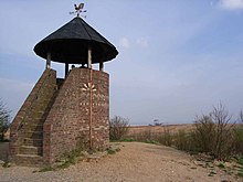
There is now a 70 km network of hiking trails around and on the Sophienhöhe, some of which are also open to cyclists and riders. At the highest point of the Sophienhöhe (Steinstraßer Wall) is the small Römerturm observation tower , which is a replica of a Roman watchtower and from which you can see as far as Cologne , Düsseldorf , the Siebengebirge , the Eifel and the Netherlands . To the south-west of it there is a game reserve and the old summit cross (approx. 265 m above sea level ), which for many years marked a high point of the Sophienhöhe and from where you could see the Hambach opencast mine before the expansion of the Sophienhöhe after 2002. The mammoth forest with sequoias was created in the immediate vicinity . On its northeast flank there used to be a launch site for paragliders ; in this area is the small cuckoo hut (approx. 246 m ) as one of several huts on the dump. There are also several toboggan runs , several mountain lakes and a way of the cross . On the newer part of the Sophienhöhe, which was built after 2002, there is a weather radar (see section Weather radar ) and a Celtic tree horoscope .
Niederzier's mayor presented a feasibility study “Bergwelt Sophienhöhe” at the Expo Real investor fair in Munich in November 2012 .
The Monte-Sophia-Lauf takes place annually, which leads around or over the Sophienhöhe. It is 28.5 km long and is considered a demanding run due to its numerous inclines. The run usually takes place in mid-August.
Weather radar
The Jülich Research Center took on 12 October 2009 at the Sophienhöhe a weather radar in operation.
The striking radar system is mounted on an approximately 34 m high tower. It provides data on the type, amount and distribution of precipitation within a radius of around 60 km for the Tereno research project. Unlike conventional horizontally aligned systems, the polarimetric radar also measures vertically and can therefore give a precipitation forecast to an accuracy of 200 m. So far the accuracy has been around 1 km. The data obtained are used to predict precipitation, the type of precipitation and wind measurements. In addition to the research institutes and the RWE , the data is also made available to the water associations and the German Weather Service .
The radar system is one of four in Germany operated by the Helmholtz Society . The 1.4 million euro project was financed by the Helmholtz Association.
See also
literature
- Wolfgang Gaitzsch : Roman road and Prussian milestones in front of the Sophienhöhe near Jülich (= Rheinische Kunststätten. Volume 375). Cologne 1992, ISBN 3-88094-724-4 .
- Wolfgang Hommel: The Sophienhöhe and its history of origin. Fischer, Jülich 2012, ISBN 978-3-87227-086-3 . New edition: 2013, ISBN 978-3-87227-088-7 .
Web links
- Research Center Recultivation (RWE), on forschungsstellerekultivierung.de
References and comments
- ↑ a b c d e Topographical Information Management, Cologne District Government, Department GEObasis NRW ( information )
- ^ E-mail information from RWE dated August 21, 2012
- ↑ Central State Authority of the Arnsberg District Government (Department 8); formerly Landesoberbergamt
- ↑ , in: Dürener Zeitung of December 17, 2012
- ^ Article after the landslide in concern , on aachener-nachrichten.de, July 20, 2009
- ↑ Location of the old summit cross in the south of the Sophienhöhe according to the article Die Grünmetropole , on Niederzier.de
- ↑ Article Positive signals for the mountain world on the Sophienhöhe , on aachener-zeitung.de, from November 7, 2012
- ↑ Jülich weather radar even measures the drop size when it rains , article in the Jülich newspaper, October 12, 2009
- ↑ For scientists and weather frogs: Jülich weather radar in operation , on fz-juelich.de
- ↑ Jülich weather radar , information on the Tereno research project at www.teodoor.icg.kfa-juelich.de


