Stepney
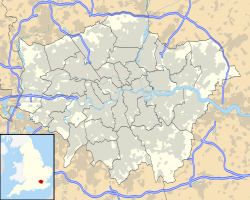
Location of Stepney in Greater London |
Stepney is a district of London in the London Borough of Tower Hamlets .
The district is located around 5.8 km northeast of Charing Cross and is part of the East End of London . The area consists of tenement houses, mostly built after the Second World War, in dense development, as well as some streets with terraced houses.
The Commercial Road , part of the A13 , crosses the area from east to west. The connection to the London Underground takes place via the underground station Stepney Green .
Although the nearby Bow , Wapping , Limehouse , Ratcliff, and Mile End areas were all gentrified , Stepney did not.
history
Stepney was listed in the Domesday Book created in 1086 .
St. Dunstan's Church from 923 is the oldest church in the district; the current building, however, dates from the 15th century. This church was responsible for the registration of births, weddings and deaths of British citizens at sea until the 19th century.
At the beginning of the 20th century, Stepney was one of the neighborhoods with the highest percentage of Jews in England . This role was later taken over by Stamford Hill .
In 1911, Sidney Street was besieged in Stepney , also known as the "Battle of Stepney".
In 1919 the future British Prime Minister Clement Attlee became Mayor of Stepney.
Stepney, which has been an immigrant area for centuries ( Huguenots , Irish , Eastern European Jews) today has a high proportion (43%) of residents of Bengali origin.
Daughters and sons of the district
- Clive Allen (born 1961), English football player
- Steven Berkoff (born 1937), British playwright, actor and director
- Bernard Bresslaw (1934-1993), British actor
- Alma Cogan (1932–1966), British pop singer
- Ashley Cole (born 1980), English football player
- Maxine Daniels (1930-2003), British jazz singer
- Kenney Jones (born 1948), British musician
- Richard Mead (1673–1754), physician, medical writer, personal physician to King George II and Henry Pemberton
- Des O'Connor (born 1932), British entertainer and singer
- Andy Powell (* 1950), British guitarist, founding member of the rock band Wishbone Ash
- Darren Purse (* 1977), English soccer player
- Fermin Rocker (1907-2004), English painter, printmaker and illustrator
- Terence Stamp (born 1938), British actor
Individual evidence
Coordinates: 51 ° 31 ′ N , 0 ° 3 ′ W

