Front mountain
| Front mountain | ||
|---|---|---|
|
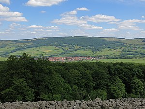
View from the Schafstein over the desert Saxony to the east to the Stirnberg |
||
| height | 901.9 m above sea level NHN | |
| location | Districts Rhön-Grabfeld and Fulda ; Bavaria , Hesse ( Germany ) | |
| Mountains | Rhön ( High Rhön ) | |
| Coordinates | 50 ° 29 '29 " N , 10 ° 2' 21" E | |
|
|
||
| Development | Forest, forest and hiking trails; Hochrhönstrasse on the eastern flank | |
|
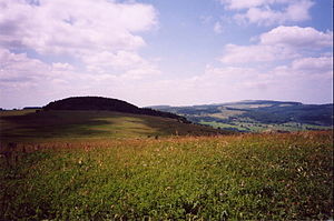
View from the Stirnberg to the west (on the right the Wasserkuppe ) |
||
The front mountain is a 901.9 m above sea level. NHN high mountain on the Bavarian-Hessian border in the Rhön , a low mountain range in Bavaria , Hesse and Thuringia .
geography
location
The Stirnberg is located in the Hohe Rhön . Within the Rhön Biosphere Reserve and the Bavarian Rhön and Hessian Rhön Nature Parks , it rises in the districts of Rhön-Grabfeld (Bavaria) in the east and Fulda (East Hesse) in the west. Its summit is located around 100 m southeast of the border with Hesse on Bavarian soil between the border mountains Querenberg ( 804.8 m ) in the north-northeast and Heidelstein ( 925.7 m ) and Steinkopf (approx. 888 m ) in the southwest. A large part of the Lange Rhön nature reserve is located on its eastern flank, over which the Heidelstein − Stirnberg − Schwarzes Moor section of the Hochrhönstrasse runs .
The main town of the Hessian community Ehrenberg is located about 2.7 km west-north-west of the Stirnberg with desert axes , about 8.5 km (each as the crow flies ) east-north-east is the core of the city of Fladungen .
Watershed
The Rhine-Weser watershed runs over the Stirnberg . Creeks that flow from the mountain towards the east reach the Rhine via Streu , Franconian Saale and Main , while those that run from the mountain towards the west reach the Weser via Ulster and Werra .
Hiking / sport
For example, the "European long-distance hiking trails" E3 and E6 as well as the section Rotes Moor −Heidelstein − Stirnberg − Schwarzes Moor of the 89 km long Rhön-Rennsteig hiking trail lead over the Stirnberg . In the cold season, there is often a steep trail that connects the trail park on the Roten Moor with the Black Moor .
Lookout point
The view of the surrounding area can be enjoyed from the forest-free slopes below the forested Stirnbergkuppe in some places: For example, one looks from its west-facing summit to the Wasserkuppe .


