Teas
| Teas | ||
| Data | ||
| location | Northern england | |
| River system | Teas | |
| River basin district | Northumbria | |
| source | On the eastern slope of Cross Fell 54 ° 42 ′ 2 ″ N , 2 ° 27 ′ 59 ″ W |
|
| Source height | 745 m ASL | |
| muzzle | southeast of Hartlepool in the North Sea Coordinates: 54 ° 37 '21 " N , 1 ° 9' 23" W 54 ° 37 '21 " N , 1 ° 9' 23" W |
|
| Mouth height | 0 m ASL | |
| Height difference | 745 m | |
| Bottom slope | 5.6 ‰ | |
| length | 132 km | |
| Catchment area | 1834 km² | |
| Left tributaries | River Lune , River Balder | |
| Right tributaries | River Greta | |
| Reservoirs flowed through | Cow Green Reservoir | |
| The Tees flows over the rapids of Cauldron Snout and the High Force waterfall | ||
|
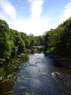
The teas at Low Dinsdale |
||
The Tees [ tiːz ] is a river in northern England . It rises in Cumbria on the eastern slope of the 893 m high Cross Fell , the highest mountain in the Pennines , and flows into the North Sea after 113 km southeast of Hartlepool . The catchment area is 1834 km².
The uppermost part of the valley known as Teesdale consists of extensive moors and is bordered by numerous hills, several of which are over 750 m high. Several waterfalls and rapids follow in quick succession, the "Cauldron Snouts"; the water falls over dolerite and basalt rocks into the depths. From a point just below the falls to its mouth, the Tees forms the border between the traditional counties of Durham and Yorkshire ; however, since the 1974 local government reform, most of the river has been in County Durham. Below the Cauldron Snout , forests replace the previously very barren landscape.
The first major settlement, more than 20 km from the source, is Middleton-in-Teesdale . Between there and neighboring Mickleton , the 24.11 km long River Lune flows from the left , not to be confused with the much larger Lune to the Irish Sea . This is followed by the places Barnard Castle , Eggleston Abbey and Rokeby Hall, described in poems by Walter Scott . Then the valley becomes significantly wider and flatter, the river meanders through the wide plains south and east of Darlington .
The Tees generally flows east and south-east until Egglescliffe . There it turns northeast and flows through the towns of Stockton-on-Tees and Middlesbrough . Teesport is located northeast of Middlesbrough and is one of the three most important ports in Great Britain. The mouth protect two large from slag formed breakwater , each 3,292 meters long are.

