Tereswa
| Tereswa | ||
| Тересва | ||

|
|
|
| Basic data | ||
|---|---|---|
| Oblast : | Zakarpattia Oblast | |
| Rajon : | Tyachiv Raion | |
| Height : | 235 m | |
| Area : | 12.32 km² | |
| Residents : | 7,554 (December 2004) | |
| Population density : | 613 inhabitants per km² | |
| Postcodes : | 90564 | |
| Area code : | +380 3234 | |
| Geographic location : | 48 ° 0 ' N , 23 ° 42' E | |
| KOATUU : | 2124456200 | |
| Administrative structure : | 1 urban-type settlement | |
| Mayor : | Mychajlo Mochan | |
| Address: | вул. Народна 83 90 564 смт. Тересва |
|
| Statistical information | ||
|
|
||
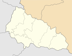
Teresva (Ukrainian and Russian Тересва ; German rarely Theresiental , Slovak Teresva , Hungarian Taracköz ) is an urban-type settlement in the Western Ukraine ( Zakarpattia Oblast , Tiachiv Raion ) about 10 kilometers east of the city Tyachiv .
The town with about 7500 inhabitants is located in the Tisza Valley at the confluence of the Tereswa and Tisza rivers .
history
The place was mentioned in writing for the first time in 1336 . In 1910 he was in the Kingdom of Hungary in Máramaros County . After the end of the First World War it came to the newly formed Czechoslovakia (as part of the Carpathian Ukraine ) and was ceded to the USSR after the end of the Second World War . In 1957 the place received the status of an urban-type settlement.
Since 1872 the place is connected to the railway ( railway line Debrecen - Sighetu Marmației ), in 1887 the forest railway Tereswa valley was added.

