Chop
| Chop | ||
| Чоп | ||

|
|
|
| Basic data | ||
|---|---|---|
| Oblast : | Zakarpattia Oblast | |
| Rajon : | District-free city | |
| Height : | 106 m | |
| Area : | 6.02 km² | |
| Residents : | 8,777 (2009) | |
| Population density : | 1,458 inhabitants per km² | |
| Postcodes : | 89500 | |
| Area code : | +380 3137 | |
| Geographic location : | 48 ° 26 ' N , 22 ° 12' E | |
| KOATUU : | 2111000000 | |
| Administrative structure : | 1 city | |
| Mayor : | Halyna Tsar | |
| Address: | вул. Берег 2 89502 м. Чоп |
|
| Website : | http://chop.org.ua/ | |
| Statistical information | ||
|
|
||
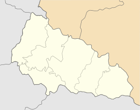
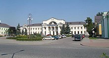
Chop ( Ukrainian and Russian Чоп , Hungarian Csap , Slovak Čop ) is a small town in Uzhhorod Raion of the Zakarpattia Oblast in the far southwest of the Ukraine ( Transcarpathian ). It lies on the border triangle of Hungary , Slovakia and the Ukraine. The border river Tisza separates the city from Hungary .
Chop has around 8,800 inhabitants, of which almost 4,000 are Hungarians , and is an important railway junction and border station . This is where the railway lines from Lemberg / Stryj (on to Debrecen and Budapest ) and Lemberg – Uzhhorod (on to Košice ) meet . Because of the change from broad gauge to standard gauge , a gauge change facility is on site.
Opposite town in Slovakia and the border station there is Čierna nad Tisou .
In addition to the railroad crossings to Hungary and the Slovak Republic , there is a truck - and cars - border crossing to Hungary ( Záhony ). In 2005, a border crossing for pedestrians and cyclists was opened about 20 km northwest of Tschop between the villages of Mali Selmenzi and Veľké Slemence .
In the vicinity of Chop, on the territory of the neighboring village Solomonovo , lies the westernmost point of Ukraine. From here it is approx. 1500 km to Rannja Zorya , the easternmost point of Ukraine.
history
Chop shares the history of Carpathian Ukraine and has belonged to numerous domains over the past centuries. In the middle of the 11th century it was conquered by the Magyars , the first written mention is in 1281 as Chap . Until 1919 the place belonged to the Kingdom of Hungary and from 1526 to the Austrian monarchy and from 1867 to Austria-Hungary . Within the Kingdom of Hungary, the city was part of Ung (Usch) county . After that, the town belonged in the Czechoslovakia of the interwar period the Slovak part of the country. From 1938 it belonged to Hungary, which was enlarged by the 1st Vienna Arbitration . On October 29, 1944, Chop was captured by the Red Army as part of the Eastern Carpathian operation . In 1945 it came to the Soviet Union ( Ukrainian SSR ) after an exchange of territory , was granted urban-type settlement status in 1947 and town charter in 1957 and has been part of independent Ukraine since 1991. There it was assigned to Uzhhorod Rajon until 2003 , and since September 5, 2003, it has been a district-free city under oblast administration.
City name / languages
Due to the large number of ethnic groups in this region, there are different language spellings for Tschop: Ukrainian and Russian Чоп , Slovak and Czech Čop , Hungarian Csap . In English transcription, the city is called Chop .
See also
- History of Czechoslovakia
- History of Ukraine
- History of Hungary
- List of historical counties of Hungary
- Three-country corner of Europe
Web links
- Map , Soviet Union 1: 100,000 (as of 1983)


