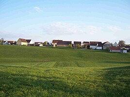
Tiefenbach (Ellingen)
|
Tiefenbach
City of Ellingen
Coordinates: 49 ° 4 ′ 55 ″ N , 10 ° 55 ′ 12 ″ E
|
|
|---|---|
| Height : | 466 m above sea level NN |
| Residents : | 35 |
| Postal code : | 91792 |
| Area code : | 09141 |
|
Tiefenbach
|
|
Tiefenbach is a district of the town of Ellingen in the central Franconian district of Weißenburg-Gunzenhausen .
The hamlet is located about four kilometers west of the center of Ellingen. To the east is the source of the Vorderen Troppelgraben , a small tributary of the Swabian Rezat . Other larger towns in the area are Pleinfeld and Weißenburg in Bavaria . With its 466 m above sea level. NN. Tiefenbach is the highest district of Ellingen.
Until the municipal reform , the place was part of the then independent municipality Dorsbrunn and was reclassified to the city of Ellingen on January 1, 1972. Wilhelm Volkert (Hrsg.): Handbook of the Bavarian offices, communities and courts 1799–1980 . CH Beck, Munich 1983, ISBN 3-406-09669-7 , p. 592 .
A municipal road connects the place with Hörlbach and the district road WUG 3. With a bus stop Tiefenbach is integrated into the transport network for the greater Nuremberg area .
Architectural monuments
The architectural monument in Tiefenbach is the two-storey farmhouse Tiefenbach 7 with a gable roof and plaster structure from the 1870s and with a portrait of Mary from the 19th century as well as the wayside cross at the junction to Stopfenheim .
Web links
- Brief description on the website of the administrative association Ellingen
Individual evidence
- ↑ Verkehrsverbund Großraum Nürnberg: Route 639 ( Memento from August 2, 2013 in the Internet Archive )


