Uma Tolu
| Uma Tolu | ||

|
||

|
||
| Data | ||
| surface | 15.72 km² | |
| population | 1,814 (2015) | |
| Chefe de Suco | Henrique Joaquim Fernandes Lobo (election 2009) |
|
| Aldeias | Population (2015) | |
| Ai Sucu Nuc | 249 | |
| Crarec Maruc | 429 | |
| Data metan | 379 | |
| Fahi Lain | 326 | |
| Tali Oan | 431 | |
|
|
||
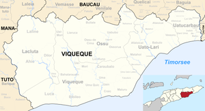
Uma Tolu ( Umatolu , Tetum for "three houses" ) is an East Timorese Suco in the administrative office of Lacluta ( municipality of Viqueque ).
The place
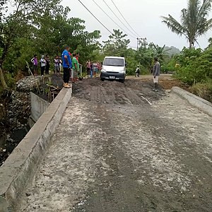
The place Uma Tolu is located in the west of the Sucos, at an altitude of 203 m , directly on the bank of the river Luca . The Sucos primary school is located here.
The Suco
| Uma Tolu | ||
| places | position | height |
| Ai Sucu Nuc | 8 ° 53 ' S , 126 ° 14' E | 203 m |
| Crarec Maruc | 8 ° 53 ' S , 126 ° 13' E | 164 m |
| Data metan | 8 ° 54 ' S , 126 ° 14' E | 203 m |
| Fahi Lain | 8 ° 54 ' S , 126 ° 13' E | 203 m |
| Tali Oan | 8 ° 54 ' S , 126 ° 13' E | 203 m |
| Uma Tolu | 8 ° 53 ' S , 126 ° 13' E | 203 m |
Uma Tolu has 1,814 inhabitants (2015), of which 922 are men and 892 women. The population density is 115.4 inhabitants / km². There are 406 households in the Suco. Almost 95% of the population name Tetum Terik as their mother tongue. Over 2% speak Midiki , small minorities Tetum Prasa , Makasae or Habun .
Before the 2015 territorial reform, Uma Tolu had an area of 15.18 km². Now there are 15.72 km². The Suco is located in the southeast of the Lacluta administrative office. To the northwest is the Suco Ahic , north of the Suco Dilor . In the south Uma Tolu borders on the Suco Luca and in the east on the Suco Bahalarauain (both administrative office Viqueque ). The Luca flows along the entire western border.
In the southeast, on the banks of the Lucas, there is a larger settlement center that consists of the districts Uma Tolu , Ai Sucu Nuc ( Aisucunuc ), Data Metan ( Datametan ), Fahi Lain ( Fahilain ) and Tali Oan ( Talioan ). A little north is the place Crarec Maruc ( Crarec Maroc , Clarecmaruc ).
In the Suco there are the five Aldeias Ai Sucu Nuc , Crarec Maruc , Data Metan , Fahi Lain and Tali Oan .
history
At the end of 1979 there was an Indonesian camp for East Timorese in Uma Tolu , who should be relocated by the occupiers for better control. In 1982 the inhabitants of Uma Tolu were forcibly deported first to Dilor and then to Uma Lor in Suco Luca.
On August 21, 1999, as part of the crisis in East Timor, there was a shooting in Uma Tolu, a few days before the independence referendum . On August 22nd, Indonesian soldiers surrounded several refugees in the community hall, near the football field. One villager was shot and nine others also injured. Several houses were burned down, including the house of the headmaster, who had organized youths in an anti- militia guard. 260 people fled the place. Militias set up roadblocks in Suco.
politics
In the 2004/2005 elections , Celestino SP was elected Chefe de Suco. In the 2009 elections won Henrique Joaquim Fernandes Lobo .
Web links
- Results of the 2010 census for the Suco Uma Tolu ( tetum ; PDF file; 7.90 MB)
- Results of the 2015 census for the Suco Uma Tolu (tetum; PDF;)
- Seeds of Life: Suco information sheets Lacluta (tetum)
Individual evidence
- ↑ a b c d Direcção-Geral de Estatística : Results of the 2015 census , accessed on November 23, 2016.
- ↑ a b UNMIT map of the Viqueque district from August 2008 ( Memento of the original from December 3, 2011 in the Internet Archive ) Info: The archive link was automatically inserted and not yet checked. Please check the original and archive link according to the instructions and then remove this notice. (PDF; 509 kB)
- ↑ Fallingrain.com: Directory of Cities, Towns, and Regions in East Timor
- ↑ Results of the 2010 census for the Suco Uma Tolu ( tetum ; PDF file; 7.90 MB)
- ↑ Direcção Nacional de Estatística: Population Distribution by Administrative Areas Volume 2 English ( Memento of the original from January 5, 2017 in the Internet Archive ) Info: The archive link has been inserted automatically and has not yet been checked. Please check the original and archive link according to the instructions and then remove this notice. (2010 census; PDF; 22.6 MB)
- ↑ a b Timor-Leste GIS Portal ( Memento from June 30, 2007 in the Internet Archive )
- ↑ Jornal da Républica with the Diploma Ministerial n. 199/09 ( Memento of February 3, 2010 in the Internet Archive ) (Portuguese; PDF; 323 kB)
- ↑ a b "Chapter 7.3 Forced Displacement and Famine" ( Memento of the original from November 28, 2015 in the Internet Archive ) Info: The archive link was inserted automatically and has not yet been checked. Please check the original and archive link according to the instructions and then remove this notice. (PDF; 1.3 MB) from the "Chega!" Report by CAVR (English)
- ↑ Secretariado Técnico de Administração Eleitoral STAE: Eleições para Liderança Comunitária 2004/2005 - Resultados ( Memento of August 4, 2010 in the Internet Archive )
- ↑ Secretariado Técnico de Administração Eleitoral STAE: Eleições para Liderança Comunitária 2009 - Resultados ( Memento of August 4, 2010 in the Internet Archive )
