
White City (London)

| |
Location of White City in Greater London |

White City is a district of London in the northern part of the Shepherd's Bush district and belongs to the London Borough of Hammersmith and Fulham . The district is located around six kilometers west of London's West End (from Piccadilly Circus , Oxford Circus ) and is roughly bounded by the A40 (Westway) in the north, the West Cross Route in the east, parallel to Uxbridge Road in the south and Bloemfontein Road to the west. The area began as an urban area at the beginning of the 20th century with a large exhibition area there.
The division into two social worlds is characteristic of White City: the large social housing estate White City Estate in the west opposite the affluent eastern side, today, among other things, as the location of modern companies and with what is now the largest shopping center in Europe. The eastern two-thirds of the district have been the subject of an extensive urban development program since the mid-1990s , which is currently (mid-2019) entering its final phase. This includes the construction of several thousand apartments, most of which are offered to a more affluent public.
White City is part of the London constituency Wormholt & White City and belongs to the Confederation W12.
history
19th century
The area of White City is flat terrain and was partly uncultivated, partly agricultural land until the 19th century. Quite a few pieces of land were public property . From the 17th century, the North High Way, today's Uxbridge Road, as the main link between London and Oxford, ran at the point that is now the extreme southern limit of White City. Wood Lane was the only road from north to south that ran through the area, which connected Shepherd's Bush with the Wormwood Scrubs open-air site a good two kilometers further north .
At the beginning of the 19th century, the first residential buildings in the form of semi-detached houses were built in what is now the southeast of White City , and the outstanding construction was the Wood House in the Georgian style east of Wood Lane . There were some plant nurseries west of Wood Lane. From 1844 the West London Railway ran parallel to Wood Lane as the first railway line in this area . Around this time, two larger farms emerged east of Wood Lane with Eynham and west with Wood Lane Farm. In the 1870s, Du Cane Road was built, a road going west from Wood Lane that now runs slightly north of the A40 Westway.
By the end of the 19th century a large number of terraced houses had been built west of Wood Lane in the southern part and the area north of it was used for the production of bricks up to Wood Lane Farm (Cowley Brick Works). East of Wood Lane there was also brick production with the large Eynham Brick Fields. The grounds of the Wood House homestead were made accessible as a public park for several years at the end of the century.
Early 20th century
The Great White City Exhibition Center

The area immediately west of Wood Lane and south of Du Cane Road was at least partly common property and was considered suitable for hosting the Franco-British Exhibition planned from 1905 and scheduled for 1908 , a show on the economy and culture of France and the United States Kingdom . All the lavish exhibition buildings erected for this purpose, some in an oriental style, were kept in white and had white, stuccoed or marble- reminiscent facades, giving the impression of a “great white city” due to the large number of magnificent buildings. Planned and carried out the construction project by the Hungarian-born event manager was Imre Kiralfy who previously 1893 World's Fair in Chicago ( World's Columbian Exposition ) had visited and the local exhibition grounds took for his buildings as a model. For advertising purposes, the name White City , which originated in Chicago, was also used, which also referred to the color of the buildings there, but also to the nightly illumination of the exhibition city. Because outside lighting at night by electricity had only recently appeared in Europe and was largely unknown in the USA until then, so that the illumination of the buildings had a correspondingly sensational character. The name Great White City, modified for London for the London Fair, was retained beyond the time of the subsequent exhibitions and was simply carried over as White City to later institutions in this area.
_14.jpg)


Kiralfy built 140 acres (56.6 hectares ) of land for its exhibition center . The site comprised 120 exhibition buildings made of steel and concrete and a further 20 palace-like exhibition halls. Around 120,000 people were employed during the construction, especially since the construction of the entire system had to be completed within just one year. Roads, bridges, canals and an artificial lake were laid out - like a city and modeled on the Chicago exhibition. In addition to the exhibition halls, there were also a number of rides , several of which were added in the following years. The flip-flap machine , which lifted visitors to a height of 60 meters, was considered particularly attractive .
There were entrances to the exhibition grounds from the east, where two train stations were set up especially for this purpose, and from the south, where an approximately 700-meter-long, covered arcade was built so that the exhibition area was as close as possible from the Uxbridge Road and Shepherd's Bush train stations (see section Traffic ) a short walk away. Access began on Uxbridge Road, where a huge, basement portal served as an entrance. The path itself was built as a raised walkway 30 feet (a good 9 meters) above the ground. Integrated into the access to the actual exhibition area were seven exhibition halls, which were walked through at the level of the pavement.
Exhibitions
After the Franco-British exhibition in 1908, which attracted over eight million visitors, the next national exhibitions followed in the next few years
- Imperial International Exhibition (1909)
- Japan-British Exhibition (1910)
- Coronation Exhibition (1911)
- Latin-British Exhibition (1913)
- Anglo-American Exposition (1914)
The exhibitions were particularly politically motivated and served to strengthen mutual relationships and to convey a certain image of the countries involved. The purpose of the Franco-British Exhibition was to strengthen a peaceful image of the centuries-old political rival France in the consciousness of the population - against the background of the Entente cordiale , an agreement concluded in 1904 between France and the United Kingdom that exerted influence on the colonies of both countries governed in Africa. The exhibition showcased the British and French achievements in industry, art, science, horticulture, education and leisure. There were also two national shows .
The following country fairs were similar. The Imperial International Exhibition referred to the Triple Entente expanded to include Russia , and much of the exhibition was unchanged from the previous year, but expanded to include contributions from Russia. The background for the subsequent Japan-British Exhibition was the Anglo-Japanese Alliance , an agreement concluded with the Japanese Empire , which represented a turning point in British foreign policy (turning away from splendid isolation ). The Coronation Exhibition then took the occasion of the coronation of King George V instead. Again, portions of the earlier exhibits related to Great Britain were shown to demonstrate the economic and cultural greatness of the British Empire .
The exhibitions of 1913 and 1914 also aimed to bring the life of the respective countries closer. In the Latin-British Exhibition in 1913, these were the colonies of France, Italy, Spain, Portugal and the British colonies, as well as Latin American countries, and in the Anglo-American Exhibition in 1914, the US-America was offered (Wild West shows, structural replicas of New York, Grand Canyon and the like). All projects understood themselves with an educational mandate, but were purely "western" and stabilizing the existing conditions; the indigenous peoples were portrayed purely as profiteers of the colonial powers, and the USA exhibition served clichés.
Olympic Games 1908
White City was also the central venue for the IV Olympic Games in 1908, parallel to the exhibition. For this purpose, the White City Stadium was built , also by Imre Kiralfy, integrated into the exhibition area , which - analogous to Great White City - was also called Great Stadium . It was a multi-purpose stadium for over 93,000 visitors. The stadium had a cycling track, facilities for athletics and gymnastics competitions, a playing field for various ball sports and a swimming pool with a retractable diving tower. The stadium was also the destination of the marathon that started at Windsor Castle . The length of the route was extended from the exact 42 km that had been customary until then to exactly 42.195 km so that the race ended directly in front of the royal box. This route length has since been considered the official length of a marathon.

The Olympic Games were closely linked to the Franco-British Exhibition. The games of 1900 in Paris and 1904 in St. Louis had already been linked to world exhibitions, at which even the trade fairs received far more attention than the sports competitions. The then IOC President Pierre de Coubertin was also a member of the organizing committee of the Franco-British exhibition, just like Lord Desborough , the chairman of the local Olympic organizing committee. The opening of the national fair and the opening of the sports stadium took place on May 14, 1908. The competitions were spread over the year and had already started on April 27, but the majority of the games took place in the stadium in the second half of July. The Olympic Games ended with a closing ceremony on October 31 of that year in the Olympic Stadium, at the same time as the state exhibition closed.
Interwar period
When the First World War broke out in 1914, the ongoing Anglo-American Exhibition was terminated prematurely and the major exhibitions came to an end. The site passed into the hands of the government, and parts of the exhibition center subsequently served different purposes. During the war the area served as a military parade ground and part of the halls was used for aircraft construction.
In the early 1920s, the military withdrew and the exhibition site was auctioned. In 1920 there was a trade fair for the advertising industry and from 1921 to 1929 the Great White City hosted the British Industries Fair for several weeks each year, a national economic and industrial exhibition that began in Birmingham in its early days in the 1910s London, later only held in Birmingham. The industrial fair, at which only exhibitors from the United Kingdom and its overseas territories were allowed, was part of a concept of economic strengthening of Great Britain, with which one tried to attack Germany's dominant market position in Europe.
In the 1930s, the exhibition buildings had already run down and were only partially used. A textile trade fair was held until 1937, after which a first part of the structures in the western half of the site was demolished and the area was used for residential construction purposes. As a result, the White City Estate was built here , a large housing estate , which was only completed after the Second World War . During the war, some of the buildings were used to make tents and parachutes for the army.
The White City Olympic Stadium remained more or less unused for a long time after the Games. It wasn't until 1927 that the Greyhound Racing Association took over the sports facility, an organization that managed greyhound racing venues. In addition to dog races, competitions in various sports were subsequently held in the stadium. In 1929 the White City Rebels were active here, a speedway racing team that did not return for a short time until the 1970s. The team was the first institution in which the name White City continued for the future.
Post-war until today
After the exhibition area as such had dissolved, four years after the end of the war, other parts of the area were sold for the construction of a BBC television center, in addition to the sale of parts of the land for residential construction . From the southern entrance to the exhibition area, the large archway at Uxbridge Road remained in a modified form and several exhibition halls that were adapted for different purposes, such as offices or film and television recordings, remained until the end of the 20th century; a tennis club was set up in one.
Athletics championships were held in White City Stadium until 1971 and dog races were held until September 1984. Shortly thereafter, the stadium was demolished and a substantial expansion of the BBC site, which had already opened in 1960, was built a few hundred meters further south in its place.
The area east of Wood Lane had developed early on into an industrial park with small-scale businesses and warehouses. Among other things, there was a machine factory and a large warehouse for dairy products, which still exists today, at least from the middle of the century. In the southern part, a depot for the Central Line underground line , which was opened at the time, had existed since 1900 and is also located there to this day.

Increasingly, however, the east of White City was felt to be in need of renovation and, with regard to the urban development concept, was seen as an area of hope. Around the mid-1990s, planning began on an extensive modernization, which should also include the BBC area west of Wood Lane and began in 2003 with the demolition of the first structures. The last buildings of the old Great White City exhibition site were also removed, including the pillar access from the south and the portal on Uxbridge Road. Subsequently, a complete redesign of the almost 59 hectare area took place in the area of the BBC site, partly by adapting existing buildings. The city district is to be seen as a new center for high demands in the fields of business, education and living. The lifestyle character of the redesign is also emphasized: "White City development is a retail, leisure and lifestyle development [...]" ("The development of White City is a development of retail, leisure and lifestyle [...]") which are considered economically promising and whose clientele comes from the more upscale milieu.
In 2008 London's largest shopping center opened, which was accompanied by the construction of new train stations and a bus station; Since 2013, the areas used by the BBC for apartments, offices and business premises for the creative industries as well as for gastronomy and leisure facilities have been redesigned or have been partially completed since then. The shopping center was also significantly expanded in 2018. In the course of the redesign, there should also be between 5000 and 6000 new apartments after completion. A university campus was also built. The total construction volume is put at over £ 8 billion.
Buildings and facilities
White City Estate

In the second half of the 1930s, a large housing estate was built on part of the former exhibition site and adjoining it to the west as a measure of social housing , which with its location officially took the name White City and was named White City Estate . The settlement takes up about the western third of White City in an east-west direction and about the northern half in a north-south direction. The streets there were named Commonwealth Avenue, India Way, Australia Road, New Zealand Way, South Africa Road and Canada Way . It referred to the Commonwealth of Nations founded in 1931 . Thus - similar to the international exhibitions at the beginning of the century - the naming of the streets also had the purpose of anchoring a constructed political structure in the consciousness of the population.
For the construction of the housing estate, the London County Council bought an area of 21 hectares from the exhibition site in 1935, and the planning included the construction of 49 four-story blocks with a total of 2286 residential units for about 11,000 residents. 23 of them had been completed by 1939; after the Second World War, the settlement was finally completed in 1953 with 2011 apartments in 35 blocks for around 8,900 people. The apartments in buildings of this type were, which was considered a novelty, not to be reached via external stairs on communal balconies, but via staircases in order to create more intimacy for the individual residential units. Some of the apartments themselves were perceived as luxurious: All of the residential units had a bathroom with a tiled floor and wash basin and some with a separate toilet; the kitchens were separated from the living room by a sliding door. The arrangement of the apartment blocks represents a compromise. On the one hand, attempts were made to align the houses lengthways from north to south by means of a row construction method in order to allow as many apartments as possible to receive as much sunlight as possible; on the other hand, houses were placed diagonally to give the impression of a closed square with the character of an inner courtyard.

The construction of the settlement was a continuation of other public housing projects of the Labor Party , with which one sought to fight the numerous slums in London. A decade before construction began, a settlement area with the Wormholt Estate had arisen to the west of the White City settlement, but it had been laid out with the character of a garden city , and the buildings were erected in the country house style.
Within the White City settlement there are shops, two schools and religious and social institutions. The White City Youth Theater was founded in 2008 as a cultural initiative for youth; The White City Health Center opened in 2014, and in 2015 a branch of the London Plus Credit Union, a non-profit bank organized as a cooperative, which grants low-income people, among other things, cheap loans. Wormholt and White City settlements together had around 13,300 residents in 2017, 8,000 of them in White City.
While the residential buildings were structurally a showpiece at the time of their construction, the area still does not enjoy a very good reputation due to the social stratification of the residents. At the beginning, the majority of the houses were assigned to residents of slums, and the social status of the residents has remained rather low to this day. Around 50% of the residents are unskilled and unskilled workers with their families, around another 20% are families of skilled workers.
Rock musician Pete Townshend is named as the most famous former resident of White City . He released a concept album in 1985 called White City: A Novel , which is named after the housing estate near which he grew up. The album cover shows the musician and two residential buildings, on the reverse a morning scene in the settlement is described. In the song White City Fighting he says: “The White City, that's a joke of a name / It's a black, violent place […] (The White City, that's a joke by a name. It's a black, violent place [...]) ". In fact, exactly 1487 crimes were recorded in the Wormholt Estate / White City Estate police station together from December 2016 to November 2017. Social offenses ("anti-social behavior") with 34.0% and violent crimes ("violent crime") with 23.2%, followed by various theft offenses (11.3% in total) and vehicle offenses (in total 8.9%). Compared to the wider area, this corresponds to an average crime rate that has remained the same as in previous years , but opinions about the safety in this area are divided. In general, however, the White City Estate in the west of the district is perceived as the worse part of White City and contrasted with today's “rich” East with television studios, expensive apartments, an elegant shopping center and now also university campuses.
Wood Lane Estate
The Wood Lane settlement is a small, south-east of the White City Estate between South Africa Road in the west and Wood Lane in the east and is also part of urban social housing. There, the names of three small residential streets still recall the development of the district: White City Road, White City Close and Exhibition Close . The White City Road already existed at the time of the existence of the exhibition site and led, among other things, around the southern curve of the White City Stadium. The section with the curved course is still present today and thus indicates the location of the former stadium.
In 1996, the Wood Lane Conservation Area was defined by the municipal district administration (Hammersmith & Fulham Council) . This is a draft that - with regard to the planned urban development of White City - is to protect certain areas around Wood Lane - similar to the monument protection of individual buildings - from destructive interference in the urban landscape. The buildings around White City Close, which were built between 1975 and 1978, were classified as worthy of protection from an architectural point of view (coordinated construction details, together with the structural boundaries of the land, landscape architecture ensemble).
In the Wood Lane Estate there is - just like in the large White City Estate - a residents' center.
Loftus Road Stadium

Loftus Road Stadium - also simply Loftus Road for short , named after this adjacent street - is located immediately south of the White City housing estate and is the home of the Queens Park Rangers football club . It went into operation before the White City Stadium in 1904, but with its capacity of 2950 people at the time, it could in no way meet Olympic requirements. Until the First World War, the local Shepherd's Bush F. C. was based there, which was disbanded during the war. The Queens Park Rangers have been at home here since 1917 - with the exception of two seasons between 1931 and 1933, during which they moved to White City Stadium, but from where they subsequently withdrew for financial reasons. The Loftus Road Stadium has been rebuilt and expanded several times over the years and now has a capacity of almost 18,500 people.
Hammersmith Park

Hammersmith Park separates the southeastern part of the White City Estate from the BBC Television Center area. The complex was built on the spot where a Japanese garden was laid out for the Japan-British Exhibition in 1910 . It still exists today in a modified form.
The park was established in the 1950s. In 1954 tennis courts and a children's playground were laid out, the remaining part was opened in 1955. The Japanese garden was in poor condition for a long time and was renovated in 2010. It is believed to be the oldest publicly accessible Japanese garden in Great Britain.
In addition to a tennis and children's playground, the park now also has a football and basketball court. As is common with parks in the British Isles , Hammersmith Park, which is maintained by Hammersmith & Fulham Council, is fenced and closed at night.
Territorial Army Center
In the South Africa Road, between the Wood Lane Estate, the White City Estate and Hammersmith Park, the Territorial Army Center is a barracks for the reserve army. The post is one of the three bases in London of the 4th Battalion of British Parachute Forces , B Company (Greater London), which was established in its current form in 1967.
The BBC in White City
The central part of White City in terms of its east-west expansion was a center of the BBC in the second half of the 20th century . Just a few years after the Second World War, the decision was made to use the site where two media centers were last located. In 2013, the company largely withdrew, and a large part of the buildings was, in the following years, partly extensively adapted for other companies as part of the urban development plan for White City, partly demolished and replaced by other buildings.
BBC Television Center

In 1949 plans were published that a television center for the British broadcaster BBC should be built on part of the former exhibition site. For this purpose, eight television production studios with associated rooms and facilities such as cloakrooms, costume and mask departments, workshops for set design, administrative facilities were built on a planned 2.4 hectare, but ultimately more than twice as large area between Hammersmith Park and Wood Lane. and operating rooms etc. built. The television center was the first building complex in the world specially designed for TV productions and went into operation at the end of June 1960. The studios were, among other things, the location for numerous popular series such as Monty Python's Flying Circus and Fawlty Towers .
As part of the development plan for White City, the TV center was sold for around £ 200 million to an investor consortium led by major investor Stanhope in 2012 and cleared in 2013. Studios 1 to 3 were retained after adaptations and conversions, which are being bought back under 15 to 25-year leasing contracts and which were moved into again in 2017 by BBC Studioworks, a subsidiary of the BBC, together with the TV broadcaster ITV . BBC Worldwide , a profit-oriented subsidiary of the BBC that sells productions of the television company abroad, had already taken up residence there in 2015 .
On the central part of the site in the so-called donut building and in the surrounding round building Crescent , which was newly built in 2015, there are 950 apartments in the stage of completion (April 2018). In addition, there will be club space and a small luxury hotel over two floors belonging to the exclusive Soho House club , whose clientele is primarily at home in the media, art and fashion industries and which is known within the club as the White City House . With the exception of the three studio buildings including the entrance lobby and the donut building , the remaining old BBC buildings were demolished, and a total of over 1,400 residential units are being built on the site, which are being offered for sale under the name White City Living .
The cost of redesigning the Television Center in 2014 before the renovation began was given differently at £ 500 million and £ 1 billion. Its official reopening was celebrated in mid-April 2018 with a festival lasting several days with a program for the general public.
White City One / BBC Media Village / White City Place
.JPG)
From the 1980s, there was a need for additional space in addition to the Television Center, so the area around the White City Stadium, which is still in use, was also purchased in the north of the current district. From the end of September 1984, the stadium was demolished and the BBC White City complex , which opened in 1990, was built in its place . The six-storey building with almost 27,000 m² of office space was designed by the architects Scott Brownrigg Turner and was originally intended for BBC Radio , but ultimately housed other facilities of the broadcaster. The building services manager judged the building, which was later also called White City One :
"It's funny thing but most staff disliked the White City building for one reason or another. To be fair to it though, the building did have a unique character, and was flexible enough to accommodate any new departments at short notice - achieved simply and quickly by putting up a few glass partition panels and rearranging furniture, at minimum cost. -
(It's weird, but most of the workforce didn't like the White City building for one reason or another. But to be honest, the structure had a character all of its own, and it was set up so flexibly that you could get on short notice could accommodate any new department - at minimal cost, by simply putting up a few glass walls and moving the furniture. "
The White City One followed in an expansion from 2001 to 2004 by another five houses named Media Center, Broadcast Center, Energy Center, Garden House and Lighthouse . The Broadcast Center was responsible for playing the film productions and the Media Center housed the subsidiary BBC Worldwide from 2008 to 2015. The Energy Center regulated the infrastructure of the entire site (electricity, heating and ventilation, etc.), but it also housed other facilities, including a recording studio. The other two houses were rented to other media companies that worked for the BBC. The new BBC center also included several shops, a cafeteria and wine bar, and a post office. The whole expansion was traded as White City 2 in the settlement .
.JPG)
Construction work on the new center, designed by the architects Allies and Morrison, began on September 10, 2001 and lasted a good two and a half years; At peak times, 2500 people were employed on the construction site. The built-up area is 6.9 hectares, and 60,000 cubic meters of earth were moved for the construction and the same amount of concrete was used; the building foundations rest on 1200 pillars. Around 480 km of power cables and 2900 km of data cables were laid for the entire system. The whole building complex was opened under the name BBC Media Village on May 12, 2004. The construction costs amounted to around 210 million pounds. In contrast to the older Television Center, the area was open to the public. On the occasion of the inauguration until September of that year, the residents of the district were offered the White City Festival , which included concerts, street theater and broadcasts of sporting events on large screens.
A music house called Music Box was originally planned as the seventh building on the site . It should be the home of the BBC Symphony Orchestra and all other musical ensembles of the BBC and, in addition to rehearsal rooms, also contain studios for live concerts with an audience for up to 600 people. According to the plan, the construction property, which is estimated at £ 22 million, should have opened in 2006, but construction was postponed and finally canceled in 2008.
As early as 2006, a parliamentary report by the British House of Commons criticized the fact that the construction costs of the entire White City 2 extension of 210 million pounds were 31 million pounds higher than planned and an additional almost 61 million pounds were spent on technical equipment and furnishings. In addition, some of the buildings had remained unused until the time of the report. Furthermore, at the beginning of 2015, the BBC was reprimanded by the National Audit Office, an independent parliamentary auditing body, because the Broadcast Center built in central London was costly and because the BBC operated other inefficient economic activities. At that time, for example, 10% of the usable space in all of the buildings used by the BBC was empty. But before that, as a savings measure, it was decided to sell the Media Village in addition to the Television Center, which had already been sold in 2012, which brought in around £ 87 million. It also saves £ 33 million in annual operating costs.
After the partial withdrawal of the BBC from White City in 2013, three of the six buildings were renovated to varying degrees by real estate investors Stanhope as well as Mitsui Fudōsan and AIMCo . Since then, the area has operated as White City Place ; the White City One building complex was renamed Westworks and the Media Center is now called Mediaworks . Various companies from the creative sector can be found in them, i.e. companies from advertising, the film and television industry, from the fields of fashion, art, design , research and development and the like. The BBC remains represented in three of the buildings - the Broadcast Center , the Energy Center and the Lighthouse - and employs around 3,000 people there in addition to the approximately 1,200 employees in the renovated Television Center. The Garden House is ultimately used after completion of the renovation work as a home for two Institute of Art and Design College Royal College of Art . The business district is supplemented by shops and restaurants.
Westfield London


As part of the redesign of White City, a large shopping center was planned in the southeast of the district as early as the mid-1990s, which was financed and built by the Australian Westfield Group and the German Commerz Real AG and which ultimately opened under the name Westfield London on October 30, 2008 has been. Construction costs were £ 1.7 billion. With 150,000 m² of retail space, 280 shops, almost 50 restaurants and 4500 parking spaces, it became the largest shopping center in London and the second largest in the United Kingdom . In February 2010, Vue Entertainment opened a cinema with 14 halls and a capacity of almost 3000 seats, and in 2013 the Kidzania company opened a children's theme park in which four to fourteen year olds simulate the professional world of adults in role-playing games.
Westfield London is characterized on the one hand by the presence of leading department stores in one place and on the other by a concentrated range of luxury-class shops from international brands. Despite the economic crisis that had already broken out at the time of opening , the company was able to hold its own brilliantly. Transport links are seen as a key factor in this success. Around 80% of the visitors arrive by public transport. The construction of the shopping center was therefore accompanied by a restructuring of the local public transport (see section Transport ). The shopping center is also close to the affluent London areas of Kensington , Holland Park and Notting Hill .
After ten years of operation, the shopping center was expanded in three steps in 2018; the first part went into operation on March 20 of that year, and the last part is to follow on October 30, exactly ten years after the new opening of the shopping center. The expansion includes over 90 additional shops, restaurants and leisure facilities as well as 1,000 parking spaces, making the site with around 241,500 m² of business space and 450 business facilities the largest shopping center in Europe. The cost of the expansion is estimated at around £ 600 million. After the last phase of the expansion, the shopping center will employ a total of around 20,000 people.
In addition to the sales facilities, Westfield London is participating in the construction of the planned residential projects in White City as part of the last expansion and is assuming the costs for 1,500 apartments on the neighboring site, which are to be built successively in the coming years. The first 90 of them were completed in summer 2018. A total of 142 apartments are to be sold to local residents around 25% below the market price, and the remaining apartments are to be traded as investment properties.
The shopping center - together with Westfield Stratford City in the Stratford district - was sold by Westfield for 18.5 billion pounds to the French company Unibail-Rodamco, which led to the renaming of the investment group as Unibail-Rodamco-Westfield .
Dimco Buildings

The Dimco Buildings (as they belong together in the Singular Dimco Building ) are two adjoining buildings east of Wood Lane, which formerly served as the power station and boiler house for the Central London Railway , today's Central Line . It was the first power generation plant of its kind in Europe. The two buildings were designed by the architect Harry Bell Measures (1862-1940) and built in 1898/99; the railway line was opened in 1900. The buildings were on the site of the Central London Railway depot and were in operation until 1928. Then they were used as a factory hall by the Dimco machine factory. At the time of this change, the previously existing chimneys were also torn down. After the company left, the buildings began to go into disrepair. In the 1980s, the Dimco Buildings was a filming location for the 1988 film Wrong Game with Roger Rabbit . In the same year the Dimco Buildings were placed under monument protection.
In the course of the renovation of White City, there were various plans to integrate the buildings into new structures. Ultimately, it was decided to leave it free. As a result, two years of detailed restoration work was carried out, and the two structures are now part of the new bus station that was built here and serve as a depot. Recent plans state that the Westfield shopping center will adapt the building and use it for public events with an audience of up to 1500 people.
traffic
Rail transport

West London Line and Uxbridge Road Station
As the first railway line in the area of White City, the West London Railway was opened on May 27, 1844 , a north-south connecting line built especially with regard to freight transport, the course of which corresponds to the now West London Line . The line, also called West London Junction Railway , was laid out parallel to Wood Lane and around 300 m east of it. It now forms - together with the West Cross Route, which was built immediately next to it - the eastern boundary of White City to the area around Notting Hill and Holland Park. There was a stop in what is now the White City. The railway line was so deficient from the start that it was discontinued six months after opening at the end of November 1844. It was put into operation again in 1863, initially as a pure freight railway and the stop was no longer served.
Residual rail passenger traffic entered the White City and Shepherd's Bush area in total in 1864 with the opening of the eastbound Hammersmith & City Railway (today's Hammersmith & City underground line ). A few weeks after the opening of the railway line, a junction to the West London Line that was used until 1940 and no longer exists from the previous station, Latimer Road , went into operation, on which there was passenger transport to Kensington . At the point where the branch line joins the West London Line, which was roughly in the area of the station built in 1844 and level with today's Westfield shopping center, a Shepherd's Bush train station was set up. However, it is unclear whether this was ever used. On November 1, 1869, the Uxbridge Road station was opened a little south of it, at the extreme southeastern end of what is now White City at the intersection of Uxbridge Road and West Cross Route. At the same time the previous station was closed.
The station consisted of a building at the southern end of the platforms across the tracks and along Uxbridge Road with two entrances to the two platforms, which were accessible via stairs. On each side there was a building with toilets and waiting room. A goods store was also connected to the train station. To improve access to the Franco-British Exhibition in 1908, a footbridge was built over the tracks at the north end of the platforms. This took you to the path leading to the exhibition grounds, which began further ahead on Uxbridge Road. The station building was also rebuilt and there was only one entrance and shops on both sides of the building.
In September and October 1940, the facilities at Uxbridge Road Station were hit several times by the Germans and badly damaged during military bombing raids on London . The station was then closed on October 21 and not reopened. Nevertheless, it appeared on the maps of the London Underground until 1947. Two days before the station closed, the junction from the Hammersmith & City Railway to the West London Line had also been closed. White City subsequently remained on the West London Line transit area. After the platforms had already been damaged and the pedestrian bridge destroyed, the entire platforms were dismantled in the 1950s or 1960s. The station building on Uxbridge Road was last torn down in July 1968 to make way for the construction of today's roundabout with the West Cross Route.

On September 28, 2008, the current Shepherd's Bush station was opened around a hundred meters north of the former Uxbridge Road station , offering direct access to the Westfield shopping center on its south side. With regard to the journey to the shopping center, the new train stop was planned and built from 2005 onwards at the instigation of the Westfield Group . The construction was part of a larger project that also included the construction of another train stop and a bus station. The construction costs for the construction of all new transport infrastructure are put at 170 million pounds.
The West London Line is operated today by the London Overground and the railway company Southern .
Hammersmith & City Line
In order to connect the developing suburb of Shepherd's Bush and Hammersmith, which is located south of it, to the city center by public transport, another railway line was laid, the Hammersmith & City Railway , which was operated by the Metropolitan Railway and led towards Paddington . The railway approaching today's White City from the northeast was opened on June 13, 1864. South of the current district there was the Shepherd's Bush stop, which existed until March 31, 1914. The next day, a new stop of the same name was opened on Uxbridge Road instead of it to the north and another station to the south that still exists today. In 2008, when the Shepherd's Bush train station for the Westfield shopping center was opened on the West London Line, the one on the Hammersmith & City Line was renamed Shepherd's Bush Market to avoid confusion , especially since it is close to this market anyway.
To enable the most efficient travel to and from the Franco-British Exhibition and the Olympic Games, the station was opened in the spring of 1908 at the intersection with Wood Lane, which crosses east of White City in a north-south direction Wood Lane (Exhibition) set up. It was originally only intended for the duration of the exhibition, and after the Shepherd's Bush station was moved north in the spring of 1914, the station was only 300 meters away. As a result, it was closed at the end of October that year, especially since the ongoing Anglo-American Exhibition had been prematurely terminated due to the outbreak of war. When the exhibition grounds were put back into operation after the First World War, the station was reopened in November 1920 for the duration of exhibitions or later for sporting events in the Olympic Stadium as a stop on demand under the name Wood Lane (White City) . In November 1947 it was named White City in the course of restructuring on the Central Line . After a fire, the station, which, due to its originally provisional character, was mainly made of wood, was finally closed on October 24, 1959, not least because it was no longer necessary for traffic reasons. Two years later, all systems were dismantled.

At the same time as the Westfield shopping center was built in the 2000s, the construction of an additional stop on the Hammersmith & City Line was part of the local transport concept. A few days after the opening of Shepherd's Bush station on the West London Line, the new Wood Lane underground station went into operation on October 12, 2008 . Since 2009, the western section of the Hammersmith & City Line has also been used by the Circle Line for reinforcement , which also serves the Shepherd's Bush Market and Wood Lane stations.
The railway line of the Hammersmith & City Railway at the time was built on viaducts in the then largely undeveloped area . These are also being restored as part of the White City development. In the area of Wood Lane Station, where the majority of the new apartments are also being built, 31 viaduct arches are currently (2018) being redesigned for business purposes by the owner Transport for London . Shops and restaurants are to be set up there.
Central Line
After further upswing in the Shepherd's Bush area at the end of the 19th century, the construction of the Central Line, initially operated by the Central London Railway , began in 1896 - already licensed in 1891 . The line opened on June 27, 1900. The Shepherd's Bush underground station, which still exists today, was the western terminus for passenger transport. However, the tracks continued a short way north to a depot ( remise ). The facility, now known as the White City Depot , was connected to a power station and a boiler house for the railway.
_tube_station_2001.png)
On the occasion of the Franco-British exhibition and the 1908 Olympic Games, the depot track was used and the Wood Lane stop, which was only provisionally planned for the one on the Hammersmith & City Railway, was set up at the north end behind the depot and opened on May 14, 1908. The stop to the east of this street provided access to the exhibition grounds by means of a pedestrian bridge over the carriageway and was on the same level as the Wood Lane (Exhibition) station on the Hammersmith & City Line. The station had only one track with platforms on both sides, separated for entry and exit. To get back, the trains did not have to turn around, but rather drove back in a loop in a tunnel created for this purpose. After the railway line had been extended in order to get a connection to places further west (Acton, Ealing ), the Wood Lane station was structurally changed in consideration of the further use of the White City exhibition area, among other things with platforms on the now through tracks and on Commissioned August 3, 1920. As an innovation, electrically operated ticket machines were installed instead of the previous ticket office, which could issue up to 20,000 tickets an hour. The station was structurally integrated into the entrance to the exhibition grounds from Uxbridge Road.

As early as 1938 it was decided to move the station a little further north. Due to the circumstances of the war, however, construction was delayed and was only started after the end of the war on May 6, 1946. Simultaneously with the closure of Wood Lane, the new stop, now White City , went into operation on November 23, 1947. The stop was now west of Wood Lane more or less opposite the White City Stadium and at the same time a little north of Wood Lane station on the Hammsermith & City Line, which was also called White City from that point on until its closure in 1959 .
The remains of the old Wood Lane station were removed when the Westfield Shopping Center was built in the 2000s. In the course of the renovation, the Central Line depot was also completely relocated under the shopping center. The two buildings of the power station and the boiler house, which are now under monument protection, have remained.
Road traffic
Roads as the boundary of White City


Two four-lane roads, the Westway and the West Cross Route, now form the northern and eastern borders of White City.
As early as the 1950s, there were major traffic jams in the White City area due to the heavy feeder traffic from the west into central London. As a relief, the Westway urban motorway was built , which passes the northern end of White City. The motorway opened in 1970 under the designation A40 (M) has an exit to Wood Lane in the area of the district and intersects at the northeast end of White City with the West Cross Route in the form of a roundabout. Just a few months after the opening, around 47,000 vehicles were using the Westway every day. The Westway is now without the status of a motorway part of the A40, which leads from the City of London to Fishguard in Wales.
At the same time as the Westway, the only 1.2 km long West Cross Route was opened leading to the Holland Park roundabout (junction of Uxbridge Road) in the south. Both streets were part of an inner ring road around central London that was planned well into the 1960s, but was not implemented. Up to the year 2000 the road had - like the Westway - the status of a motorway (M41), after which it became the responsibility of the Greater London Council and was made an A Road . The West Cross Route is now part of the inner city main road A3220 from Ladbroke Grove in the north to Clapham Common in the south and also runs in sections in the Royal Borough of Kensington and Chelsea .
In mid-July 1996 the West Cross Route was the scene of a protest, initiated by the action movement “ Reclaim the Streets ”, which - located in the area of anti- globalization - also sees itself as a resistance movement against the domination of automobiles as a means of transport. Between 6000 and 7000 participants blocked the road and held a carnival-like festival. As a sign of protest against private traffic, the asphalt was broken up in two places and a tree was planted in each.
In 2008 a driveway to Westfield Shopping Center was built, the only exit on the short four-lane road.
The southern end of White City is not defined. The main road here is Uxbridge Road from the roundabout with the West Cross Route in a westerly direction. Westfield Shopping Center is just north of it, and the street is separated by a few residential streets from both Hammersmith Park and Loftus Road Stadium. As the western boundary of White City, the Bloemfontein Road, named after the South African city , can be assumed, a residential street in north-south direction that forms the western boundary of the White City Estate in the northern section.
Streets within White City

The most important street within the White City district is Wood Lane, which runs from north to south and has existed at least since the beginning of the 19th century. It connected Shepherd's Bush in the south with the outdoor area of Wormwood Scubs in the north and is shown on contemporary maps as a continuous avenue. Its northern part is now called Scrubs Lane . Trees on Wood Lane are named as objects worthy of protection in the Wood Lane Conservation Area Character Profile from the 1990s. Wood Lane was of great importance for through traffic until the opening of the Westway and West Cross Route in 1970. All vehicles approaching from the west via Western Avenue had to turn right and drive south through Wood Lane, at its end via Holland Park Avenue to get further into the city center.
Du Cane Road (also: Ducane Road), laid out in the 1870s and going west from Wood Lane, is now just north of the Westway. It originally served as a driveway to a prison, which was also a piece to the west, the Wormwood Scubs Prison. The road that leads to East Acton is of local importance today. Next to it - at the level of White City, but actually no longer part of the district - are the grounds of two schools. Then the Hammersmith Hospital is adjacent.
Other streets within White City are streets in residential areas or feeders to shops and various facilities. Depot Road , north of the White City subway station, is named after the Central Line depot, which has now been completely underground. The Eynham Road near what is now the northern end of Wood Lane just outside of White City recalls the be settled in the 19th century brickworks that name.
Connected to the Territorial Army Center on South Africa Road is a training ground for motorcycle students, where the basic course for motorcycle and moped drivers, which is mandatory in Great Britain, can be completed.
Bus transport
White City is connected to the public bus network via a number of bus routes. On the one hand there are stops along Wood Lane served by several bus routes, on the other hand there are bus stops along Bloemfontein Road and South Africa Road to serve the Loftus Road football stadium. There is also bus service on the Westway, Du Cane Road and Uxbridge Road.
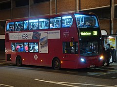
A 220 bus to Willesden Junction at a stop on Wood Lane

Buses parked in one of the Dimco Buildings at White City Bus Station; The various operators of the bus routes are allocated certain contingents of parking space in the depot buildings (2014)

Partial view of the White City bus station, in the background one of the Dimco Buildings (2009)
.jpg)


At the same time as the construction of new train stations for access to Westfield Shopping Center, a new bus station was also built on Wood Lane. The White City Bus Station , occasionally also Westfield London Bus Terminal , has been in operation since November 29, 2008 and is currently (2018) served by nine bus routes, whereby the routing of eight routes has been changed so that they now have their terminus at the bus station . The bus station is in the area of the previous Central Line depot; The two Dimco Buildings, which serve as a depot, are integrated into the bus station.
Arts and Culture
Cultural values in the BBC centers
The construction concept of both BBC centers in White City, the Television Center and the Media Center, included works of art and artistic aspects in the planning from the start, and the Television Center in particular had a special cultural value.
Art in the Television Center

The central structure of the Television Center was a circular office building with an inner courtyard, which BBC members jokingly received the nickname donut building , based on the donut building , which is still rumored today. In the middle of the courtyard a three meter high gilded bronze statue of the Greek sun god Helios was placed. The statue comes from the British sculptor T. B. Huxley-Jones (1908-1968) and the broadcasting of the should television ( "the radiation of television light") symbolize. At its foot end there are two more statues that represent sound and vision, the two media components of television. The building has been under monument protection ( Grade II ) since 2009 and was treated according to the requirements during the renovation work. The Helios statue, which is also listed, was removed, maintained and returned to its old location in February 2017. In the application for the purchase of the newly built apartments in the donut building, the adapted building is also named after the statue Helios .

Also listed are the entrance lobby with a wall mosaic inside by the British artist John Piper (1903–1992) and the brick wall of Studio 1 at the entrance to the TV center, often called atomic dot wall , on the 26 point-like structures reminiscent of atoms are upset. How the shape of the Television Center as a whole and the arrangement of the dots on the wall came about is told in anecdotes. The TV center was designed by the architect Graham Dawbarn (1893–1976). After receiving a written contract to build a pub, he is said to have asked himself how the buildings should be arranged and scribbled a question mark on an envelope in this regard. When he saw the shape of the sign, it served as a spontaneous inspiration. The dots on the studio wall are the result of chance. The BBC asked for a graphic element to complement its three-letter logo . The letters were painted on the cardboard of the architectural model, which had several pricks from pins at this point. BBC officials misinterpreted these puncture holes as a draft and accepted the proposal.
With the three-letter BBC lettering that was removed on September 30, 2014. the wall and the donut building symbolized the emotional closeness of the population to the BBC: "... the Grade II-listed parts of the site will remain - the ones that make people feel they have been here before." Listed parts of the site will be preserved - those that make people feel that they have been here before. ”) The entire Television Center itself“ […] had a unique place in the culture and shared memory of almost every adult living in the UK. "(" [...] had a unique place in the cultural memory of almost every adult living in the UK. ")
Art in the Media Village
Artistic aspects were also important when planning the Media Village site. The Japanese painter and installation artist Yuko Shiraishi (* 1956) worked with the Allies and Morrison architectural firm commissioned to build the interior and exterior colors of the Broadcast Center and Media Center houses. The British artist Simon Patterson designed a wall in the entrance area of the Broadcast Center, the patterns of which were based on those that were installed on stealth ships of the British merchant navy, mainly during the First World War.

The design of the grassland was part of the landscape architecture concept. The park adjacent to the construction site was designed by the landscape architect Christopher Bradley-Hole.
The British poet Andrew Motion (* 1952), who was honored as a Poet Laureate , wrote the poem Voices of White City , which was worked into the pavement in the open space between the buildings in collaboration with the graphic designer John Morgan. It was intended to write further texts in workshops with the local population, which should be permanently attached to the entire area of the Media Center.
On May 24, 2005, IOC President Jacques Rogge unveiled a plaque commemorating the White City Olympics on the building called the Energy Center. It shows the five Olympic rings and the medal table from the 1908 Games. The plaque is located where the finish line of the marathon was in the old Olympic Stadium.
Further art and culture initiatives
"Hereafter" is the title of a 2017 artistic redesign of an abandoned gas station on Wood Lane. The roofing and the sales building were redesigned by the designer duo Craig & Karl using colorful geometric patterns to create visually compact and strictly structured objects. In the same color and shape, several cuboids represent the former gas pumps. The title “Afterwards” is intended to express that the object is a place where something can still follow. The work is the designer’s first major work of art in public spaces in London.
With the White City Youth Theater, an initiative has existed in the White City Estate since 2008, which teaches the children and young people of the large estate that acting as a cultural activity. The theater initiative sees itself as an educational project with broad integration requirements. Recently, based on the positive experiences with young people, the aim is to establish acting with people of other age groups as a psychotherapeutic and socio-therapeutic measure under the name White City Theater Project . The theater group works with schools and other institutions.
Education and religion
Elementary schools
In the White City Estate, the Pope John School (officially also St John XXIII Catholic Primary School ) run by the Roman Catholic religious community is attended by around 230 three to eleven year olds; the majority of the students are from ethnic minorities. As part of an assessment, the school received an overall rating of “Excellent” in 2003 from the official school control authority Ofsted (Office for Standards in Education, Children's Services and Skills) and an “Excellent” rating in an efficiency rating in 2008. The building was expanded in 2016. The Pope John School is the only elementary school in White City that should meet high standards.
Another primary school is the Bentworth Primary School, which was previously run by the administration of the Hammersmith and Fulham district, north of the housing estate between the Westway thoroughfare and Du Cane Road . The school was built on the edge of the White City exhibition grounds back in 1929 and originally had around 400 students. Today it is roughly the same size as the Pope John School, but has a higher proportion of students whose first language is not English. In 2010 it was given a "good" rating of lower quality than that. The school was then taken over by the children's welfare organization Ark (Absolute Returns for Kids) and has been called the Ark Bentworth Primary Academy since then . In 2014 it received the same quality rating as before.

The Canberra Primary School, located in the eastern section of the White City housing estate on Australia Road, is a primary school with around 400 students, almost exclusively from ethnic minorities. In a 2012 Ofsted survey, three quarters of students were not native English speakers. The school performance of the children, the pedagogical concept and the school management were described as inadequate in the study report and the school received the worst possible grade with “poor”. The school ceased operations at the end of August 2013 and was then also taken over by the Ark charity. Since then, the school has been operating under the name Ark Swift Primary Academy and was given the status of “good” in the 2016 assessment. Also on Australia Road is the Randolph Beresford Early Years Center, a childcare facility for three to five year olds.
South of the White City housing estate and west of the Loftus Road Stadium is one with the Jack Tizard School special school . It was named after the New Zealand-born psychologist and social medicine doctor of that name, who was particularly active in London in the 1950s and 1960s. As in previous years, Ofsted rated the special school as “Excellent” in 2018 and looks after children and young people with disabilities from the age of 2 to 19. As early as the 1890s, there was a school and a care facility for small children in two separate buildings at this location.
There are no secondary schools in the defined area of White City, but there are several of them in the immediate vicinity, which are also operated by different institutions.
Universities
Until the urban planning redevelopment of White City, there were no other training opportunities in this area besides primary schools. With the plan to turn the district into a center for a more upscale public, the settlement of two elite educational institutions was connected.
- Imperial College London
- In 2013, Imperial College London , a leading university, bought land from the BBC in the adjoining area of the Media Center and built a new teaching and research center, the White City Campus , immediately north of Westway , which began operating in three stages between 2016 and 2018 has been. The Imperial College, which is located in the area between technology, medicine and business, concentrates on the White City Campus - with one house each - on molecular science , biomedicine and on the training of economic companies in the field of research and development . The teaching hospital is the nearby Hammersmith Hospital, just north of White City. The university is also committed to opening the White City Campus to local residents. The facility, its research area and its services are to be brought closer to the residents of the area by means of various events.
- Royal College of Art
- The Royal College of Art was named the world's best university for art and design from 2015 to 2017. After the sale of the BBC Media Village and renovation work, the university has had a third campus in White City in addition to locations in Kensington and Battersea since September 2017. The Garden House of the former BBC Media Center offers courses from the School of Communications and School of Arts & Humanities departments. In September 2018, courses from the architecture department were added.
Other educational institutions
South of the Westfield shopping center on the outskirts of White City is the West London School of Dance, a dance school founded in 1986 for children and young people from kindergarten to 16 years of age.
On Wood Lane also south of Westfield London is Shepherd's Bush Library, a public library operated by Hammersmith & Fulham Council. The library is open seven days a week.
Religious sites


- Churches
- The White City Housing Estate has an Anglican Church dedicated to Saints Michael and George on Commonwealth Avenue.
- White City is a Roman Catholic parish in the Archdiocese of Westminster . Also located in the White City housing estate is the parish church of Our Lady of Fatima with an attached kindergarten and elementary school, the Pope John School , and the community center Fatima Center .
- Musalla
- Of the 460 mosques and Islamic prayer rooms in London, two of them exist in White City. The White City Musalla, also known as the Egyptian House in the White City housing estate, is used as a place of prayer ( Musallā ).
- In the Westfield shopping center there is a so-called Quiet Room in the underground parking area, which is made available as a prayer room for all denominations.
Web links
- White City on hidden-london.com
- White City Exhibitions on 20thcenturylondon.org
- White City Area Guide on ludlowthompson.com
- Information on the White City redesign is available on televisioncentre.com
To the White City Estate:
- The White City Estate, Shepherd's Bush: 'the modern outlook in housing provision'
- The White City Estate, Shepherd's Bush: 'I like it but maybe it's not for everyone'
Individual evidence
- ↑ In March 2020, residential units starting at £ 1 million were offered on the Internet platform televisioncentre.com (website accessed on March 26, 2020).
- ↑ a b c d e Hammersmith & Fulham Council: Wood Lane Conservation Area Character Profile. October 14, 1996, accessed August 18, 2018 .
- ↑ See a map from 1832 on londonancestor.com (accessed August 28, 2018).
- ↑ a b See a historical map of Ordnance Survey on the website of the National Library of Scotland: Ordnance Survey Maps, London, Five feet to the Mile, 1893-1896. Retrieved August 23, 2018 .
- ↑ a b c Wood Lane Station (Central Line). Retrieved August 17, 2018 .
- ^ World's Columbian Exposition. In: Encyclopaedia Britannica. Retrieved March 3, 2018 .
- ↑ "The glow of the fair's buildings, illuminated by electric lights at night, awed even those who had grown used to the miracle of modern science. - The glow of the exhibition buildings, which were illuminated by electric light at night, awe even those who had become accustomed to the wonders of modern science. ”( Charles J. Johnson and Marianne Mather: Take a 'walking tour' of the 1893 World's Columbian Exposition . - the 'White City' (picture station: Electricity building) In: . Chicago Tribune May 4, 2017, retrieved on 3 March 2018 . )
- ↑ In the publications from that time (postcards, exhibition catalogs) the London exhibition venue is referred to as the Great White City . The English word great means 'large' less in the sense of a spatial size than rather 'great, significant, unique'. (See bilingual dictionaries such as online on dict.cc. )
- ^ A b c White City Exhibitions. Retrieved February 19, 2018 .
- ^ History of White City. In: BBC Media Village White City. Retrieved February 22, 2018 .
- ^ Peter Trott: The Franco British Exhibition - Uxbridge Road Entrance Arch to the Franco British Exhibition. May 16, 2016, accessed August 18, 2018 .
- ↑ See olympic.org (Link: All Facts ), accessed on April 8, 2018.
- ^ Chris Upton: British Industries Fair in Birmingham was a right royal occasion. In: Birmingham Post. September 15, 2013, accessed March 1, 2018 .
- ^ White City Stadium. Retrieved August 24, 2018 .
- ^ Defunct Speedway Tracks - White City (London). Retrieved August 24, 2018 .
- ^ White City Commercial Development. Retrieved February 17, 2018 .
- ↑ a b First look inside BBC TV center homes at White City. Retrieved February 26, 2018 .
- ↑ a b Case Study: White City. Archived from the original on January 1, 2008 ; accessed on August 31, 2018 .
- ↑ See for example the price segment of the newly built apartments or the emphasis on the lifestyle character in the advertising of the new facilities on the websites televisioncentre.com , whitecityplace.com and in the real estate magazine Homes & Property .
- ↑ The real estate magazine Homes & Property speaks in an article of April 20, 2016 of over 5000 apartments, in another article of May 10, 2017 of 6000 residential units.
- ↑ What are meant are "five-storey buildings", i.e. the ground floor and four upper floors.
- ↑ See on this and on the following data The White City Estate, Shepherd's Bush: 'the modern outlook in housing provision'. January 17, 2017, accessed February 18, 2018 . and The White City Estate, Shepherd's Bush: 'I like it but maybe it's not for everyone'. January 17, 2017, accessed February 18, 2018 .
- ↑ a b whitecitytheatre.com. Retrieved March 3, 2018 .
- ^ White City Health Center Opens. Retrieved February 12, 2018 .
- ^ Ros Wynne-Jones: Council brings credit union services to White City. July 22, 2015, accessed February 15, 2018 .
- ↑ a b Crime Statistics for Wormholt and White City. Retrieved February 12, 2018 .
- ^ Ros Wynne-Jones: One Motorway, two Britains: Social divide in West London. In: The Independent. May 10, 1997, accessed February 12, 2018 .
- ↑ Average values from the statistical data for the electoral districts (which can be called up individually on the website) on streetcheck.com , based on data from 2011 (accessed on March 27, 2020).
- ↑ hidden-london.com .
- ↑ "The actual White City, as Pete thoughtfully explains in an interview […], is a public housing complex in West London near where he grew up." Internet Movie Database , accessed on March 3, 2018.
- ↑ genius.com. Retrieved February 12, 2018 .
- ↑ Corresponding information was found in a Google search for "White City Estate" in the search results in mid-February 2018 (newspaper articles, discussion forums, etc.).
- ↑ On Hammersmith Park cf. Hammersmith Park. Retrieved February 16, 2018 . and Hammersmith & Fulham Council: Wood Lane Conservation Area. Retrieved August 19, 2018 .
- ↑ The Parachute Regiment - 4th Bn Parachute Regiment (4 Para). Retrieved August 30, 2018 .
- ^ Andrea Watson: A commercial break for historic BBC site. In: Express. May 29, 2013, accessed April 7, 2018 .
- ^ The world's first purpose-built TV center to be conceived. Retrieved February 17, 2018 .
- ^ A b Clare Price: The Television Factory. In: Twentieth century society. June 2013, accessed April 7, 2018 .
- ↑ BBC Television Center sold for £ 200m. July 16, 2012, accessed February 18, 2018 .
- ^ Soho House. Retrieved February 24, 2018 .
- ↑ sohohouse.com. Retrieved April 7, 2018 .
- ↑ a b BBC TV center homes at White City. Retrieved February 23, 2018 .
- ↑ Daivd Spittles: The rise of White City: the transformation of the former BBC HQ has begun. In: Homes & Property. July 2, 2014, accessed March 11, 2018 .
- ↑ a b Jonathan Prynn: End of an era: BBC letters taken down from Television Center in Shepherd's Bush after 54 years. In: Evening Standard. September 30, 2014, accessed February 25, 2018 .
- ↑ a b White City Place. Retrieved March 4, 2018 .
- ↑ Rachid Errtibi: Closure of the White City building. March 28, 2013, accessed March 4, 2018 .
- ↑ a b c d See BBC brochure BBC Media Village White City. Retrieved February 19, 2018 .
- ^ A b c House of Commons Committee of Public Accounts: The BBC's White City 2 development. Twenty-fourth Report of Session 2005-06. February 14, 2006, accessed March 3, 2018 .
- ↑ See BBC Media Village White City , p. 18, accessed on February 25, 2018. For details on the planned architecture of the building, see BBC Music Center, London. Retrieved February 19, 2018 . .
- ^ A b John Plunkett: BBC move continues after £ 87m deal for Media Village. In: The Guardian. June 5, 2015, accessed March 5, 2018 .
- ^ National Audit Office: Managing the BBC's estate. January 21, 2015, accessed March 5, 2018 .
- ^ Tara Conlan: Running costs of BBC's London headquarters are triple UK average. In: The Guardian. January 21, 2015, accessed March 5, 2018 .
- ↑ a b c Westfield flagship opens in London. October 30, 2007, archived from the original on November 2, 2008 ; accessed on August 8, 2018 .
- ^ Vue Entertainment to Open Two World Class all Digital Multiplexes at Westfield London and Westfield Stratford City. April 30, 2009, archived from the original on July 18, 2009 ; accessed on August 8, 2018 .
- ^ "Key to the success of the shopping center over its 10 years has been transport" (Duncan Bower, project manager), in Ben Stevens: Spotlight: Westfield London's expansion. In: Retail Gazette. March 13, 2018, accessed August 8, 2018 .
- ^ A b Westfield London Becomes the Largest Mall in Europe. In: Across - The European Retail Real Estate Magazine. May 24, 2018, accessed August 15, 2018 .
- ↑ Westfield London now largest shopping center in Europe with launch of £ 600m extension. In: Independent. March 20, 2018, accessed August 15, 2018 .
- ^ Rowan Moore: Television Center review - the high life on Auntie's doorstep. In: The Guardian. February 11, 2018, accessed April 7, 2018 .
- ^ The Hammersmith Society: White City. January 18, 2018, accessed September 1, 2018 .
- ↑ For the Dimco buildings see Historic England: Dimco Machine Tools. Accessed August 31, 2018 . and London Architecture: The Dimco Buildings. Accessed August 31, 2018 .
- ^ Yasmine Estephanos: A century-old building will be new bus depot. November 25, 2008, accessed September 1, 2018 .
- ↑ See a 2017 broadcast from the Westfield shopping center to the surrounding population, shown on Dimco buildings to become events venue. January 4, 2018, accessed August 31, 2018 . . Presumably 1500 people per building are meant, because elsewhere we speak of a 3000-person capacity; see The Hammersmith Society: White City. January 18, 2018, accessed September 1, 2018 .
- ↑ british-history.ac.uk. Retrieved August 9, 2018 .
- ↑ a b Uxbridge Road Station. Retrieved August 10, 2018 .
- ↑ A detailed map of the London Underground on carto-metro.free.fr. Retrieved August 26, 2018 .
- ↑ Wood Lane. Retrieved August 23, 2018 .
- ↑ a b White City Station. Retrieved August 29, 2018 .
- ^ Circle Line extended to the west. March 5, 2009. Retrieved August 25, 2018 .
- ↑ Wood Lane arches. Retrieved August 13, 2018 .
- ↑ For the Wood Lane station on the Central Line, see Wood Lane Station (Central Line) (I). Retrieved August 23, 2018 . , Wood Lane Station (Central Line) (II). Retrieved August 23, 2018 . , Wood Lane Station (Central Line) (III). Retrieved August 23, 2018 . , Wood Lane Station (Central Line) (IV). Retrieved August 23, 2018 . (all on www.subbrit.org.uk and all with pictures) and Wood Lane (on underground-history.co.uk). Retrieved August 23, 2018 . , Wood Lane tube station (at www.urban75.org). Retrieved August 23, 2018 . and Wood Lane (at www.abandonedstations.org.uk). Retrieved August 28, 2018 . (all with pictures).
- ↑ a b West Cross Route. Retrieved September 1, 2018 .
- ^ The Motorway Comes. Retrieved August 29, 2018 .
- ^ M41 West Cross Route - from notoriety to obscurity in thirty years. Retrieved September 1, 2018 .
- ↑ a b What the papers said about Street Party '96. Retrieved September 2, 2018 .
- ↑ The Independent, on the other hand, speaks of about half as many participants; see. Protesters' party bars motorway. July 14, 1996, accessed September 2, 2018 .
- ↑ What is Compulsory Basic Training (CBT Training)? Accessed August 31, 2018 .
- ↑ See the image description on Commons
- ^ White City Bus Station. Accessed August 31, 2018 .
- ↑ a b Steve Boggan: BBC Television Center: A nostalgic wander through the sets, studios and ghosts of programs past. September 23, 2014, accessed February 25, 2018 .
- ↑ In the course of the renovation of White City, this joking name of the building is repeatedly quoted in the PR work and in the advertising of the new facilities, for example on televisioncentre.com (accessed on February 23, 2018).
- ↑ Helios statue. Retrieved February 17, 2018 .
- ^ Television Center opens to the public for the first time. Retrieved February 22, 2018 .
- ↑ The Helios. Retrieved February 24, 2018 .
- ↑ This story was and continues to be told to visitors to the Television Center. The envelope in question has also been preserved and in the possession of the BBC. (Cf.. John Rabon: . Great London Buildings - The Old BBC Television Center January 25, 2018, retrieved on April 7, 2018 . This is also said to have been that the question mark drawn first on a napkin, and only then transferred to the envelope It seems more plausible, however, that the question mark was drawn for someone to explain rather than serve as inspiration, since the envelope is probably from a later date. See in detail An unreliable and wholly unofficial history of BBC Television Center ... Accessed March 11, 2018 .
- ↑ Melissa York: As the first residents move into Television Center, a new era is beginning for the BBC's former home in west London. November 28, 2017. Retrieved April 7, 2018 .
- ↑ An unreliable and wholly unofficial history of the BBC Television Center ... Retrieved March 11, 2018 .
- ↑ See also (with pictures) Derelict Petrol Station on Wood Lane Transformed by Craig & Karl. June 1, 2017, accessed April 10, 2018 .
- ↑ See the Ofsted School Report 2004 and the Ofsted School Report 2008 .
- ^ Pope John Catholic Primary School Expansion. Retrieved April 8, 2018 .
- ↑ On the website televisioncentre.com , which promotes the redesign of the district for the discerning public, this school is listed as the only one in White City in the list of existing educational institutions. (See televisioncentre.com/education , accessed April 10, 2018.)
- ↑ Bentworth Primary School on teachweb.co.uk. Retrieved April 9, 2018 .
- ↑ See Ofsted School Report 2010 .
- ^ Ofsted School Report 2014. Accessed April 10, 2018 .
- ↑ See the Ofsted page Canberra Primary School. (No longer available online.) October 12, 2012, archived from the original on July 24, 2016 ; accessed on April 10, 2018 . See also the Ofsted School Report 2012. Archived from the original on December 3, 2015 ; accessed on April 10, 2018 .
- ↑ Ark Swift Primary Academy website. Retrieved April 10, 2018 .
- ↑ Ofsted School Report 2018. Retrieved on August 24, 2018 .
- ^ Ordnance Survey Maps, London, Five feet to the Mile, 1893-1896. Retrieved August 23, 2018 .
- ^ White City Campus. Retrieved February 11, 2018 . See also the links on this website below.
- ^ RCA White City. Retrieved September 2, 2018 .
- ^ Royal College of Art sets up creative hub in White City. January 5, 2017, accessed September 2, 2018 .
- ^ West London School of Dance. Retrieved September 2, 2018 .
- ^ Shepherd's Bush Library. Retrieved August 19, 2018 .
- ↑ muslimsbritain.org. Retrieved August 25, 2018 .
Coordinates: 51 ° 30 ′ 45.4 ″ N , 0 ° 13 ′ 39 ″ W.