
Winseldorf
| coat of arms | Germany map | |
|---|---|---|

|
Coordinates: 53 ° 57 ' N , 9 ° 36' E |
|
| Basic data | ||
| State : | Schleswig-Holstein | |
| Circle : | Stone castle | |
| Office : | Itzehoe country | |
| Height : | 6 m above sea level NHN | |
| Area : | 5.62 km 2 | |
| Residents: | 313 (Dec. 31, 2019) | |
| Population density : | 56 inhabitants per km 2 | |
| Postal code : | 25551 | |
| Area code : | 04826 | |
| License plate : | IZ | |
| Community key : | 01 0 61 114 | |
| Office administration address: | Margarete-Steiff-Weg 3 25524 Itzehoe |
|
| Website : | ||
| Mayor : | Udo Foelster | |
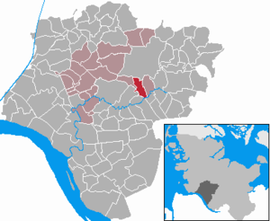
| Location of the community of Winseldorf in the Steinburg district | ||
  |
||

Winseldorf ( Low German : Winseldbod ) is a municipality in the Steinburg district in Schleswig-Holstein .
Geography and traffic
Winseldorf is located south of Hohenlockstedt an der Stör on the edge of the Aukrug Nature Park . The Rantzau flows through the municipality. Winseldorf is on federal highway 206 .
history
The place name probably goes back to a personal name and could mean "Dorf des Winziko" or "Dorf des Winzilo".
In 1502 the village partially belonged to the Bordesholm monastery . In 1528 Field Marshal Johann Rantzau received the village as a gift from King Friedrich I. Heinrich Rantzau , the son of Johann Rantzau, built a paper water mill in 1570 and planted a pine paddock by sowing in 1580.
coat of arms
Blazon : "In green a slanting silver wave bar, accompanied by a silver bell of a chess flower above and below ."
Web links
Individual evidence
- ↑ North Statistics Office - Population of the municipalities in Schleswig-Holstein 4th quarter 2019 (XLSX file) (update based on the 2011 census) ( help on this ).
- ↑ Wolfgang Laur : Historisches Ortsnamelexikon von Schleswig-Holstein , 2nd edition, Neumünster 1992, p. 701 f.
- ↑ Schleswig-Holstein's municipal coat of arms
Carrion | Abbissinwish | Agethorst | Altenmoor | Auufer | Bahrenfleth | Beidenfleth | Bekdorf | Bekmünde | Besdorf | Blomean Wilderness | Bokelrehm | Bokhorst | Borsfleth | Breitenberg | Breitenburg | Brokdorf | Brokstedt | Büttel | Christinenthal | Dägeling | Dammfleth | Drage | Ecklak | Elskop | Engelbrecht Wilderness | Fitzbek | Glückstadt | Grevenkop | Gribbohm | Hadenfeld | Heiligenstedten | Heiligenstedtenerkamp | Hennstedt | Heart horn | Hingstheide | Hodorf | Hohenaspe | Hohenfelde | Hohenlockstedt | Holstenniendorf | Horst (Holstein) | Huje | Itzehoe | Kaaks | Kaisborstel | Kellinghusen | Lapwing row | Kleve | Kollmar | Kollmoor | Krempdorf | Brim | Kremperheide | Krempermoor | Kronsmoor | Krummendiek | Kudensee | Lägerdorf | Land law | Landscheide | Lockstedt | Lohbarbek | Looft | Mehlbek | Moordiek | Moorhusen | Mühlenbarbek | Münsterdorf | Neuenbrook | Neuendorf b. Elmshorn | Neuendorf-Sachsenbande | Nienbüttel | Nortorf | Nutteln | Oelixdorf | Oeschebüttel | Oldenborstel | Oldendorf | Ottenbüttel | Peissen | Pöschendorf | Poyenberg | Pulse | Quarnstedt | Wheel | Reher | Rethwisch | Rosdorf | Sankt Margarethen | Sarlhusen | Schenefeld | Schlotfeld | Silzen | Summer land | Stördorf | Störkathen | Süderau | Vaale | Vaalermoor | Wacken | Warring wood | Westermoor | Wewelsfleth | Wiedenborstel | Wills | Wilster | Winseldorf | Wittenbergen | Wrist | Wulfsmoor