
Wohltorf
| coat of arms | Germany map | |
|---|---|---|

|
Coordinates: 53 ° 31 ' N , 10 ° 18' E |
|
| Basic data | ||
| State : | Schleswig-Holstein | |
| Circle : | Duchy of Lauenburg | |
| Office : | High Elbgeest | |
| Height : | 28 m above sea level NHN | |
| Area : | 5.97 km 2 | |
| Residents: | 2398 (Dec. 31, 2019) | |
| Population density : | 402 inhabitants per km 2 | |
| Postal code : | 21521 | |
| Area code : | 04104 | |
| License plate : | RZ | |
| Community key : | 01 0 53 133 | |
| LOCODE : | DE 54H | |
| Office administration address: | Christa-Höppner-Platz 1 21521 Dassendorf |
|
| Website : | ||
| Mayor : | Gerald Dürlich (WW) | |
| Location of the community of Wohltorf in the Herzogtum Lauenburg district | ||
  |
||

Wohltorf is a municipality in the Duchy of Lauenburg in Schleswig-Holstein .
geography
Wohltorf is located about 20 kilometers east of Hamburg in the Sachsenwald , the largest forest area in Schleswig-Holstein, which is also a local recreation area for the Hamburg metropolitan region .
Wohltorf basically consists of four parts: the old farming village with a village pond and a few farms; the residential area at the distant stop of the Hamburg S-Bahn; the Aumühler shopping street Grosse Strasse, which is partly part of Wohltorf, and the villa settlement on Börnsener Weg / Strasse. Towards the neighboring community of Reinbek , the place is limited by the river Bille , which is also the boundary between the district of Duchy of Lauenburg and the district of Stormarn . The border to neighboring Aumühle, on the other hand, can hardly be seen and is only known to the immediate residents.
history
The place was first mentioned in a document in 1308. In 1529 Wohltorf fell to the Duke of Lauenburg and became a duke village . In 1705 Lauenburg came into the possession of the elector of Hanover after the death of the last Ascanian duke, who died without male descendants . At the time of the Napoleonic Wars, in the course of which Napoleon incorporated the entire North Sea coast into the French Empire , Wohltorf became " Mairie " and belonged to the Canton of Schwarzenbek . In 1865, with the Gastein Convention , Lauenburg and with it Wohltorf came to Prussia . 1871 was neighboring Saxony Forest Otto von Bismarck by Kaiser Wilhelm I paid.
Until around 1900 the community of Wohltorf had a very rural character. After the turn of the century, the so-called villa colony gradually emerged , in which Hamburg entrepreneurs and industrialists settled due to the proximity to the city and easy access via the Hamburg-Berlin railway line . This has decisively shaped the place as a Hamburg villa suburb until today. At the time of the Nazi regime, consideration was given to merging Wohltorf and the neighboring town of Aumühle . This idea was quickly rejected, however, because Wohltorf (rural, agricultural) and Aumühle (purely operational community) are too dissimilar.
politics
Community representation
Since the local elections in 2018, the community of voters WW has five seats in the municipal council, the Greens four and the SPD and the FDP two of the 13 seats each.
coat of arms
Blazon : "In red over a silver gable board consisting of two horse heads looking at each other, a silver wavy bar, raised by three silver oak leaves."
Partner municipality
Wohltorf's partner communities are Mortagne-sur-Sèvre in France and Sleen in the Netherlands.
economy
Wohltorf is one of the richest communities in Germany, due to its preferred location as a Hamburg villa suburb. In rankings of the municipalities with the highest purchasing power in Germany, Wohltorf regularly takes top places. Wohltorf's economy itself is medium-sized.
traffic
The Sachsenwald lies between the federal highway 24 Hamburg - Berlin , the federal highway 1 Hamburg- Lübeck - Puttgarden and the federal highway 404 .
Wohltorf has an S-Bahn station and is connected to the Hamburger Verkehrsverbund (HVV). The journey time to Hamburg Central Station is around 30 minutes.
Attractions
The list of cultural monuments in Wohltorf includes the cultural monuments entered in the list of monuments of Schleswig-Holstein.
leisure
The Wohltorfer Tonteich enjoys great popularity beyond the municipal boundaries . The Friedrichsruher Tonwerke stood there until 1911 , but in that year a large fire destroyed the brickworks. It was not rebuilt. Today the clay pit has filled with water and two thirds of it is leased to a public swimming pool and one third to the private clay pigeon club Sachsenwald . The clay pigeon club offers its members tennis and hockey in addition to the use of the club's own swimming pool.
Religious life
The Protestant parish of Wohltorf was created in 1928 by outsourcing from the parish of Aumühle. In 1930 the first Wohltorf church was inaugurated. It was based on a design by Carl Bensel , the wooden church cross was a work by Walter von Ruckteschell . In July 1950, the Wohltorfer church burned out while trying to smoke out two wasp nests. It was rebuilt in 1950 according to plans by the Hamburg architect Langmaack ; the inauguration took place on Christmas Eve 1950.
Personalities
- Cornelius Hartz (* 1973), author, grew up in Wohltorf.
- Karsten Huck (* 1945), show jumper, was born in Wohltorf.
- Felicitas Princess of Prussia (born June 7, 1934 in Bonn; † August 1, 2009 in Wohltorf)
- Reinhard Schröder (1902–1984) was pastor in Wohltorf for 44 years
photos

The Heilig-Geist-Kirche Wohltorf

Meadow by the village pond

Wohltorf primary school

Meadows in Wohltorf
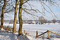
Wohltorf in winter


literature
- Erich Zschau: The church on the mountain. Wohltorfer church history (s) . Einhorn-Presse Verlag 2009. ISBN 978-3-88756-064-5
Web links
Individual evidence
- ↑ North Statistics Office - Population of the municipalities in Schleswig-Holstein 4th quarter 2019 (XLSX file) (update based on the 2011 census) ( help on this ).
- ↑ http://wohltorf.de/gemeindevertreter-und-vertreterinnen/
- ↑ Schleswig-Holstein's municipal coat of arms
- ↑ "Sibling communities"
- ^ Claas Greite, Matthias Popien, Matthias Röhrs and Michael Schick: Income: That is how rich Hamburg's bacon belt is. In: Hamburger Abendblatt . January 8, 2015, accessed July 6, 2019 .
- ↑ Rolf Schröter: Where the Germans with the highest purchasing power live. In: Advertise & Sell . February 14, 2018, accessed July 6, 2019 .
- ↑ [1] ( Page no longer available , search in web archives ) Info: The link was automatically marked as defective. Please check the link according to the instructions and then remove this notice. Hamburger Abendblatt, July 17, 1950
- ↑ Zschau: Die Kirche auf dem Berg, pp. 24 ff., 29 ff., 47 ff.
Albsfelde | Alt-Mölln | Aumühle | Bäk | Blue | Basedow | Basthorst | Behlendorf | Berkenthin | Besenthal | Bliestorf | Exchanges | Borstorf | Breitenfelde | Bröthen | Brunsmark | Brunstorf | Books | Buchholz | Buchhorst | Dahmker | Dalldorf | Dassendorf | Düchelsdorf | Duvensee | Single house | Elmenhorst | Escheburg | Fitzen | Fredeburg | Fuhlenhagen | Geesthacht | Giesensdorf | Göldenitz | Goddess | Grabau | Grambek | Grinau | Big floor | Great Disnack | Groß Grönau | Great Pampau | Great Sarau | Groß Schenkenberg | Grove | Gudow | Gülzow | Bream | Hamfelde | Hamwarde | Harmsdorf | Havekost | Hohenhorn | Hollenbek | Hornbek | Horst | Juliusburg | Kankelau | Kasseburg | Kastorf | Kittlitz | Klein Pampau | Klein reveler | Plumbing | Klinkrade | Koberg | Kollow | Koethel | Kröppelshagen-Fahrendorf | Krukow | Curved mass | Krüzen | Kuddewörde | Killing | Kulpin | Labenz | Langenlehsten | Lankau | Lance | Lauenburg / Elbe | Clay wheel | Linau | Lüchow | Lütau | Mechow | Möhnsen | Mölln | Mill wheel | Must | Mustin | Niendorf ad St. | Niendorf near Berkenthin | Nuts | Panting | Pogeez | Poggensee | Ratzeburg | Ritzerau | Römnitz | Rondeshagen | Roseburg | Sahms | Salem | Sandesneben | Schiphorst | Schmilau | Schnakenbek | Schoenberg | Schretstaken | Schulendorf | Poking soles | Schwarzenbek | Seedorf | Seven trees | Seven oaks | Sierksrade | Sirksfelde | Steinhorst | Sterley | Stump | Talkau | Tramm | Walksfelde | Wangelau | Wentorf (Amt Sandesneben) | Wentorf near Hamburg | Wiershop | Witzeeze | Wohltorf | Woltersdorf | Worth | Ziethen
Community-free area in the Duchy of Lauenburg
Sachsenwald district