Bear Creek Reservoir: Difference between revisions
Content deleted Content added
m →See also: cat |
Changing units to decameters^3 for consistency across TVA dam pages |
||
| (12 intermediate revisions by 11 users not shown) | |||
| Line 1: | Line 1: | ||
{{Infobox |
{{Infobox body of water |
||
| |
| name = Bear Creek Reservoir |
||
| |
| image = |
||
| |
| caption = |
||
| image_bathymetry = |
| image_bathymetry = |
||
| caption_bathymetry = |
| caption_bathymetry = |
||
| Line 17: | Line 17: | ||
| depth = |
| depth = |
||
| max-depth = |
| max-depth = |
||
| volume = {{convert|37,800|acre-ft|dam3|lk=on|sigfig=2|abbr=off|sp=us}} |
|||
| volume = |
|||
| residence_time = |
| residence_time = |
||
| shore = |
| shore = |
||
| Line 23: | Line 23: | ||
| islands = |
| islands = |
||
| cities = |
| cities = |
||
<!-- Map --> |
|||
| pushpin_map = Alabama#USA |
|||
| pushpin_label_position = |
|||
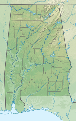
| pushpin_map_alt = Location of Bear Creek Reservoir in Alabama, USA. |
|||
| pushpin_map_caption = |
|||
<!-- Below --> |
|||
| website = |
|||
| reference = |
|||
}} |
}} |
||
The '''Bear Creek Reservoir''' is a [[reservoir]] located in [[Franklin County, Alabama]], along Bear Creek. '''Bear Creek Dam''' is one of four [[Tennessee Valley Authority]] dams in the area, 68 |
The '''Bear Creek Reservoir''' is a [[reservoir]] located in [[Franklin County, Alabama]], along Bear Creek. '''Bear Creek Dam''' is one of four [[Tennessee Valley Authority]] dams in the area, {{convert|68|ft|m}} high, creating a maximum [[flood control]] capacity of {{convert|37,800|acre-ft|dam3|lk=on|sigfig=2|abbr=off|sp=us}}. No hydroelectric power is generated here.<ref>{{cite web| url = http://www.tva.gov/sites/bearcreek.htm| url-status = dead| archive-url = https://web.archive.org/web/20020623135853/http://www.tva.gov/sites/bearcreek.htm| archive-date = 2002-06-23| title = TVA: Bear Creek Reservoir}} </ref> |
||
==References== |
==References== |
||
| Line 37: | Line 45: | ||
{{Tennessee Valley Authority Facilities}} |
{{Tennessee Valley Authority Facilities}} |
||
{{authority control}} |
|||
[[Category:Reservoirs in Alabama]] |
[[Category:Reservoirs in Alabama]] |
||
[[Category: |
[[Category:Bodies of water of Franklin County, Alabama]] |
||
[[Category:Ozark – St. Francis National Forest]] |
|||
[[Category:Dams in Alabama]] |
[[Category:Dams in Alabama]] |
||
[[Category:Tennessee Valley Authority dams]] |
[[Category:Tennessee Valley Authority dams]] |
||
[[Category:Dams completed in 1969]] |
[[Category:Dams completed in 1969]] |
||
{{ |
{{FranklinCountyAL-geo-stub}} |
||
Latest revision as of 19:02, 29 October 2023
| Bear Creek Reservoir | |
|---|---|
| Location | Franklin County, Alabama |
| Coordinates | 34°23′55″N 87°59′16″W / 34.39861°N 87.98778°W |
| Type | reservoir |
| Primary inflows | Bear Creek |
| Primary outflows | Bear Creek |
| Basin countries | United States |
| Water volume | 37,800 acre-feet (47,000 cubic dekameters) |
The Bear Creek Reservoir is a reservoir located in Franklin County, Alabama, along Bear Creek. Bear Creek Dam is one of four Tennessee Valley Authority dams in the area, 68 feet (21 m) high, creating a maximum flood control capacity of 37,800 acre-feet (47,000 cubic dekameters). No hydroelectric power is generated here.[1]
References[edit]
- ^ "TVA: Bear Creek Reservoir". Archived from the original on 2002-06-23.
See also[edit]


