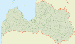
Veclaicene Parish: Difference between revisions
Content deleted Content added
No edit summary |
added settlement/wikidata infobox |
||
| Line 1: | Line 1: | ||
{{Infobox settlement/Wikidata | fetchwikidata=ALL}} |
|||
'''Veclaicene Parish''' ({{lang-lv|Veclaicenes pagasts}}) is an administrative unit of [[Alūksne Municipality]], [[Latvia]]. |
'''Veclaicene Parish''' ({{lang-lv|Veclaicenes pagasts}}) is an administrative unit of [[Alūksne Municipality]], [[Latvia]]. |
||
== Geography == |
== Geography == |
||
Revision as of 15:20, 10 March 2021
Veclaicene Parish | |
|---|---|
 | |
| Country | Latvia |
| Area | |
| • Total | 71.88 km2 (27.75 sq mi) |
| • Land | 69.91 km2 (26.99 sq mi) |
| • Water | 1.97 km2 (0.76 sq mi) |
| Population (1 January 2023)[2] | |
| • Total | 291 |
| • Density | 4.0/km2 (10/sq mi) |
Veclaicene Parish (Latvian: Veclaicenes pagasts) is an administrative unit of Alūksne Municipality, Latvia.
Geography
Veclaicene parish has several small rivers — Līčupe, Pērļupīte and lakes — Dzērve Lake, Ieva Lake, Lake Ilgājs, Koruļu Lake, Palpieris Lake, Pilskalna Lake, Raipala Lake, Veclaicene Lake.
Towns, villages and settlements of Veclaicene Parish
57°35′30″N 26°57′10″E / 57.59167°N 26.95278°E
- ^ "Reģionu, novadu, pilsētu un pagastu kopējā un sauszemes platība gada sākumā". Central Statistical Bureau of Latvia. Retrieved 18 January 2023.
- ^ "Iedzīvotāju skaits pēc tautības reģionos, pilsētās, novados, pagastos, apkaimēs un blīvi apdzīvotās teritorijās gada sākumā (pēc administratīvi teritoriālās reformas 2021. gadā) 2021 - 2022". Central Statistical Bureau of Latvia. Retrieved 2 October 2023.
