Fort Berkeley: Difference between revisions
Content deleted Content added
CareAhLine (talk | contribs) infbox |
CareAhLine (talk | contribs) mNo edit summary |
||
| Line 3: | Line 3: | ||
| map_type = Antigua#Caribbean |
| map_type = Antigua#Caribbean |
||
| native_name = |
| native_name = |
||
| location = [[ |
| location = [[English Harbour]], [[Antigua]] |
||
| image = Antigua - View from the Dow Hill Fort - Fort Berkeley - panoramio.jpg |
| image = Antigua - View from the Dow Hill Fort - Fort Berkeley - panoramio.jpg |
||
| caption = View of Fort Berkeley remains |
| caption = View of Fort Berkeley remains |
||
| map_size = 250 |
| map_size = 250 |
||
| map_alt = |
| map_alt = |
||
Revision as of 17:56, 22 October 2023
| Fort Berkeley | |
|---|---|
| English Harbour, Antigua | |
 View of Fort Berkeley remains | |
| Coordinates | 17°00′N 61°47′W / 17.00°N 61.78°W |
| Type | Fortification |
| Site information | |
| Open to the public | Yes |
| Condition | Ruins |
| Site history | |
| Built | 1704 |
| In use | No |
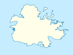
Fort Berkeley is a historic military fort on the island of Antigua. It is located in Saint Paul parish at the entrance to English Harbour. The fort was originally built in 1704 and was expanded in the mid 18th century. It is part of Nelson's Dockyard National Park and part of a UNESCO World Heritage Site.


