Pacific Beach, San Diego


Pacific Beach is a neighborhood of San Diego, bounded by La Jolla to the north, Mission Beach to the south, Interstate 5 and Clairemont to the east, and the Pacific Ocean to the west. While largely populated by surfers and college students, the population is becoming more professional and affluent due to rising property and rental costs. "PB", as it is known as by local residents, is also home to one of San Diego's more popular nightlife, with dozens of bars, cafes, and eateries lining the main east-west street Garnet Avenue and Mission Boulevard, which runs north-south.
Beaches
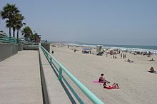
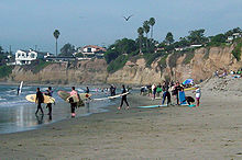
Pacific Beach boasts miles of shoreline and beaches along the Pacific Ocean to the west and Mission Bay to the South. The boardwalk overlooking the Pacific Ocean spans from Palisades Park South at Beryl Street in Northern Pacific Beach to Mission Beach, the neighborhood and beach directly to the south. There is also a sidewalk along Mission Bay which runs around Crown Point through Sail Bay and Mission Beach. The boardwalk is typically crowded with pedestrians, cyclists, rollerbladers, and shoppers. The beach scene revolves around Crystal Pier, a large pier and hotel at the west end of Garnet Avenue.
Alcohol
Alcohol is not legal on the sand in Pacific Beach.
Smoking
Effective August 17, 2006, after months of legal debating and thoughts of exceptions, the City of San Diego banned smoking at all city beaches and parks. As of the summer of 2007, smoking on the boardwalk is prohibited as well.
Streets
The primary north-south street running parallel to the beach is Mission Boulevard, with the streets named after late 19th century federal officials, then incrementing in alphabetical order as they move further from the coast: Bayard, Cass, Dawes, Everts, Fanuel, Gresham, Haines, Ingraham, Jewell, Kendall, Lamont, Morrell, Noyes, Olney, Pendelton. Mission Boulevard was formerly Allison Street, being the "A" street of the series.
The east-west streets are named after precious stones and are roughly in alphabetical order from north to south (two of which are officially misspelled):
Other east-west streets also named after stones fall in there, but out of order. These include: Sapphire, Tourmaline, Opal and Turquoise.
1Despite the fact that Garnet Avenue is surrounded by streets named after other stones, many San Diego residents pronounce it like the surname "Garnette" /gɑrˈnɛt/, instead of the stone "garnet" /ˈgɑr.nɪt/.
History
Pacific Beach was developed during the boom years of 1886-1888 by D. C. Reed, A. G. Gassen, Charles W. Pauley, R. A. Thomas, and O. S. Hubbell. It was Hubbell who "leared away the grainfields, pitched a tent, mapped out the lots, hired an auctioneer and started to work." To attract people, they built the Race Track and San Diego College of Letters, neither of which survive today. A railway also connected Pacific Beach with downtown San Diego, and was later extended to La Jolla.
Bars and nightlife
Pacific Beach is one of the main centers of nightlife in San Diego. Garnet Avenue between Ingraham Street and Mission Blvd. is the main area where bars and restaurants are located. Pacific Beach tends to cater to a younger college- and post-college-oriented crowd, compared to downtown San Diego's Gaslamp District. Dress codes are generally less strict if they are enforced at all.
External links
- Discover Pacific Beach website
- Video of Sunset at Pacific Beach, San Diego, California
- Pacific Beach Neighborhood Guide
- New Pacific Beach Site Coming Soon
References
| To the North: La Jolla |
California State Beaches | To the South Mission Beach |
