Pic de Médécourbe
| Pic de Médécourbe | |
|---|---|
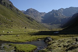
 The Soulcem valley looking towards Pic de Médécourbe and Col de Bareytes (2859m) in the background | |
| Highest point | |
| Elevation | 2,914 m (9,560 ft) |
| Geography | |
| Location | |
| Parent range | Pyrenees |
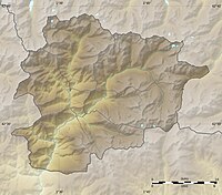
Pic de Médécourbe (Catalan: Pic de Medacorba) is a mountain in Europe that sits on the western tripoint boundary of Andorra, France and Spain. It is 2,914 metres (9,560 ft) tall, with the highest part of the peak being in France.[dubious ]

