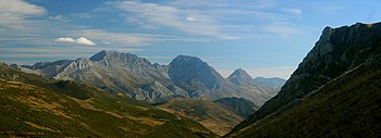
Tuíza

Tuiza or San Cristóbal de Tuiza is one of 24 parishes (administrative divisions) in Lena, a municipality within the province and autonomous community of Asturias, in coastal northern Spain.
The parish is the home of the Ubiña Massif (Macizo de Ubiña) of the Cantabrian Mountains.
The parroquia is 23.32 km2 (9.00 sq mi) in size, with a highly seasonal population.[1] Its post code is 33628.
Villages
The villages of Tuiza include:
- Tuiza de Abajo, located at an altitude of 1,050 meters
- Tuiza de Arriba, 1,300 meters high, the pass to the Ubiña Massif
- El Campo, at 1,100 meters
References
- ^ 2011 statistical data, "Sociedad Asturiana de Estudios Económicos e Industriales" (SADEI), http://www.sadei.es/indexsub.asp?id=Nomenclator/Nomenclator.HTM, accessed 22 Jan 2013
External links
- Asturian society of economic and industrial studies, English language version of "Sociedad Asturiana de Estudios Económicos e Industriales" (SADEI)
43°01′25″N 5°54′19″W / 43.02351°N 5.9052°W
