Atescatempa: Difference between revisions
Content deleted Content added
No edit summary Tags: Mobile edit Mobile web edit |
No edit summary Tags: Mobile edit Mobile web edit |
||
| Line 6: | Line 6: | ||
|native_name = <!-- for cities whose native name is not in English --> |
|native_name = <!-- for cities whose native name is not in English --> |
||
|nickname = |
|nickname = |
||
|settlement_type = Municipality |
|settlement_type = Municipality |
||
|motto = |
|motto = |
||
<!-- images and maps -----------> |
<!-- images and maps -----------> |
||
Revision as of 15:55, 2 February 2020
Atescatempa | |
|---|---|
Municipality | |
| Coordinates: 14°10′30″N 89°44′30″W / 14.17500°N 89.74167°W | |
| Country | |
| Department | |
| Area | |
| • Municipality | 31.0 sq mi (80.2 km2) |
| Population | |
| • Municipality | 18,402 |
| • Density | 590/sq mi (230/km2) |
| • Urban | 9,606 |
| Climate | Aw |
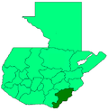
Atescatempa is a town and municipality in the Jutiapa department of Guatemala.
14°10′30″N 89°44′30″W / 14.17500°N 89.74167°W
References
- ^ Citypopulation.de Population of departments and municipalities in Guatemala


