Bugaksan: Difference between revisions
Content deleted Content added
No edit summary |
No edit summary |
||
| Line 21: | Line 21: | ||
|mr = Pugaksan |
|mr = Pugaksan |
||
}} |
}} |
||
'''Bugaksan''' is a mountain north of [[Gyeongbokgung Palace]] in [[Seoul]], also known as ''' |
'''Bugaksan''' is a mountain north of [[Gyeongbokgung Palace]] in [[Seoul]], also known as '''Baegaksan'''. [[Inwangsan]], [[Naksan]], and [[Namsan (Seoul)|Namsan]] are the mountains that surround the Seoul Basin. The bedrock is [[granite]] and is about 342m high.<ref>{{cite web|url=http://www.doopedia.co.kr/doopedia/master/master.do?_method=view&MAS_IDX=101013000845027|title=북악산|publisher=Doosan Encyclopedia|accessdate=29 September 2014|language=Korean}}</ref> |
||
==See also== |
==See also== |
||
Revision as of 12:00, 22 February 2021
| Bugaksan | |
|---|---|
 Bugaksan overlooking Gyeongbokgung Palace and the Blue House | |
| Highest point | |
| Elevation | 342 m (1,122 ft) |
| Geography | |
| Korean name | |
| Hangul | |
|---|---|
| Hanja | |
| Revised Romanization | Bugaksan |
| McCune–Reischauer | Pugaksan |
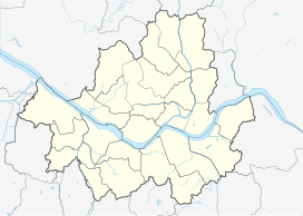
Bugaksan is a mountain north of Gyeongbokgung Palace in Seoul, also known as Baegaksan. Inwangsan, Naksan, and Namsan are the mountains that surround the Seoul Basin. The bedrock is granite and is about 342m high.[1]
See also
References
37°36′22″N 126°59′00″E / 37.60611°N 126.98333°E

