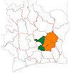
Didiévi: Difference between revisions
Content deleted Content added
→Villages: +villages |
→Villages: +villages |
||
| Line 97: | Line 97: | ||
# Kouamé-Akaffoukro (950) |
# Kouamé-Akaffoukro (950) |
||
# Koukoun-Zogrékro (121) |
# Koukoun-Zogrékro (121) |
||
# Kouassi-Kprékro (300) |
|||
# Krayabo (603) |
|||
# Langui-Kouadiokro (390) |
|||
# N'da-Akissikro (1 110) |
|||
# Anouazè-Okabo (850) |
|||
# Attekro (590) |
|||
==References== |
==References== |
||
Revision as of 16:14, 10 September 2019
Didiévi | |
|---|---|
Town, sub-prefecture, and commune | |
| Coordinates: 7°8′N 4°54′W / 7.133°N 4.900°W | |
| Country | |
| District | Lacs |
| Region | Bélier Region |
| Department | Didiévi |
| Population (2014)[1] | |
| • Total | 22,510 |
| Time zone | UTC+0 (GMT) |
Didiévi is a town in central Ivory Coast. It is a sub-prefecture of and the seat of Didiévi Department in Bélier Region, Lacs District. Didiévi is also a commune.
In 2014, the population of the sub-prefecture of Didiévi was 22,510 [2].
Villages
The xx villages of the sub-prefecture of Didiévi and their population in 2014 are [2]:
- Ahougnanou (428)
- Allokokro (792)
- Attien-Kouassikro (787)
- Broukro-Totokro 1 (470)
- Broukro-Totokro 2 (476)
- Didiébou-Dioula (752)
- Didiévi (7 917)
- Kouakou-Koffikro (224)
- Kouamé-Akaffoukro (950)
- Koukoun-Zogrékro (121)
- Kouassi-Kprékro (300)
- Krayabo (603)
- Langui-Kouadiokro (390)
- N'da-Akissikro (1 110)
- Anouazè-Okabo (850)
- Attekro (590)
References
- ^ "Côte d'Ivoire". geohive.com. Retrieved 9 December 2015.
- ^ a b "RGPH 2014, Répertoire des localités, Région Bélier" (PDF). ins.ci. Retrieved 5 August 2019.


