
Gamlestaden, Gothenburg


Gamlestaden is an urban district (Swedish: stadsdel) of Gothenburg, Sweden. The district has 7273 inhabitants (2009).[1][2] In and around Gamlestaden there are some industries. Most well-known is SKF. The district has a commuter rail station by the same name.
Gallery
-
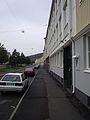
 Street in Gamlestaden
 -
 Street in Gamlestaden
 -
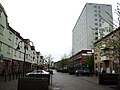
 Street in Gamlestaden
 -
 Street in Gamlestaden
 -
 Gatubild från Gamlestaden


References
- ^ Statistisk Årsbok Göteborg 2009
- ^ Göteborgs stad - Stadsdelar och primärområden Läst 2011-01-23.
External links
57°42′2″N 11°57′12″E / 57.70056°N 11.95333°E
KML is from Wikidata
This Swedish geography article is a stub. You can help Wikipedia by expanding it. |