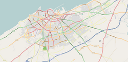
Hay Hassani
Hay Hassani
الحي الحسني | |
|---|---|
District and arrondissement of Casablanca | |
| Coordinates: 33°34′25″N 7°40′34″W / 33.57361°N 7.67611°W | |
| Country | |
| Region | Casablanca-Settat |
| Area | |
| • Total | 25.91 km2 (10.00 sq mi) |
| Population (2004) | |
| • Total | 323,277 |
| Time zone | UTC+0 (WET) |
| • Summer (DST) | UTC+1 (WEST) |
Hay Hassani (Arabic: الحي الحسني) is a district, arrondissement and suburb of southwestern Casablanca, in the Berrechid Province of the Casablanca-Settat region of Morocco. The district covers an area of 25.91 square kilometres (10 square miles) and as of 2004 had 323,277 inhabitants.[1] The district contains one arrondissement of the same name.
References[edit]
- ^ "La Préfecture de Casablanca (in French)". Casablanca.ma. Archived from the original on 26 March 2010. Retrieved 22 April 2012.


