Tambolaka: Difference between revisions
Content deleted Content added
mNo edit summary |
No edit summary |
||
| Line 1: | Line 1: | ||
{{unreferenced|date=September 2012}} |
{{unreferenced|date=September 2012}} |
||
{{Infobox settlement |
|||
| ⚫ | |||
|official_name = Tambolaka (Waitabula) |
|||
|motto = |
|||
|image_skyline = |
|||
|imagesize = |
|||
|image_caption = |
|||
|image_flag = |
|||
| image_map = Lokasi Nusa Tenggara Timur Kabupaten Sumba Barat Daya.svg |
|||
| mapsize = |
|||
| map_caption = Location of Southwest Sumba Regency in [[Lesser Sunda Islands]] |
|||
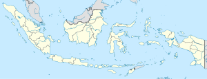
|pushpin_map = Indonesia |
|||
|pushpin_map_caption = Location in [[Indonesia]] |
|||
|pushpin_mapsize = 300 |
|||
|pushpin_label_position = top |
|||
|subdivision_type = Country |
|||
|subdivision_name = [[Indonesia]] |
|||
|subdivision_type1 = Region |
|||
|subdivision_name1 = [[Lesser Sunda Islands]] |
|||
|subdivision_type2 = Province |
|||
|subdivision_name2 = [[East Nusa Tenggara]] |
|||
|subdivision_type3 = Regency |
|||
|subdivision_name3 = [[Southwest Sumba Regency|Southwest Sumba]] |
|||
|established_title = |
|||
|established_date = |
|||
|area_magnitude = |
|||
|area_total_km2 = |
|||
|area_total_sq_mi = |
|||
|area_land_km2 = |
|||
|area_land_sq_mi = |
|||
|area_water_km2 = |
|||
|area_water_sq_mi = |
|||
|area_water_percent = |
|||
|area_urban_km2 = |
|||
|area_urban_sq_mi = |
|||
|area_metro_km2 = |
|||
|area_metro_sq_mi = |
|||
|population_as_of = |
|||
|population_note = |
|||
|population_total = |
|||
|population_metro = |
|||
|population_density_metro_km2 = |
|||
|population_density_metro_sq_mi = |
|||
|population_urban = |
|||
|timezone = [[Time in Indonesia|WITA]] / [[UTC]] |
|||
|utc_offset = +8 |
|||
|timezone_DST = |
|||
|utc_offset_DST = |
|||
| ⚫ | |||
|elevation_m = |
|||
|elevation_ft = |
|||
|blank_name = |
|||
|blank_info = |
|||
|website = |
|||
}} |
|||
| ⚫ | |||
| ⚫ | |||
==Transportation== |
|||
The town is served by [[Tambolaka Airport]]. |
|||
{{DEFAULTSORT:Tambolaka}} |
|||
[[Category:Populated places in East Nusa Tenggara]] |
[[Category:Populated places in East Nusa Tenggara]] |
||
[[Category:Regency capitals of Indonesia]] |
|||
[[Category:Sumba]] |
|||
{{ENusaTenggara-geo-stub}} |
{{ENusaTenggara-geo-stub}} |
||
Revision as of 14:01, 17 June 2017
Tambolaka (Waitabula) | |
|---|---|
 Location of Southwest Sumba Regency in Lesser Sunda Islands | |
Location in Indonesia | |
| Coordinates: 9°26′S 119°14′E / 9.433°S 119.233°E | |
| Country | Indonesia |
| Region | Lesser Sunda Islands |
| Province | East Nusa Tenggara |
| Regency | Southwest Sumba |
| Time zone | UTC+8 (WITA / UTC) |
Tambolaka is the capital of the Southwest Sumba Regency, Sumba, East Nusa Tenggara province of Indonesia. Tambolaka is in fact the name of the airport, the real name of the city being Waitabula (sometimes written Weetabula).
Transportation
The town is served by Tambolaka Airport.

