Ust-Muta
Ust-Muta
Усть-Мута | |
|---|---|
Selo | |
| Coordinates: 51°13′N 84°45′E / 51.217°N 84.750°E[1] | |
| Country | Russia |
| Region | Altai Republic |
| District | Ust-Kansky District |
| Time zone | UTC+7:00 |
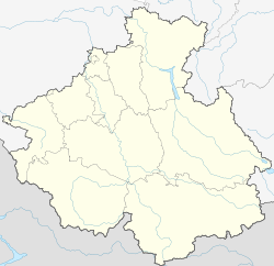
Ust-Muta (Russian: Усть-Мута; Altay: Моты-Оозы, Motı-Oozı) is a rural locality (a selo) and the administrative centre of Ust-Mutainskoye Rural Settlement, Ust-Kansky District, the Altai Republic, Russia. The population was 445 as of 2016.[2] There are 7 streets.
Geography
Ust-Muta is located 42 km north of Ust-Kan (the district's administrative centre) by road. Keley is the nearest rural locality.[3]
References
- ^ Карта Усть-канского района Алтая
- ^ "Оценка численности постоянного населения Республики Алтай по населённым пунктам за 2012-2016 годы". statra.gks.ru. Retrieved 2018-09-24.
- ^ Расстояние от Усти-Муты до Усти-Кана


