Abra el Acay
| Abra el Acay | |||
|---|---|---|---|
|
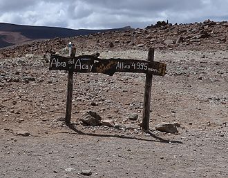
Signpost with distance information on the pass |
|||
| Compass direction | south | North | |
| province | Salta , Argentina | ||
| Valley locations | El Saladillo | Muñano | |
| expansion | Pass road | ||
| Map (Salta) | |||
|
|
|||
| Coordinates | 24 ° 26 '12 " S , 66 ° 14' 20" W | ||
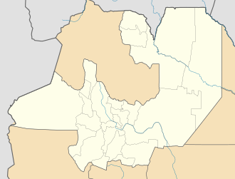
Abra el Acay (also Abra del Acay ) is the name of a mountain pass in the province of Salta in Argentina , about 30 kilometers south of San Antonio de los Cobres . The pass lies between the 5378 meter high mountain Cerro Saladillo in the southwest and the 5716 meter high extinct volcano Nevado de Acay in the northeast.
height
The information about the pass height varies, one old sign states 4895 meters, according to another it is 4995 m . Further details are in between.
Navigability
The lonely, unpaved road, part of the Ruta Nacional 40 , can usually only be negotiated with off-road vehicles, especially after rainfall. It is not uncommon for the road to be impassable due to landslides or the like. Nevertheless, it is possible to drive over the mountain road with a normal road car on good days, whereby several small fords have to be passed.
Individual evidence
- ↑ Abra el Acay - Punto mas alto. In: Ruta 40. March 2, 2010, accessed March 24, 2013 (Spanish).
- ↑ OpenCycleMap


