San Antonio de los Cobres
San Antonio de los Cobres is the capital of the Los Andes department in the Salta province in north-western Argentina .
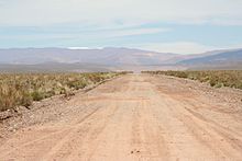
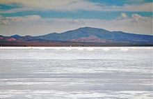
Landscape image
The city is located at about 3775 meters on the river of the same name, which flows into the Salinas Grandes about 50 kilometers north . The Abra el Acay pass, about 25 kilometers south, provides access to the Valles Calchaquíes . The Río Rosario provides access to the Valle de Lerma . The Nevado de Acay (5716 m) towers above the city in the southeast, to the northwest are the peaks of the Sierra del Cobre, on the Abra de los Chorrillos (4855 m) the Ruta Nacional 51 crosses this mountain range.
The vegetation is limited outside the river oasis - typical for the Puna - to grasses and low scrub. There are also some trees in the city. The fauna is also poor in species and extremely adapted to the altitude of the Altiplano .
population
About 3700 people live in the extensive urban area. These are mostly descendants of the Quechua -speaking Coya ( people who live between the hills ), the Inca rite of Pachamama is still practiced here. Every year in August there is a festival in her honor. It is a harvest festival and religious ceremony at the same time, in which numerous indigenous customs are incorporated.
Economy and Transport

In addition to the declining surrounding copper mines , the residents mainly find a livelihood in the public service and in the emerging tourism. The manufacture, processing and sale of llama and alpaca wool are still important today .
Today, San Antonio de los Cobres is the end point of the tren a las nubes , which offers a passenger service between Salta and the Viaducto La Polvorilla (4280 m) just a few kilometers to the west . The railway line called Ramal C-14 continues - without passenger traffic - to Antofagasta and Iquique in Chile.
The Ruta Nacional 40 and the Ruta Nacional 51 meet near the village . Both are paved in places in the town.
tourism
The place itself presents itself as an unadorned mining settlement without colonial buildings. However, it offers a tourist infrastructure with guest houses and restaurants that is unique for the wide area. There are numerous popular destinations in the area:
- The mountains Nevado de Acay (5716 m) and the Nevado de Chañí (5896 m) are covered with snow all year round.
- The Fuentes Termales de Pompeya offer the possibility of a bath 10 kilometers north of the city. The national road 51 provides one access.
- The Salinas Grandes salt lake can be reached via national road 40. From there, the journey can be continued via the Ruta Nacional 52 to Jujuy.
- The adobe (adobe) built village of Santa Rosa de los Pastos Grandes and the Termas de Incachuli can be reached via the Ruta Provincial 129. The mountain Nevado de Cueva (6130 m) towers over both.
history
As early as pre-Columbian times, nomadic indigenous people lived in the area of the Argentine Altiplano, who fell under the rule of the Incas at the beginning of the 16th century . The destruction of this empire did not lead to immediate colonization by the Spaniards.
The highlands, largely inhabited by nomadic llama breeders, were only crossed by trade routes from Salta to Chile , Bolivia and Peru . It was not until the eighteenth century that the first mining settlements emerged along the river oases of the Río San Antonio, which extracted the mineral-rich rock of the Sierra del Cobre. Due to its location at the intersection of the roads between San Pedro de Atacama and Salta and between Bolivia and San Juan and Mendoza, San Antonio slowly grew into a center of regional importance.
The loose ties to the central governments of their countries can be seen in the fact that until well into the 19th century the inhabitants of the region were allowed to choose their citizenship freely between Bolivia, Chile and Argentina according to their own preferences.
For a short time, from 1899 to 1943, San Antonio de los Cobres was the capital of an Argentine territory ( Territorio Nacional de los Andes ), which consisted of the departments of the provinces Jujuy , Salta and Catamarca located in the Puna .
Web links
Coordinates: 24 ° 13 ′ 32 ″ S , 66 ° 19 ′ 9 ″ W


