Bastion Point (New Zealand)
Coordinates: 36 ° 50 ′ 39 ″ S , 174 ° 49 ′ 27 ″ E

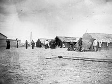
Bastion Point ( Māori Takaparawhau ) is a piece of coastal land in Orakai in Auckland, New Zealand . It is located south of the entrance to Waitemata Harbor . The area holds special significance in New Zealand history as it has been a focus of Māori protests against the forcible transfer of property to Māoriland by White New Zealanders.
The area belonged to the Iwi Ngāti Whātua before the colonization of New Zealand and was an important area with rich fishing grounds and fields. The New Zealand government either bought the area and its surroundings or expropriated it for public use. The area was developed over a period from the 1840s to the 1950s.
In 1885 the New Zealand government built a military outpost at Kohimarama or Bastion Point, as the area offered an important strategic position on the approach to Waitemata Harbor. The outpost was not built on Takaparawhau Point , a piece of land given to the government by the Māori for this very purpose . In 1886, the Crown used the Public Works Act 1882 to expropriate 53,000 m² of Bastion Point for defense purposes. However, when the crown no longer needed Bastion Point for this purpose, the land was not returned to original Māori owners. Instead, she donated it to the Auckland City Council. This was the last 240,000 m² of unused land in Orakei that the local sub-tribe (Hapū) hoped to regain. In 1976, the Krone announced that it was planning to develop Bastion Point and to auction it off to the highest bidder real estate company for the construction of houses for the upper classes of the population.
Joe Hawke and other members of the Hapū, but also activists of the Pākehā (New Zealanders of European descent) formed the Orakei Māori Action Committee to stop the division of land. From 1977 to 1978 the committee organized the occupation of the remaining crown land and prevented its confiscation by the Muldoon government . A marae and houses were built and crops were grown.
The peaceful occupation lasted 507 days and ended on May 25, 1978, 800 police officers and the New Zealand army forcibly evicted the occupiers and destroyed the houses, the marae and the fields. 220 squatters were arrested. The land occupation and its violent termination helped to expose the injustice against the indigenous people and was a milestone in the history of the Māori protest movement .
In the 1980s, the New Zealand government formally apologized and returned the land to the Ngāti Whātua with compensation as part of the agreements in the Waitangi Treaty . A documentary about the expropriation of Maoriland and the events on Bastion Point was made by filmmaker Merata Mita . It's called "Bastion Point Day 507" and uses video footage from the land occupation in Bastion Point.
New Zealand's 23rd Prime Minister Michael Joseph Savage is buried at Bastion Point. A mausoleum and a memorial were built in his honor.
Web links
- TV images of the evacuation of Bastion Point, Te Ara anEncyclopedia of New Zealand
- Report of the Waitangi Tribunal to the claims on Orakei
- Te Tiriti o Waitangi - Events from the 1970s . 1974, archived from the original onAugust 4, 2012; accessed on January 18, 2016(English, original website no longer available).
Individual evidence
- ^ A b Police cordon At Bastion Point, Te Ara Encyclopedia of New Zealand. Retrieved July 31, 2008
- ^ Report of the Waitangi Tribunal on the Orakei Claim . Waitangi Tribunal , 2008, archived from the original on October 17, 2008 ; accessed on March 31, 2018 (English, original website no longer available).


