Ben Metir
| Ben Metir dam and reservoir | |||||||||
|---|---|---|---|---|---|---|---|---|---|
| View from 2016 | |||||||||
|
|||||||||
|
|
|||||||||
| Coordinates | 36 ° 44 ′ 49 " N , 8 ° 44 ′ 30" E | ||||||||
| Data on the structure | |||||||||
| Lock type: | Gravity dam | ||||||||
| Construction time: | 1947-1953 | ||||||||
| Height of the barrier structure : | 78 m | ||||||||
| Building volume: | 432,000 m³ | ||||||||
| Crown length: | 483 m | ||||||||
| Crown width: | 14 m | ||||||||
| Base width: | 86 m | ||||||||
| Data on the reservoir | |||||||||
| Water surface | 3.5 km² | ||||||||
| Storage space | 73 million m³ | ||||||||
| Design flood : | 610 m³ / s | ||||||||
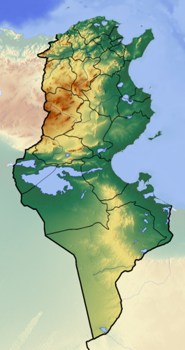
The Ben Metir Dam (also Beni Metir or Beni M'tir, Arabic بني مطير, DMG Binī Mṭīr ) is located in northwestern Tunisia ( Jendouba Governorate ). The reservoir has an area of about 3.5 km² and is dammed by a dam wall about 78 meters high. It is used for the energy and drinking water supply of the city of Tunis as well as for irrigation.
The barrier structure consists of three parts: the central part is a gravity dam with 20 supporting pillars, so that the wall looks like a pillar dam , the right wing is a pure gravity dam and the left wing is a dam made of bedrock . The structure was designed by the Swiss engineer Alfred Stucky . It is the highest dam in Tunisia.
The flood discharge has a capacity of 610 m³ / s and the two drains an additional 380 m³ / s.
The annual electricity production of the hydropower plant is around 17 million kilowatt hours.
literature
- La villégiature sereine au concret, in: Le Renouveau, February 2, 2008, p. 7.


