Frisland

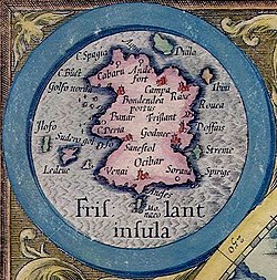
Frisland (also: Frißland , Frischlant , Friesland , Freezeland , Frislandia , Frislanda and Fixland ) is a phantom island , which from the middle of the 16th century was recorded on almost all maps of the North Atlantic, sometimes very different in size; while on the Zeno map it almost covers the area of Iceland , on other maps like that of Gerhard Mercator or Abraham Ortelius it is not even half or a third as large.
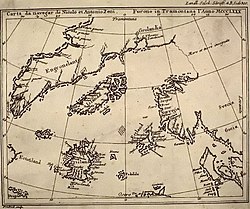
The Venetian Nicolò Zeno (1515 to 1565) made his own version of the Atlantic North Sea with great imagination, but without any local knowledge or experience , from the only partially realistic maps available at his time ( Olaus Magnus ' map, a supplemented Ptolemy map). He issued this card , which went down in history as the Zeno card, as the result of the travels of his ancestors decades later.
The fantasy island of Frisland, which was repeatedly taken from his fantasy map, led to further confusion for centuries. In 1578 Martin Frobisher took possession of West Friseland instead of Greenland for Queen Elizabeth I of England , since he relied on his Mercator map, which Zenos had also recorded Frisland.


