Jørgen Brønlund Fjord
| Jørgen Brønlund Fjord | ||
|---|---|---|
|
MODIS satellite image |
||
| Waters | Independence fjord | |
| Land mass | Pearyland | |
| Geographical location | 82 ° 8 ′ N , 30 ° 0 ′ W | |
|
|
||
| width | 2 km | |
| length | approx. 30 km | |
| Tributaries | Midsommer Elv, Børglum Elv, Kajakelv | |
|
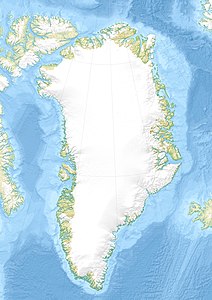
Map of North Greenland |
||
The Jørgen-Brønlund-Fjord is a fjord in northern Greenland in the south of the Pearyland . Its mouth to Independence inlet is 82 ° 7 '30 " N , 29 ° 53' 18" W . The Jørgen-Brønlund Fjord is about 30 km long and almost 2 km wide. It has several tributaries, e.g. B. in the north the Børglum Elv and in the south the Kajakelv. The Midsommer River ( Midsommer Elv ) , which comes from the Wandeltal , flows at its top .
The Jørgen Brønlund Fjord can be divided into an inner and an outer fjord. The inner one, which extends 15 km in an east-west direction, is up to two kilometers wide and up to 85 m deep. To the east of a four-kilometer-wide threshold with depths between 14 and 20 m extends the outer fjord, the bottom of which drops below 200 m before its mouth.
The ice on the fjord usually breaks in the first half of July. The new icing begins at the beginning of September.
The former research base Brønlundhus is west of the fjord near the mouth and Cape Harald Moltke on its east side. The fjord is named after the Greenland polar explorer Jørgen Brønlund .
literature
- Ejnar Mikkelsen , Naja Mikkelsen: Tre år på Grønlands østkyst . Gyldendal København 2010, ISBN 978-87-02-08885-4 .
- Tom Schiøtte: Marine Mollusca from Jørgen Brønlund Fjord, North Greenland, including the description of Diaphana vedelsbyae n.sp. In: Meddelelser om Grønland. Geosciece 18, 1987, pp. 3–25 ( limited preview in Google book search).


