Ko Taen
| Ko Taen | ||
|---|---|---|
| Beach on the east side of Ko Taen | ||
| Waters | Gulf of Thailand | |
| Archipelago | Samui Archipelago | |
| Geographical location | 9 ° 22 ′ 25 ″ N , 99 ° 57 ′ 0 ″ E | |
|
|
||
| length | 4.4 km | |
| width | 2.8 km | |
| surface | 5 km² | |
| Residents | 50 10 inhabitants / km² |
|
| main place | Ban Ko Taen | |
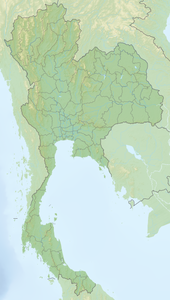
Ko Taen (also Koh Taen , Koh Katen , Ko Tan , Koh Tan , Thai : เกาะ แตน ) is about 15 kilometers from the mainland away and 5 kilometers south of Koh Samui in the Gulf of Thailand located island . It is part of the Samui Archipelago (Mu Ko Samui - หมู่ เกาะสมุย ), which also includes around 60 other islands. To the northwest of Ko Taen is the Mu Ko Ang Thong National Park .
Residents
Ko Taen is inhabited by about 25 people. Due to the tourist use of the island, the population fluctuates constantly. About 30 years ago, 500 people are said to have lived on the island. Since the earning opportunities on the neighboring island of Ko Samui are much better, many migrated there. As a result, for example, the school and the “Health Center” on the island have been closed and many houses and huts are empty and fall into disrepair.
use
Ko Taen is used for tourism. The island has several beaches that are not suitable for swimming due to the rocky subsoil. Coral reefs are worth seeing in front of the island . Snorkeling vacationers are one cause of coral death. As a result, the biodiversity and the number of fish on the reefs has decreased significantly. Bungalows have been built on the island that can be rented by small tour groups. The island can only be reached by water.


