
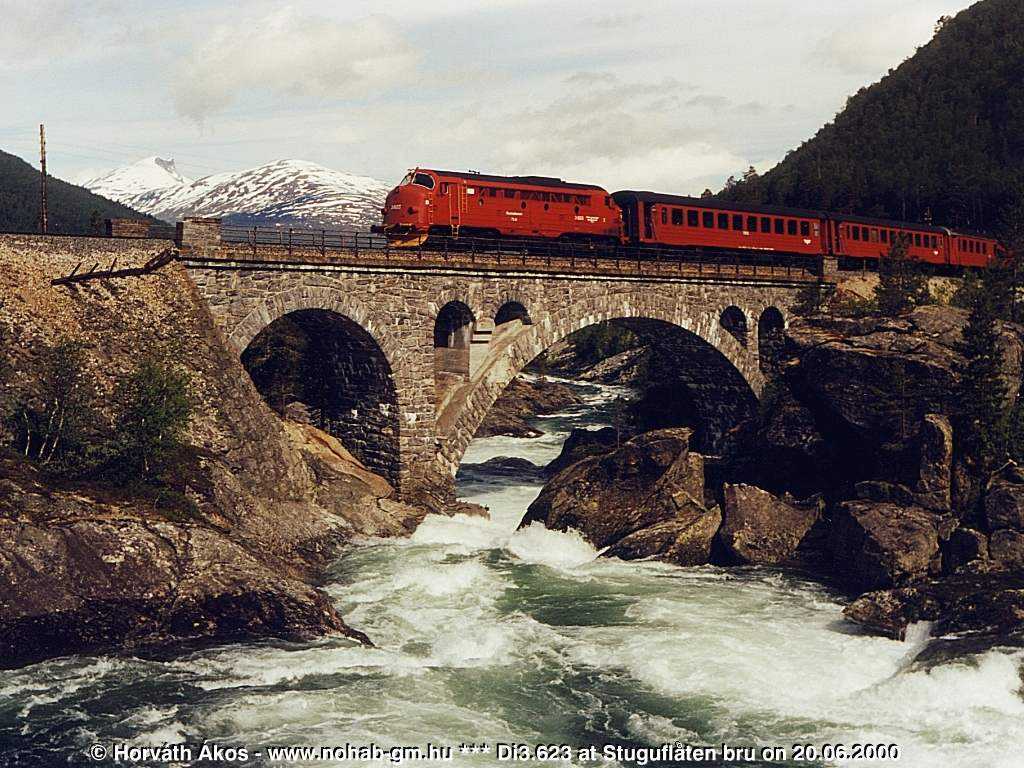
Kylling bru
Coordinates: 62 ° 20 ′ 17 ″ N , 8 ° 3 ′ 39 ″ E
| Kylling bru | ||
|---|---|---|
 |
||
| use | Railway bridge | |
| Convicted | Room tabs | |
| Crossing of | Rauma | |
| place | Verma | |
| construction | Stone arch bridge | |
| overall length | 76 m | |
| Number of openings | 3 | |
| Longest span | 42 m | |
| Clear height | 59.3 m | |
| building-costs | NOK 676,000 | |
| start of building | September 1913 | |
| completion | Late 1921 | |
| opening | November 29, 1924 | |
| location | ||
|
||

The Kylling bru is a railway bridge that crosses the Rauma near the village of Verma .
history
The 59 m high and 76 m long stone bridge made of Gruo Granite was built between 1913 and 1921. It is one of the most famous railway bridges in Norway and at the same time the symbol of the Raumabane .
Construction of the Kylling bru began in September 1913 and was not interrupted during the First World War. After almost nine years of construction, the bridge was completed at the end of 1921. The Raumabane itself was opened on November 29, 1924. The Kylling bru cost 676,000 crowns .
A small footpath branches off from the road through the Raumatal from Verma. Via this you can reach a vantage point in a few minutes, from which the bridge can be clearly seen.
See also
Web links
- Kylling bru in the store norske leksikon (Norwegian)
- Di3 623