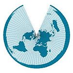
Equal length cone projection
Longitudinal (equidistant or isometric) cone projections are map network designs in which the earth's surface is projected onto a cone. In the normal position, the meridians are shown true to length. The slightest distortions occur at the equally lengthwise contact or the two also lengthwise intersecting circles. The map network design can be optimized for different areas via the position of the contact or intersection circles.
If the contact circle is allowed to move to the equator, the limit case (cone with infinite height) is the true-to-length cylindrical projection ( square flat map ).
