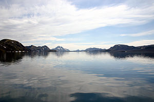
Langisjór
| Langisjór | ||
|---|---|---|

|
||
| Geographical location | Iceland | |
| Drain | to Skaftá | |
| Data | ||
| Coordinates | 64 ° 10 '56 " N , 18 ° 17' 15" W | |
|
|
||
| surface | 27 km² | |
| Maximum depth | 75 m | |
The Langisjór is a lake in the highlands of Iceland . It is located in the municipality of Skaftárhreppur .
geography
Its area is about 27 km², its depth up to 75 m. It is approx. 20 km long and up to 2 km wide.
The lake is very remote on the southwestern edge of Vatnajökull at an altitude of 670 m above sea level. West lie the Tungnaáfjöll , a little further west the Veiðivötn , east of Skáftarjökull .
The long and narrow lake extends parallel to the tectonic plate boundary from southwest to northeast, surrounded by high mountains. The best known of these is the Sveinstindur (1090 m). The surroundings of the lake are desert-like.
A small river flows out of the Langisjór and soon flows into the Skaftá .
There are numerous islands and peninsulas in the lake.
history
Until the end of the 19th century, only shepherds and farmers who looked for stray sheep at the end of summer knew of its existence.
