Lauterenviertel
The Lauterenviertel in the old town of Mainz was created as part of a city expansion in the 19th century.
history
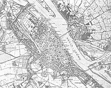
The need to expand the built-up area in the city of Mainz had existed for a long time due to the narrow fortress corset. The fortifications enclosed an area which, after centuries of the fortress period, had gradually been fully built. The area of the " bleaching " was planned as the last quarter in the history of urban construction . On December 15, 1825, Mainz fortress was handed over to the Federal Military Commission as a federal fortress of the German Confederation, which significantly hampered urban development during the rest of the 19th century.
From 1840 onwards, with the emergence of romanticism on the Rhine , aided by the emergence of steam shipping , splendid hotels emerged on Rheinstrasse, which significantly changed the city's silhouette. In 1847, the old Gothic fish gate was demolished in order to maintain a clear view of the cathedral from the Rhine . As part of the regulation of the Rhine near Mainz, the opportunity arose to gain new building land by straightening the banks by means of embankments, after the states bordering the Rhine were able to agree on the regulation of the fairway in 1860. At that time, Mainz already had the highest population density in the Grand Duchy of Hesse . The wealthy Mainz industrial tycoon and politician Christian Ludwig Lauteren seized the opportunity to land for the first Mainz train station and a residential area by means of landfills . From 1864 Eduard Kreyssig was the city architect of Mainz and of decisive importance for the urban design. Between 1866 and 1885, the previous bank area was redesigned.
Location and limits
The area known today as the "Lauterenviertel" was outside the fortifications on the banks of the Rhine in Mainz. To the northeast, the district is bounded by the Rhine , in the southeast lies the winter harbor, formerly with its farm buildings, today with living on the water. The Rheinstrasse forms the southwestern border of the development. Today the street "Am Rathaus" (→ Mainz Town Hall ) formerly forms the Halleplatz, the north-western border.
Perimeter block development , promenade
Individual evidence
- ^ Ferdinand Scherf , Franz Dumont : Mainz - People, Buildings, Events: A City History , Verlag Philipp von Zabern , Mainz, 2010 ISBN 978-3-8053-4247-6
- ^ Joachim Glatz: Urban planning, architecture and art in the 19th and 20th centuries , p. 1144; in: Franz Dumont (ed.), Ferdinand Scherf, Friedrich Schütz: Mainz - The history of the city.
- ↑ Michael Kläger: Mainz on the way to the big city (1866-1914) . In: Mainz: The history of the city . Verlag von Zabern, Mainz 1998, pp. 465-467

