
Nord-Ostsee-Kanal cycle route
The Kiel Canal Cycle Route (also known as the “ NOK Route ”) is a long-distance cycle path that accompanies the Kiel Canal between Brunsbüttel and Kiel over a length of 325 km . The mainly concreted paths along the canal have no inclines, as they follow the watercourse directly.
The landscape on the canal is varied. While fertile, extensive marshes still characterize the area near Brunsbüttel, forests, meadows and fields later line the path to the Eider valley. Here, between Rendsburg and the Holtenau locks, gentle hills determine the picture. The Hüttener Berge and Dänischer Wohld landscape areas are close to the Kiel Canal cycle route . Sights on the canal include the large lock systems in Brunsbüttel and Kiel-Holtenau. The entry and exit of the ships can be observed from viewing platforms. The course of the cycle path is well documented by numerous information boards on the canal.
photos
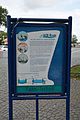
Notice board in Brunsbüttel

Web links
Coordinates: 54 ° 13 '9.6 " N , 9 ° 35' 7.3" E