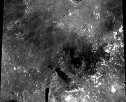
Palus Putredinis
| Palus Putredinis | ||
|---|---|---|

|
||
| Palus Putredinis, recorded in 1994 by the Clementine lunar probe | ||
|
|
||
| position | 27.36 ° N , 0 ° E | |
| diameter | 180 km | |
| Named after | Marsh of Decay. | |
| See also Gazetteer of Planetary Nomenclature | ||
Palus Putredinis ( Latin for swamp of putrefaction ) is a layer of solidified lava on the Earth's moon , which is similar to the larger Maria in terms of its origin . It lies on the eastern edge of the Mare Imbrium and is bounded to the east by the Montes Apenninus . The mean diameter of the plain is 161 km.
In 1971 the lander of the Apollo 15 mission landed on the northeastern edge of the Palus Putredinis in the vicinity of the Hadley Rille .
Web links
- Palus Putredinis on The-Moon Wiki
