1998 Papua New Guinea earthquake
| 1998 Papua New Guinea earthquake | ||
|---|---|---|
|
|
||
| date | July 17, 1998 | |
| Magnitude | 7.1 M W | |
| epicenter | 2 ° 57 '36 " S , 141 ° 55' 12" E | |
| country | Papua New Guinea | |
| Tsunami | Yes | |
| dead | ≈ 2,200 | |
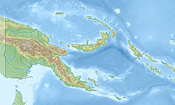
The Papua New Guinea earthquake occurred on July 17, 1998 off the coast of Papua New Guinea . It had a magnitude of 7.1. The epicenter was 70 km southeast of Vanimo . A severe tsunami followed that hit the northeast coast of the island. He devastated the villages of Sissano, Warupu, Arop and Malol, among others. About 2,200 people were killed.
See also
Individual evidence
- ↑ http://www.drgeorgepc.com/Tsunami1998PNG.html
- ↑ http://srl.geoscienceworld.org/content/71/3/344.extract
- ↑ On the evening of July 17, 1998, an earthquake with a magnitude of 7.1 struck off the northwest coast of Papua New Guinea. Followed by three catastrophic tidal waves that devastated the villages of Sissano, Warupu, Arop and Malol on the north coast of Papua New Guinea, killing more than 2,182 people - photo. In: Focus Online . March 11, 2011, accessed October 14, 2018 .

