Park Cwm
Coordinates: 51 ° 35 ′ 18 ″ N , 4 ° 6 ′ 45.7 ″ W.
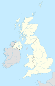
The megalithic park Park Cwm (also called Parc le Breos Cwm or Giant's Grave ), located near Parkmill in Glamorgan , belongs to the "Gower Group" on the peninsula of the same name near Swansea in South Wales . Discovered in 1869, the system is of the Cotswold Severn type with side chambers, which is relatively rare in this area. The well-preserved complex is regarded as an outlier of the tradition that is common further east.
location
The memorial sits in a narrow, wooded limestone canyon cut by a river flowing south to Oxwich Bay. The place is surrounded on all sides by above-ground outcrops of the bedrock. The Cat Hole, a well-known cave, and the Tinkinswood facility are nearby.
description
The trapezoidal cairn measures 22.2 m in length and is a maximum of 12.4 m wide. The 6.2 m long axial main chamber (also known as the corridor) is accessible from the forecourt, which here is an exceptional case in the south. The corridor is about three feet wide. A total of four large side chambers , arranged in pairs and starting at right angles, complete the complex. The side chambers are 1.6 m long and also about one meter wide. No ceiling stones have been preserved. It is therefore possible that the ceiling was erected using the cantilever technique .
- Parc Cwm
Finds
The facility was excavated in 1869 and again in the early 1960s. The excavation carried out by Sir John Lubbock in 1869 found the remains of 20 to 24 people. Lubbock was of the opinion that the cairn, of which only remnants remain, was originally oval. The facility was re-examined and restored in 1960–1961. As a result of this re-excavation, more buried people were found and their number rose to 40 people. In addition, deposits of corpse burn and the bones of wild animals and domestic animals as well as 32 pieces of flint and pottery shards were found. The outer shape of the cairn could not be defined well because side stones were missing.
Dating
It is the only facility in the area that has been dated. The radiocarbon dates show that the monument was built between 3800 and 3500 BC. Was built. There is also evidence of late Neolithic use of the site by members of the bell-cup culture . Isotope analyzes of the bones show that the people buried there ate a lot of meat but hardly any food from the sea.
The cat hole
The Katzenloch ( English cathole ), the Katzenloch-Höhle, is a cave about 180 m north of Parc Cwm. It is a steep limestone eruption near the top of the gorge, about 15.0 m from the valley floor. The cave is a deep triangular gap that tapers towards the top. The cat hole has two entrances, with a natural platform in front of the larger of the two.
The cave was mainly used by Mesolithic hunters and Neolithic farmers. During the first excavation in 1864, finds were made from the Mesolithic to the Medieval period. The archaeologist McBurney (1914-1979) notes in his "The Proceedings of the Prehistoric Society Volume 25 (1959), pp. 260-69 that the cave was used by Mesolithic hunters in the post-glacial period. A conclusion made by John Andrew Campbell's excavation was confirmed in 1977. The 1984 excavation by Miranda Aldhouse-Green revealed the earliest findings from the cave, two tanged point arrowheads dated to 26,000 BC, the last interglacial. This falls in the period of the Red Lady of Paviland , discovered in a cave about eight miles west of the Cathole, and the oldest known human burial in Great Britain dates back to 27,000 BC.
literature
- Bob Greaves: Walk the Brecon Beacons. Discovery Walking Guides, Northampton 2006, ISBN 1-904946-17-8


